Map of Rialto
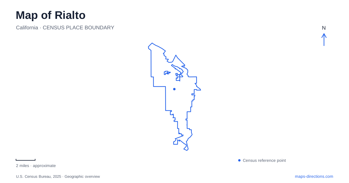
Street tiles load from OpenStreetMap when opened. The blue line shows the 2025 Census boundary.
- State
- California
- Population · July 2025
- 106,554
- Land area
- 24.1 sq mi
- Water area
- 0.0 sq mi
Rialto's map preserves several generations of transportation in a compact set of street names. Foothill Boulevard belongs to the story of Route 66. Riverside Avenue recalls an electric railway junction as well as a surviving cluster of historic buildings. Palm Avenue provides the address for today's passenger rail station. Reading those corridors together gives the city more definition than a freeway-centered overview: this is a place where an older townsite, railway infrastructure, and neighborhood recreation grounds remain visible within the surrounding Inland Empire.
The railway town beneath the street grid
The Semi-Tropic Land and Water Company laid out the townsite in 1887 after the Santa Fe Railroad extended between San Bernardino and Los Angeles. That sequence matters. Rail access preceded the organized town layout, helping explain why transportation corridors belong near the beginning of any account of the city rather than appearing as an afterthought.
A later railway added another layer. In 1914, the Pacific Electric San Bernardino Line passed through town, with a junction at Riverside Avenue for the Riverside Line. This was a different system from the Santa Fe railroad that helped establish the original townsite. On a historical map, the two should be understood as distinct investments serving different periods and travel patterns.
Foothill Boulevard adds the road-travel layer. Its association with historic U.S. Route 66 makes it a recognizable corridor across the larger region. In Rialto, however, the older center is also explained by Riverside Avenue and the railway alignments. Concentrating only on the famous highway would miss the infrastructure that shaped the town before automobile tourism became central to its identity.
Riverside Avenue's historic buildings
At 205 North Riverside Avenue, the historical society's museum brings local records and artifacts together. The adjacent 1906 Christian Church, also known as the Kristina Dana Hendrickson Cultural Center, uses the nearby 201 North Riverside address. Second Street and Riverside Avenue provide the intersection reference for this small heritage grouping.
These closely spaced addresses make the area suitable for looking at how an institution occupies more than one building. The museum and former church contribute different elements: collections in one setting, an early twentieth-century community building in the other. The society also identifies the adobe at Bud Bender Park among the historic sites it works to preserve.
That adobe extends the Rialto story beyond the railway-era center. The historical society dates it to 1853, making it older than the 1887 townsite. A visit organized around both Riverside Avenue and Bud Bender Park therefore crosses an important historical divide, from the earlier adobe landscape to the institutions of the later town. The park is on North Lilac Avenue, so this second heritage location also introduces another north–south street into the map.
A station and a former electric corridor
The current Metrolink station is at 261 South Palm Avenue on the San Bernardino Line. Palm Avenue also contains the civic center, with City Hall at 150 South Palm. Those two addresses create a useful civic-and-transit reference south of the older North Riverside heritage buildings.
Rialto's Pacific Electric Trail project concerns a separate historic alignment. The city describes an existing regional trail reaching Cactus Avenue and a proposed extension east to Pepper Avenue. The extension is intended to carry a multiuse path through the older urban area, with the historic depot included in plans for restoration and trail amenities.
The distinction between an operating passenger station and a heritage depot is particularly useful here. South Palm is the passenger-rail address; the electric railway corridor has a different history and a recreation-oriented future. The extension's environmental study documents a proposal for connecting additional parts of the former railway corridor. A proposed line on a project drawing should therefore not be treated as confirmation that the complete Cactus-to-Pepper path is already open.
Parks spread across named avenues
Frisbie Park occupies 1901 North Acacia Avenue. Its facilities include softball and Little League fields, basketball, playgrounds, a skatepark, and separate large- and small-dog areas. That combination makes it a substantial recreation destination rather than simply an open patch on the street map.
Other park addresses reveal the wider distribution of recreation space. Alec Fergusson Park is on West Sunrise Drive, while Andreson Park sits on South Lilac Avenue and Bud Bender Park on North Lilac. The repeated Lilac name links two parks on different portions of the same avenue, whereas Acacia and Sunrise identify other neighborhoods. Together these locations give a practical picture of Rialto beyond its historic core: a city whose civic sites, heritage buildings, rail facilities, and playing fields are distributed among several recognizable corridors.
Map and statistics: U.S. Census Bureau, 2025 Gazetteer, January 2025 generalized place boundaries and Vintage 2025 population estimates. Local references: City of Rialto; Rialto Historical Society; Metrolink. Article prepared by Maps & Directions.