Map of Reynoldsburg
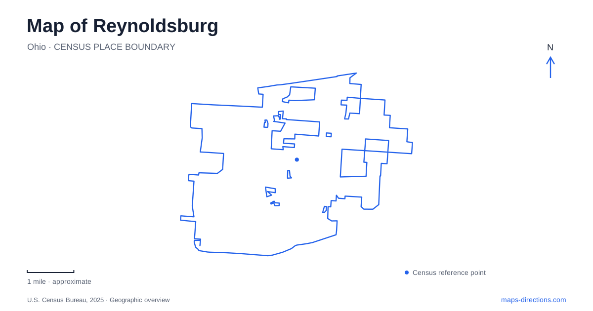
Street tiles load from OpenStreetMap when opened. The blue line shows the 2025 Census boundary.
- State
- Ohio
- Population · July 2025
- 43,350
- Land area
- 11.3 sq mi
- Water area
- 0.1 sq mi
Reynoldsburg has a local landscape shaped by horticulture, a creek corridor, and a protected forest that predates much of the surrounding development. Main Street and Livingston Avenue provide useful road references, while Graham Road anchors the history behind the city's tomato identity. Following those places reveals a more specific picture than the familiar suburban pattern of highways, shops, and neighborhoods east of Columbus.
Locate the seed-growing story on Graham Road
The Alexander W. Livingston House stands at 1792 Graham Road. Livingston built the house in 1864, during the period when he was developing tomato varieties for cultivation. The city's historical account identifies the introduction of Paragon in 1870 and Acme in 1875, both associated with his years at the property.
The important point is plant breeding and commercial horticulture. Reynoldsburg's tomato identity commemorates the development and distribution of cultivated varieties; it should not be understood as a claim that the tomato species originated here. Locating that history at the house makes the distinction clearer and gives an agricultural theme a real place on the map.
Livingston's seed gardens occupied a larger landscape east of Graham Road and on both sides of Palmer Road. The surviving house and park therefore represent part of a former working operation, not its entire footprint. The National Register identifies agriculture and Livingston himself as the property's areas of significance, reinforcing the connection between the domestic building and the enterprise around it.
A historic house within everyday public space
Livingston House Park includes approximately five acres, picnic tables, and a playground as well as the historic building. That mixture places a recognized heritage site within a setting used for ordinary neighborhood recreation. The house remains the historical anchor, but the surrounding grounds have a wider public role.
This scale differs sharply from the city's larger natural areas. A visit centered on the house can focus on a compact property and the former seed-growing landscape around Graham Road. It does not require treating every nearby park as part of one continuous historical estate.
The annual Tomato Festival carries the agricultural association into a separate public gathering. The municipal festival page identifies Huber Park as its setting. Linking the two places historically is useful; confusing their locations is not. One preserves a nineteenth-century home, while the other accommodates a much broader recreation and event landscape.
Blacklick Creek links city parks
Huber Park, also identified as the Heritage Sports Complex, gives Reynoldsburg a recreation corridor along Blacklick Creek. The city's facility information describes a bike and walking path through the park connecting JFK Park at Main Street with Livingston Avenue.
That relationship makes the creek a practical organizing feature. The path connects two road references and public recreation areas, creating a route through the city that differs from following a commercial street. Sports fields and gathering areas occupy the park, while the creekside route provides continuity between them.
On a map, this is a useful place to distinguish a linear connection from a destination. Huber Park is somewhere to stop for an activity, but the path also carries people through the broader corridor. Both functions are part of its geography.
The forest that became the first Metro Park
Blacklick Woods, at 6975 East Livingston Avenue, adds an older ecological landscape to Reynoldsburg. It opened in 1948 as the first park in the metropolitan park district. At the time, woods and farmland surrounded it; later development made the protected area increasingly important as a surviving natural space.
The park contains beech-maple forest, wet woodland, seasonal swamp ponds, and a buttonbush swamp. These habitats respond to differences in moisture rather than forming one uniform stand of trees. The Beech, Buttonbush, and Maple trails provide different ways to encounter that variation, while the short Walter A. Tucker connection includes boardwalk sections between trail areas.
The canopy walk adds another perspective above ground level. Seen together, the elevated walkway and wetland paths show the forest vertically as well as horizontally: treetops, trunks, understory, and waterlogged ground are distinct parts of the same living landscape.
A corridor extending beyond the city
The Blacklick Creek Greenway connects the local park system with a wider route toward Groveport. Metro Parks identifies Blacklick Woods, Pickerington Ponds, and Three Creeks among the regional parks connected by the corridor. This gives Reynoldsburg a place within a larger network of creekside recreation.
The regional trail and the smaller woodland loops serve different purposes. The former connects destinations across several communities, while the latter concentrate on habitats within one protected park. Reading them separately helps establish the scale of an outing. Alongside the Livingston property and the city-park connection between Main Street and Livingston Avenue, they reveal a community where cultivation, conservation, and movement follow different but intersecting lines.
Map and statistics: U.S. Census Bureau, 2025 Gazetteer, January 2025 generalized place boundaries and Vintage 2025 population estimates. Local references: City of Reynoldsburg; National Park Service; Columbus and Franklin County Metro Parks. Article prepared by Maps & Directions.