Map of Renton
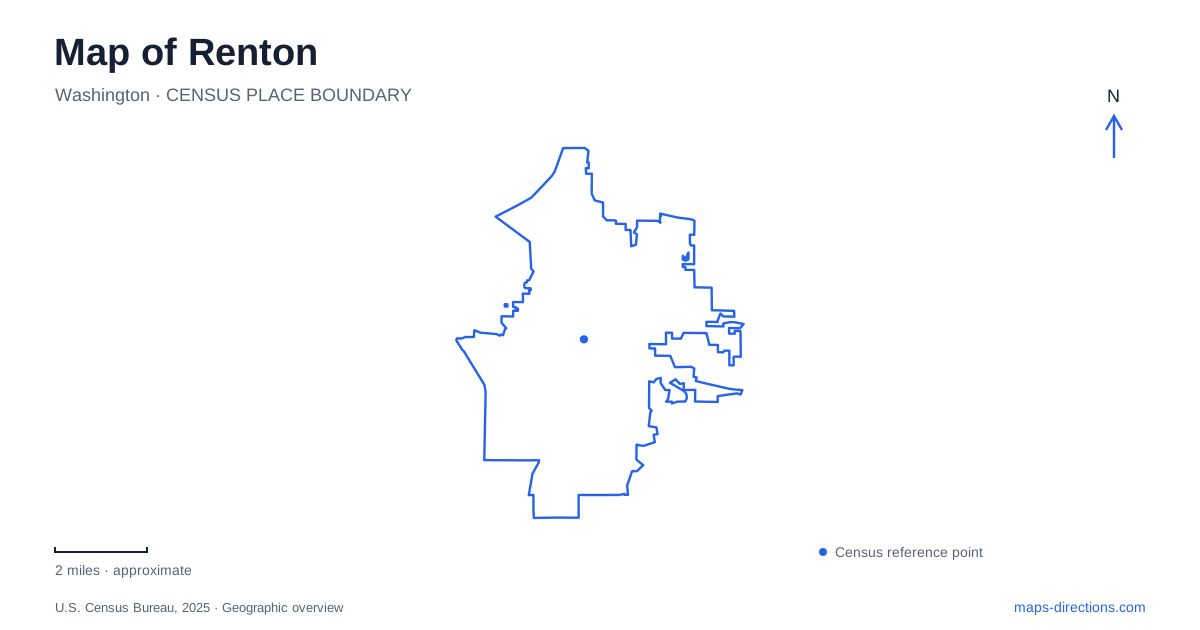
Street tiles load from OpenStreetMap when opened. The blue line shows the 2025 Census boundary.
- State
- Washington
- Population · July 2025
- 104,975
- Land area
- 23.5 sq mi
- Water area
- 1.7 sq mi
Renton's waterways produce several different landscapes within the same city. The Cedar River passes through the downtown area, where a library famously spans the water. Lake Washington provides a broader shoreline setting at Gene Coulon Memorial Beach Park. Southwest of downtown, the Black River and Springbrook corridors introduce wetlands and wooded paths. A useful map keeps these waters separate while showing the streets that lead to them: Mill Avenue, Maple Valley Highway, Lake Washington Boulevard, and Oakesdale Avenue each open a different part of the city.
A library that crosses the river
The downtown library uses 100 Mill Avenue South. Its unusual relationship with the Cedar River dates to the building opened in 1966, which stretched roughly 80 feet across the channel. The library was renewed in 2015, continuing the close connection between reading space and river views.
This is more than a scenic backdrop to a civic building. The water physically runs beneath the structure, making the library itself a particularly memorable reference on a downtown map. Mill Avenue supplies the street address, while the river explains the building's setting.
Nearby Liberty Park uses 1101 Bronson Way North. The park, library, and Cedar River form a compact group of public destinations at the edge of the downtown streets. For Renton, this combination gives the center a distinctive outdoor character: a civic visit and a riverside walk can begin in the same small area without the river being hidden behind commercial blocks.
Mill Avenue's former firehouse
The history museum stands at 235 Mill Avenue South in the former Fire Station No. 1. Completed in 1942 through the Works Progress Administration, the Art Deco building was the city's first dedicated fire station. Its later museum use preserved a public-service building within the historic downtown.
The short stretch of Mill Avenue between museum and library therefore brings together two different eras of civic architecture. The firehouse reflects the expansion of municipal services in the early twentieth century; the river-spanning library represents a later approach to public space and design.
The museum building is an identifiable historic landmark, while gallery admission depends on the institution's visitor arrangements. Confirm those arrangements before planning an indoor visit, especially if older material describes building improvements or a projected reopening. A map label locates the former fire station and its relationship to the surrounding streets; it does not establish an exhibition schedule or guarantee access to every room.
Three Cedar River names to distinguish
Renton's park system includes Cedar River Park, Cedar River Trail Park, and the Cedar River Trail. Their similar names describe different things. Cedar River Park is at 1717 Maple Valley Highway, near the community center and Henry Moses Aquatic Center. It is a developed recreation setting with sports facilities.
Cedar River Trail Park uses 1060 Nishiwaki Lane near Lake Washington. Its amenities include a canoe launch, picnic shelter, play equipment, and a walking path. The trail itself is the longer linear route, listed by the city from the lake toward 149th Avenue Southeast.
These distinctions turn a potentially confusing set of labels into a clear geographic sequence. Maple Valley Highway identifies an inland recreation complex, Nishiwaki Lane identifies the lakeside end, and the trail links points along the river corridor. Choosing a park by its complete name makes a substantial difference to the part of the city reached.
Lake Washington's recreation shoreline
Gene Coulon Memorial Beach Park occupies 1201 Lake Washington Boulevard North. The city's park map distinguishes its boat launch, swimming area, Water Walk, and picnic sections. The shore is therefore organized into different activity areas rather than functioning as one undifferentiated beach.
For Renton visitors, the Water Walk offers a particularly useful landmark within the grounds. It belongs to the park's circulation along the lake, while the boat launch serves a separate movement between road and water. The swimming area and picnic sections add further destinations within the same park address.
Lake Washington Boulevard also leads to Kennydale Beach Park at 3501. The two named parks occupy different locations on the same broader lakeshore corridor. Their shared relationship with the lake does not erase the distinction between the larger Coulon recreation grounds and the separate Kennydale beach setting.
Wetlands southwest of the center
Black River Riparian Forest is identified around Oakesdale Avenue Southwest and Southwest Seventh Street. The Springbrook Trail continues through the southwestern part of the city, with boardwalk areas among its features. These wetlands offer a different environment from the developed Cedar River parks and the open lake shoreline.
Access conditions are specific here: the city reports damage-related closure at the Southwest 27th Street boardwalk entrance. That notice concerns a particular access point within the trail system. Taken together, Renton's river-spanning library, historic firehouse, lakefront parks, and wetland routes show how water shapes several distinct public landscapes, each connected to its own set of streets and crossings.
Map and statistics: U.S. Census Bureau, 2025 Gazetteer, January 2025 generalized place boundaries and Vintage 2025 population estimates. Local references: King County Library System; City of Renton. Article prepared by Maps & Directions.