Map of Reno
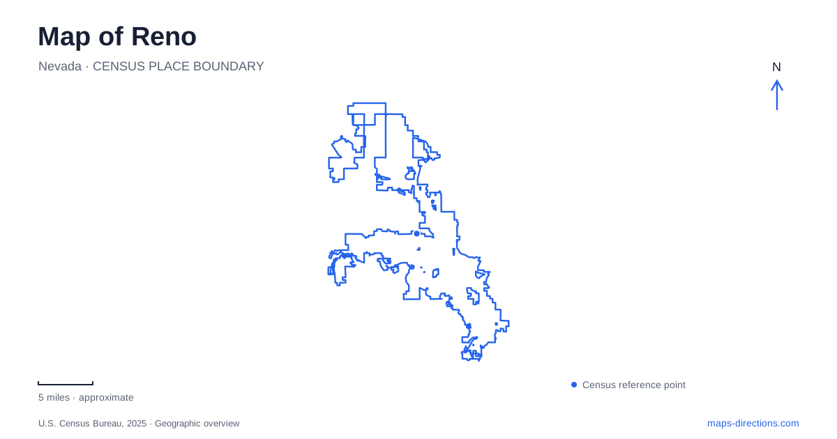
Street tiles load from OpenStreetMap when opened. The blue line shows the 2025 Census boundary.
- State
- Nevada
- Population · July 2025
- 283,621
- Land area
- 109.3 sq mi
- Water area
- 2.8 sq mi
Reno's central geography becomes clearer when the Truckee River is treated as an organizing feature rather than a line behind the buildings. The Riverwalk follows its downtown banks, Wingfield Park occupies an island between channels, and bridges connect streets with different roles on either side. South of downtown, MidTown has developed a distinct identity through local businesses and public art. The university adds another kind of urban landscape, with a historic quadrangle and a lake that have long served as gathering places.
An island within the downtown river
Wingfield Park sits between the north and south branches of the Truckee River. Arlington Avenue crosses both channels, which explains why the crossing consists of two bridges rather than a single uninterrupted span over one channel. Barbara Bennett Park lies nearby, west of Arlington Avenue, adding another public space to the river setting.
This geography gives central Reno an unusual relationship between streets, water and recreation. The island is surrounded by urban activity but remains physically defined by the river. Its access depends on the crossings and paths that tie it to the banks. The Arlington Avenue bridge replacement retained that two-part arrangement: the northern bridge uses a single pier, while the shorter southern bridge has a clear span. Both have an art-deco appearance. The engineering responds to the two channels separately, even though travelers experience them as one street crossing.
The Riverwalk as a district
The Riverwalk District occupies the downtown area along the Truckee, bringing together parks, public art, restaurants and bars. Its identity comes from the river corridor rather than from one enclosed attraction. A walk along the banks can therefore reveal changing relationships between buildings and water: some spaces are devoted to movement, others to sitting, dining or looking across the channel.
Bicentennial Park's sculpture garden adds an outdoor cultural stop to this setting. Public art is particularly useful here because it gives individual places a recognizable identity within a continuous river landscape. For someone exploring Reno on foot, the district offers a way to organize several stops around a shared geographic feature. The river is the connecting element, while bridges and cross streets determine how that route relates to the rest of downtown.
Southward to MidTown and the art museum
MidTown lies south of downtown and developed its district identity through a revitalization effort involving local business owners. The merchants' association formed in 2008, and the area became known for independent businesses, historic buildings and murals. Its boundaries are not always described consistently, even by local sources. That is a reminder that a neighborhood's cultural identity can be stronger than the precision of its outline on a visitor map.
The Nevada Museum of Art, at 160 West Liberty Street, occupies a position between the Riverwalk area and MidTown. Its location makes it a useful cultural reference point when moving between those districts. The museum and the murals represent different ways art appears in Reno: one through an institution with changing exhibitions, the other through the surfaces and public spaces of a commercial neighborhood. Treating both as part of the city's cultural geography produces a richer visit than confining attention to one building or one collection of storefronts.
A quadrangle with an architectural model
The university's Historic Quadrangle is based on the academic-village concept associated with Thomas Jefferson's University of Virginia. The campus core received National Register recognition in 1987. Large elm trees planted in 1908 help define the space, which has long been used for commencement, concerts and informal gathering.
The quadrangle illustrates a deliberately composed landscape, with open ground and surrounding academic buildings working together. Its character differs from the river corridor, where flowing water determines the shape of the public space. Here, institutional planning establishes the central lawn as a shared focus. The mature trees also give the campus a visible timescale: the grounds are the result of more than a century of planting, use and adaptation.
Manzanita Lake and the campus shoreline
Manzanita Lake marked its centennial in 2011. University histories describe it as a longstanding setting for recreation and campus traditions, including past winter skating. The nearby Manzanita Hall dates to 1896 and faces the lake, adding a historic residential building to the waterside scene.
These places give Reno another relationship with water beyond the Truckee. The campus lake is a contained gathering landscape, while the river flows through the downtown street system and divides around a public island. MidTown's murals and Liberty Street's museum add a cultural connection between the broader districts. Read together, the island, Riverwalk, commercial streets and university grounds show a city with several distinct public environments, each made clearer by its physical setting and history.
Map and statistics: U.S. Census Bureau, 2025 Gazetteer, January 2025 generalized place boundaries and Vintage 2025 population estimates. Local references: City of Reno; Regional Transportation Commission of Washoe County; Reno Tahoe; Nevada Museum of Art; Travel Nevada; University of Nevada, Reno. Article prepared by Maps & Directions.