Map of Redwood City
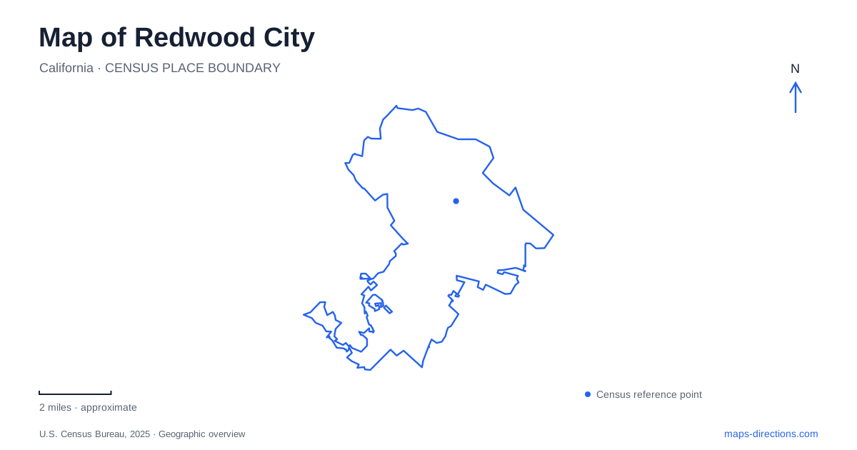
Street tiles load from OpenStreetMap when opened. The blue line shows the 2025 Census boundary.
- State
- California
- Population · July 2025
- 82,178
- Land area
- 19.3 sq mi
- Water area
- 15.4 sq mi
Redwood City occupies several landscapes that should remain distinct on a useful map: the downtown blocks around Broadway, the working waterfront reached by Seaport Boulevard, the water-edged streets of Redwood Shores, and the western approaches to the foothills. Highway 101 is an especially important dividing line. A destination near the bay may belong to a very different street network from a destination near the downtown train station, even when both share the same municipal address.
Broadway and the courthouse
The San Mateo County History Museum occupies the historic courthouse at 2200 Broadway. The building dates to 1910, giving the downtown street scene a substantial civic landmark rather than simply another commercial address. Courthouse Square is also a municipal event location. The museum building and the public square are related places, but a visit to an exhibition and a gathering outside have different destinations within that setting.
The museum's approach map identifies Broadway, Marshall Street, Middlefield Road, Winslow Street, and Jefferson Avenue around the central district. Those names form a useful small-scale framework. Begin with Broadway for the museum, then read the intersecting streets to understand the surrounding blocks. This is more informative than treating the entire downtown area as a single point.
Redwood City Caltrain station is at 1 James Avenue. Regional transit information identifies Caltrain, SamTrans, and shuttle connections there. The station and courthouse provide two different orientation anchors: one belongs to the Peninsula rail corridor, while the other belongs to the historic civic center. Keeping both visible helps explain an arrival by train followed by movement through the downtown street network.
The port beyond the highway
The waterfront's history explains why it is separate from the courthouse district. The municipal general plan describes early shipping at the head of tidewater on Redwood Creek, followed by the port's move toward deeper water in the 1920s. Channel improvements and rail extensions helped establish the later municipal marina and international port site.
Today, the general plan places heavy maritime and industrial activity along Seaport Boulevard and Blomquist Street. That industrial geography matters when interpreting a waterfront label: a harbor destination is not automatically part of a continuous downtown shopping or recreation district. Cargo facilities, public waterfront spaces, and business properties have different roles along the same approach corridor.
The port identifies its public-access waterfront at Seaport Court and Seaport Boulevard. For a map of Redwood City, that intersection is a more meaningful reference than a broad pin over the shipping channel. It also distinguishes this waterfront from the shoreline parks and residential streets farther north. The bay is the common setting, but the landward approaches lead into separate districts.
Reading Redwood Shores as its own street pattern
The city's street map shows Redwood Shores around roads such as Twin Dolphin Drive, Marine Parkway, Bridge Parkway, and Redwood Shores Parkway. Water channels shape the surrounding land, while numerous smaller streets end within residential areas. This pattern contrasts with the intersecting downtown blocks around Broadway and Marshall Street.
The difference is useful when comparing addresses. A location on Marine Parkway belongs to a bayward network whose organization depends on waterways and larger curving roads. A downtown address belongs to a compact collection of cross streets. The two areas should not be mentally combined simply because their postal city is identical.
Municipal planning maps also identify highways, rail lines, and water as barriers to pedestrian and bicycle movement. Redwood City therefore needs more than a map of street names when planning a cross-district trip. The actual crossings explain connections between neighborhoods, while the waterways help explain why nearby streets may point toward different access corridors.
The western foothill approach
Pulgas Ridge Open Space Preserve offers a contrasting landscape near San Carlos. The regional open-space district directs visitors from Interstate 280 to Edgewood Road, then Crestview Drive and Edmonds Road. These names identify the preserve approach more precisely than a broad search over the western hills.
Within the preserve, Cordilleras Trail follows a gentler route toward Cordilleras Creek, while Polly Geraci Trail climbs through oak woodland toward chaparral. The trail descriptions reveal elevation and vegetation changes that are not apparent from a road map alone. This is a landscape of canyon bottoms and ridge approaches, rather than the bay's channels or downtown's civic blocks.
A coherent Redwood City map can hold all these contrasts together without flattening them: the courthouse and station establish downtown, Seaport Boulevard explains the working harbor, the Shores parkways organize water-shaped neighborhoods, and Edgewood Road leads toward upland open space. Each supplies a different geographic reference for choosing where an outing actually begins.
Map and statistics: U.S. Census Bureau, 2025 Gazetteer, January 2025 generalized place boundaries and Vintage 2025 population estimates. Local references: San Mateo County Historical Association; City of Redwood City; Metropolitan Transportation Commission 511; Port of Redwood City; Midpeninsula Regional Open Space District. Article prepared by Maps & Directions.