Map of Rapid City
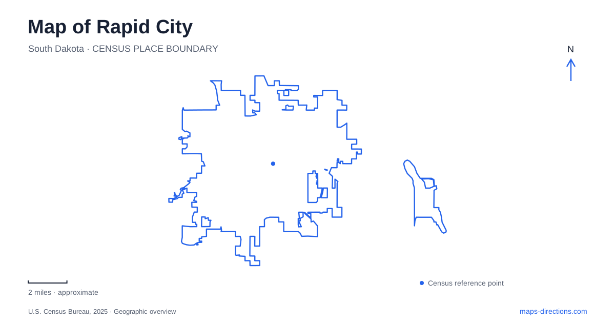
Street tiles load from OpenStreetMap when opened. The blue line shows the 2025 Census boundary.
- State
- South Dakota
- Population · July 2025
- 80,589
- Land area
- 56.0 sq mi
- Water area
- 0.1 sq mi
Rapid City can be read through three landscape lines: the downtown streets, Rapid Creek, and the ridge followed by Skyline Drive. Each supports a different way of moving through the city. Main and Saint Joseph streets organize a public-art walk among buildings, the creek links parks on a paved route, and the ridge introduces elevation and broad views. Keeping these three settings visible together gives a useful picture of the city at the edge of the Black Hills.
Main Street and Saint Joseph Street
The public library's account of downtown development places the City of Presidents statues along Main Street and Saint Joseph Street. The sculptures stand at street corners, so the collection is experienced by moving through the business district. The individual intersections are part of the attraction's structure: the walking route and the surrounding buildings supply the setting for each figure.
Main Street Square occupies another downtown role. Its operator lists the destination at 512 Main Street and describes seasonal fountains, skating, and public events. The square provides a gathering place within the broader downtown street network, while the presidential sculpture route extends beyond its edges.
For a map of Rapid City, that relationship gives a practical downtown plan. The square is a recognizable meeting destination, and the parallel Main and Saint Joseph corridors support a wider exploration on foot. A visitor interested in the sculptures can use the collection's mapped intersections to shape a route, rather than expecting all of the works to stand together in the square.
The tourism office also describes the square's granite artwork, Passage of Wind and Water, as an interpretation of the natural history of the Black Hills and Badlands. This connects the central urban gathering space with the surrounding region through art. It offers a different subject and material from the bronze presidential figures nearby.
Rapid Creek as a park corridor
The Leonard Swanson Memorial Pathway follows the creek through the city and past several parks. The municipal parks map shows a succession of green spaces and path segments across the urban area. This creek-side geography gives cyclists and walkers a continuous organizing line alongside the street network.
Canyon Lake Park is listed at 4181 Jackson Boulevard, while Founders Park uses 1510 West Omaha Street. Farther along the central corridor, Memorial Park is identified at 8th and Omaha streets, and Roosevelt Park at 300 East Omaha Street. These names and addresses describe separate starting places along the larger recreational landscape.
A Rapid City outing can therefore begin with a selected park and expand along the creek route. Jackson Boulevard establishes the western lake-park approach; Omaha Street identifies several more central parks. The municipal map is useful because it shows the path in relation to those streets and facilities, allowing a route to be understood as connected segments rather than a single undifferentiated green strip.
The creek is also part of the city's natural identity. The tourism bureau describes it flowing through the middle of town and supporting fishing activity. Its presence explains why a developed urban area contains a long thread of water, vegetation, and recreation opportunities close to the downtown buildings.
Skyline Drive and Dinosaur Park
Dinosaur Park is at 940 Skyline Drive. The city brochure traces the attraction to a project conceived in 1935, and the parks program guide records its dedication in 1936 through work by city crews and the Works Progress Administration. Its large sculptures belong to an early roadside-tourism landscape as well as to the modern park system.
The location introduces a different map scale. Skyline Drive follows the elevated setting around the park, and the nearby Skyline Wilderness Area provides a trail network with views over the city. A visit to the dinosaur sculptures, a drive along the ridge, and a trail outing can share this district while using different portions of it.
Rapid City's terrain becomes easier to interpret from this relationship between ridge and creek. The elevated park offers perspective over the developed streets, while the water corridor provides a lower route through them. Their proximity creates variety within the city without requiring every outdoor trip to begin deep in the surrounding forest.
A second urban trail landscape
Hanson-Larsen Memorial Park, also known locally as M Hill, is another outdoor destination identified by the tourism bureau. It is a privately owned park open to the public for hiking, biking, and running, with a substantial trail network. Its separate name matters because searches for nearby urban hiking can return both this park and Skyline Wilderness Area.
Rapid City thus offers several coherent ways to organize a map-based visit: downtown intersections for sculpture, a creek corridor for park-to-park movement, Skyline Drive for an elevated historical attraction, and distinct hillside trail systems for a longer outdoor route. Choosing the landscape first makes the individual street address or trail starting point more meaningful.
Map and statistics: U.S. Census Bureau, 2025 Gazetteer, January 2025 generalized place boundaries and Vintage 2025 population estimates. Local references: Rapid City Public Library; Visit Rapid City; City of Rapid City. Article prepared by Maps & Directions.