Map of Rancho Palos Verdes
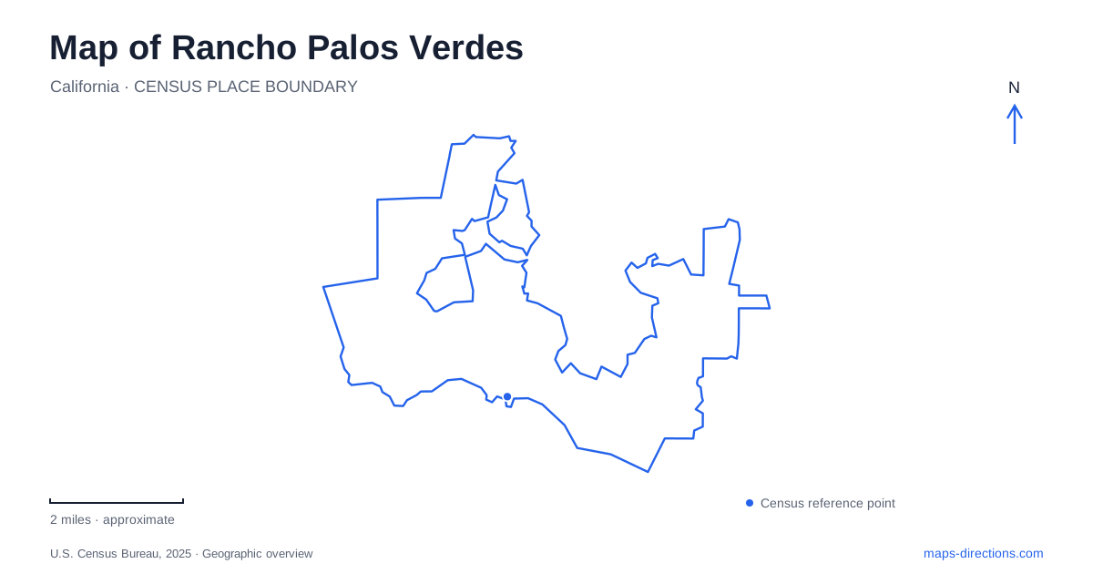
Street tiles load from OpenStreetMap when opened. The blue line shows the 2025 Census boundary.
- State
- California
- Population · July 2025
- 39,654
- Land area
- 13.5 sq mi
- Water area
- 26.2 sq mi
Rancho Palos Verdes occupies a landscape where a conventional street map explains only part of the journey. Coastal bluffs, slopes, canyons, and protected habitat give nearby locations very different approaches. A viewpoint above the ocean is not necessarily a beach entrance, and a path drawn through a reserve may be affected by ground movement. The most useful reading combines the road network with the shape of the peninsula and the separate identities of its public places.
Point Vicente looks both inland and offshore
The Point Vicente Interpretive Center is at 31501 Palos Verdes Drive West, beside the lighthouse. Opened in 1984 and expanded in 2006, it presents the peninsula's natural and cultural history. Its particular emphasis on Pacific gray whales makes the ocean beyond the bluff part of the subject, rather than merely a backdrop to the museum.
The park grounds include paths and picnic areas, while the museum provides an indoor explanation of the setting. These are complementary spaces with different purposes. The lighthouse is a neighboring landmark; a map label for it should not be confused with the interpretive center's entrance. Lower Point Vicente also belongs to the nature preserve, so this developed visitor area is connected institutionally to the larger conservation landscape. That relationship helps explain why the coast can contain a museum, a maintained park, and protected habitat within a small area.
Reserves form a connected landscape
The protected lands of Rancho Palos Verdes are divided into named reserves rather than one uniform park. Portuguese Bend is the largest of these, with 399 acres preserved in 2005. Its role becomes clearer when considered alongside adjoining lands: conservation protects routes used by wildlife across slopes and canyons as well as individual scenic viewpoints.
The land conservancy describes the importance of a reserve protected in 2022 for connections between upper Filiorum lands and the coast at Abalone Cove, and between Three Sisters and neighboring preserve land across Barkentine Canyon. This is ecological connectivity, not a promise of an unrestricted public walking route along every boundary. On a map, the continuous green area can conceal differences in trail access, ownership arrangements, terrain, and management. Named reserve boundaries therefore remain useful even where vegetation appears continuous.
Portuguese Bend is an active geological setting
Land movement is a defining practical consideration in the southern part of Rancho Palos Verdes. The city's monitoring identifies several distinct landslides within the broader complex, rather than a single point hazard. Accelerated movement beginning in spring 2023 damaged roads and utilities and affected homes in several neighborhoods. A static map cannot convey the changing condition of that infrastructure.
This does not mean that the whole peninsula shares one access condition. Broad labels such as Portuguese Bend or Abalone Cove are too imprecise to identify a particular path. Abalone Cove Park, Abalone Cove Beach, Sacred Cove Beach and their connecting trails are separate places within a landslide-affected landscape. Consult the city's trail-condition information for the named segment, because movement, weather and remediation can affect each differently. A park-wide announcement does not necessarily settle the question of access to an individual beach.
A landmark absent from its familiar photographs
Wayfarers Chapel provides a particularly clear example of why historic imagery can mislead. Designed by Lloyd Wright, the glass-walled chapel became a National Historic Landmark in 2023. Land movement forced its closure in February 2024, and the structure was subsequently dismantled for preservation. Its architectural importance survives, but a photograph of the intact chapel does not describe the building's current availability at its former site.
Restoration planning has concerned the preservation and possible reassembly of its components. A preservation proposal is not confirmation of access to a reconstructed chapel. The distinction matters when reading older visitor guides, which naturally describe the chapel as a standing destination within a landscaped coastal setting. The institution's history and the physical condition of its former grounds in Rancho Palos Verdes now belong to different timelines.
Ladera Linda and the eastern trails
At 32201 Forrestal Drive, Ladera Linda Community Park offers a more developed public setting, with courts, playgrounds, grassy areas, and a community center. Its rebuilt facilities opened in February 2024. The park also provides access to adjacent hiking areas, creating a transition between organized recreation and the surrounding slopes.
That combination captures the varied public geography of Rancho Palos Verdes: indoor interpretation at Point Vicente, preserved habitat across the hills, changing ground around Portuguese Bend, and neighborhood recreation beside trail country. Keeping those functions distinct makes the map more useful than treating every coastal marker as an interchangeable scenic stop.
Map and statistics: U.S. Census Bureau, 2025 Gazetteer, January 2025 generalized place boundaries and Vintage 2025 population estimates. Local references: City of Rancho Palos Verdes; Palos Verdes Peninsula Land Conservancy; Wayfarers Chapel. Article prepared by Maps & Directions.