Map of Rancho Cucamonga
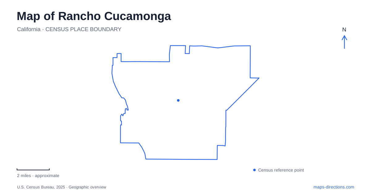
Street tiles load from OpenStreetMap when opened. The blue line shows the 2025 Census boundary.
- State
- California
- Population · July 2025
- 177,856
- Land area
- 46.5 sq mi
- Water area
- 0.0 sq mi
Rancho Cucamonga contains the histories of three older communities: Cucamonga, Alta Loma, and Etiwanda. Their names remain useful geographical references because the modern city did not develop from a single compact center. Water supply, agriculture, rail transportation, and the foothills each influenced settlement. On a map, the older neighborhoods and preserved buildings provide one set of reference points, while the Pacific Electric Trail and North Etiwanda Preserve reveal different kinds of open space. Together they explain the relationship between an urban street network and the landscape from which it developed.
Settlement followed available water
Alta Loma's early development began in the 1870s but was limited by inadequate water. A venture associated with Isaias Hellman improved supply in the early 1880s, allowing development to continue. Farther east, the Chaffey brothers developed Etiwanda. These separate beginnings help explain why the community names retain meaning beyond modern postal addresses.
Water was an organizing resource rather than merely a household service. It determined where agricultural operations and homes could take hold. Later housing expanded north toward the San Gabriel foothills, bringing urban development closer to remaining chaparral. The transition is still important when reading the city's northern edge: established neighborhoods meet a landscape whose slopes, vegetation, and drainage patterns extend beyond the street grid.
This background makes a map of Rancho Cucamonga more informative when it retains the older place names. Alta Loma and Etiwanda describe distinct parts of local settlement history, while the contemporary municipal name encompasses both and the earlier Cucamonga community.
A rancho house built from local clay
The María Merced Williams and John Rains House at 8810 Hemlock Street preserves an earlier layer of that history. Built in 1860, it used bricks made from clay on the property. The family moved into the new house in 1861. Its construction and domestic arrangement offer a tangible way to understand life on the rancho before the later suburban landscape.
Water also shaped the house itself. A flume carried spring water through the kitchen and patio and beneath the structure toward the orchard, helping cool the building. This unusual arrangement tied domestic comfort directly to the property's agricultural water system.
The county acquired the threatened building in 1971 after community efforts to save it. In 2022, its official name was expanded to recognize María Merced Williams alongside John Rains. For Rancho Cucamonga, the site therefore records both nineteenth-century life and later decisions about preservation and whose history receives recognition. Its present museum role is the result of that continuing stewardship.
A railway corridor repurposed for movement
The Pacific Electric Trail follows a former railway right-of-way through the developed city. Its recreational role retains a transportation logic: the long corridor can connect places that would otherwise require following several ordinary streets. Walking, running, and cycling now give the alignment a use distinct from the passenger and freight movements associated with the earlier railway.
Central Park provides a useful nearby reference at Base Line Road and Milliken Avenue, immediately south of the trail. Its community facilities occupy a developed portion of a larger park property. The city's park planning distinguishes existing facilities from additional areas envisioned for later development, so the full master-plan footprint should not be read as a completed recreation complex.
The relationship between the park, arterial roads, and former rail line helps orient trips across Rancho Cucamonga. The trail is a linear route through urban neighborhoods; the park is a place for community programs and gathering. Their proximity makes them complementary without making their boundaries identical.
Conservation at the edge of the foothills
North Etiwanda Preserve has a different origin and purpose. Established in 1998, it initially protected 762 acres as mitigation for habitat affected by construction of the 210 Freeway. Subsequent conservation expanded it to more than 1,200 acres. Its characteristic Riversidean alluvial fan sage scrub is a central reason for protection, along with habitat for species including the coastal California gnatcatcher.
The alluvial setting connects the preserve to the mountains above: it is a foothill landscape shaped by material carried outward from the uplands. Its conservation mission differs from that of a neighborhood park with lawns and sports facilities. Management emphasizes habitat protection, stewardship, education, and research, and access can be restricted when those purposes require it.
This protected land completes the local geographical picture. A preserved brick house records the rancho, older community names explain settlement, and a former railway supports modern movement. Beyond the developed neighborhoods, the preserve keeps a portion of the foothill ecosystem visible. Reading those elements together shows how Rancho Cucamonga grew through changes in water use, transportation, housing, and the protection of remaining natural land.
Map and statistics: U.S. Census Bureau, 2025 Gazetteer, January 2025 generalized place boundaries and Vintage 2025 population estimates. Local references: California CEQAnet; City of Rancho Cucamonga; San Bernardino County Museum; San Bernardino County. Article prepared by Maps & Directions.