Map of Quincy
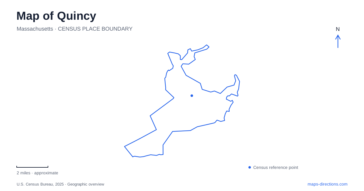
Street tiles load from OpenStreetMap when opened. The blue line shows the 2025 Census boundary.
- State
- Massachusetts
- Population · July 2025
- 103,173
- Land area
- 16.6 sq mi
- Water area
- 10.3 sq mi
Quincy contains several landscapes that deserve separate attention on a map: a presidential family's homes embedded in modern neighborhoods, a long harbor beach with marshland at its ends, and former granite workings beside the Blue Hills. Hancock Street, Franklin Street, and Adams Street organize the historic sites, while the shoreline and quarry paths introduce different kinds of movement. Reading these areas together reveals a place shaped by domestic history, coastal access, and the extraction and transportation of stone.
The Adams sites occupy several addresses
Adams National Historical Park is a collection of properties rather than a single enclosed estate. The visitor center stands at 1250 Hancock Street, approximately between the birthplace properties at Penn's Hill and the Old House at Peace field. Starting with that arrangement clarifies why the park appears at several points in search results.
John Adams's birthplace is at 133 Franklin Street, and the birthplace of John Quincy Adams is beside it at 141 Franklin Street. Peace field stands at 135 Adams Street and includes the Old House and Stone Library. These addresses describe two different family settings: the birthplace houses associated with early life, and the larger estate occupied by successive generations. A route that includes both follows the family's history across the surrounding city instead of remaining inside one museum building.
The National Park Service's landscape-treatment planning at Penn's Hill addresses the setting around the historic buildings. Its purpose is to recover elements of the earlier setting after substantial change around the houses. That is an especially useful interpretive point for a map reader: the surviving buildings are historic, but the modern streets and neighboring development do not reproduce the entire landscape known to the family.
Hancock Street as the central reference
The visitor center provides a practical anchor for the historic district, with introductory interpretation and information about the separate properties. The United First Parish Church and Hancock Cemetery add another layer nearby. The two presidents and their wives are entombed in the church's family crypt, while other family members are buried in the cemetery.
These sites serve different functions despite their shared historical associations. The church and cemetery relate to commemoration and burial; the Franklin Street properties explain family origins; Peace field preserves a later household and its accumulated collections. Organizing a visit around those distinctions produces a more coherent route than following every Adams-related marker in arbitrary order. The streets remain part of an active urban center, and the historical geography is woven into that everyday setting.
A beach with different landscapes at each end
Wollaston Beach forms the long open waterfront of Quincy Shore Reservation. The state describes a 2.3-mile beach with a route used for jogging and cycling. This length gives the waterfront a linear character, contrasting with the compact groups of historic buildings inland. A promenade walk can therefore be understood as a journey along the bay rather than a circuit around one park.
Caddy Park occupies the southern end, combining more than 15 acres of fields and marsh with recreation facilities. At the northern end, Moswetuset Hummock offers woodland and marshland paths. The latter was a summer campsite of the Massachusett people during the seventeenth century, adding an Indigenous history that long predates the presidential landmarks.
The hummock's short loop offers views toward the bay and Squantum Marsh. Its wooded setting differs from the open beach, even though both belong to the same broader shoreline system. The two ends are useful landmarks when describing a coastal walk: Caddy's fields and marsh anchor one end, while the hummock introduces a smaller, enclosed landscape at the other.
Granite workings near the Blue Hills
Quincy Quarries Reservation preserves a landscape created by extraction. Stone for the Bunker Hill Monument came from this area, and the inactive workings now support activities including rock climbing, hiking, and picnicking. The rock faces are therefore both recreational terrain and evidence of an industry that altered the ground itself.
The state park map identifies Ricciuti Drive, the Granite Railway Quarry, the smaller adjacent quarry, and a Rim Trail. It also marks Bunker Hill Quarry, a railway terminus, and the former railway alignment near the Blue Hills Reservation boundary. These labels reveal a connected industrial system: stone had to move from a quarry face into a transport route before it could become part of a distant monument.
For a map of Quincy, that industrial landscape completes the picture provided by the coastline and the Adams properties. The harbor offers a long public edge, the historic homes occupy specific urban blocks, and the quarries expose the material history beneath the city's development. Each area is most rewarding when read at its own scale, with the named roads, paths, and property boundaries showing how the pieces fit together.
Map and statistics: U.S. Census Bureau, 2025 Gazetteer, January 2025 generalized place boundaries and Vintage 2025 population estimates. Local references: National Park Service; Massachusetts DCR. Article prepared by Maps & Directions.