Map of Prescott
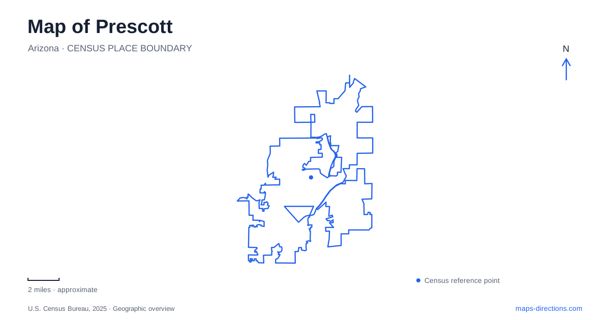
Street tiles load from OpenStreetMap when opened. The blue line shows the 2025 Census boundary.
- State
- Arizona
- Population · July 2025
- 48,420
- Land area
- 49.4 sq mi
- Water area
- 0.2 sq mi
Prescott has a compact territorial history district, but its map also reaches into pine forest, granite country and recovering creek habitat. Those landscapes deserve separate attention. The Governor's Mansion explains an early administrative center; Watson Woods reveals a damaged watercourse returning to life; the two Goldwater lakes demonstrate why adjacent blue shapes need different recreation plans. Reading these places together gives the city a more specific identity than an undifferentiated collection of Old West attractions.
A territorial house on its original ground
The log Governor's Mansion was built in 1864 for territorial governor John Goodwin and secretary Richard McCormick. Its position west of Granite Creek survives at the Sharlot Hall Museum. When the territorial capital moved to Tucson in 1867, H. W. Fleury acquired the building for private use. It did not resume its governmental role when the capital later returned. That distinction matters: a historic title can describe an earlier function rather than the building's entire working life.
The museum also contains structures relocated from elsewhere. The Fremont House, built in 1875, arrived at the museum in 1971. Consequently, the campus is both an original territorial location and a collection of buildings gathered for preservation. Check the museum's visitor guidance for the Governor's Mansion separately from other buildings on the grounds. A map pin therefore locates the museum campus without promising admission to that particular interior.
Whose history the museum tells
The Museum of Indigenous People gives Prescott a different, necessary historical perspective. Opened in 1935, the institution adopted its current name in 2020. Its earlier identity was associated with the non-Native Smoki organization, which performed invented representations of Native ceremonies. The museum describes those performances as fabricated, not authentic Indigenous traditions. Hopi objections contributed to their ending in 1990.
The current institution emphasizes Native voices and partnerships. Its stone museum and neighboring pueblo-style structure are twentieth-century historic buildings, not remains of an ancient settlement. This is an especially important distinction when interpreting architectural symbols on a visitor map. The site's significance includes a change in who interprets Indigenous culture and how that interpretation is presented, rather than simply the survival of picturesque buildings.
Creek woodland beyond the historic center
Northeast of central Prescott, Watson Woods Riparian Preserve protects 126 acres of a formerly much larger cottonwood-and-willow forest. The managing conservation organization describes an earlier riparian area of roughly 1,000 acres. Livestock grazing, dumping, wood cutting and especially sand-and-gravel extraction damaged the habitat. The wooded landscape visible today is therefore neither untouched wilderness nor just an ornamental city park.
Granite Creek and a perennial pond support the preserve's recovering vegetation and wildlife. The city and its conservation partner work with volunteers on protection and restoration. On a map, the stream corridor is a useful organizing feature: it connects the ecological story across parcels that might otherwise look like unrelated patches of green. A woodland outing here has a different purpose from launching a boat at the nearby reservoir or visiting a downtown museum.
Granite scenery and a reservoir destination
Watson Lake provides Prescott with a separate recreation focus among the Granite Dells. The municipal park entrance is reached from Highway 89, with its destination on Watson Lake Park Road. The lake's rock formations, boating opportunities and adjacent recreation land make the reservoir more than a decorative background on a regional road map.
Camping requires more care than identifying a tent symbol. The municipal campground uses a limited seasonal schedule, and special events can remove public camping availability. Check the campground's own calendar when an overnight stay overlaps an event at the lake. Someone planning a day beside the water and someone bringing overnight equipment therefore need different information, even when they begin with the same lake label. An overnight itinerary should be checked against the actual campground schedule and reservation arrangements.
Two forest lakes with different rules
South of Prescott, Upper and Lower Goldwater Lake occupy a pine setting. The city's recreation history traces the reservoir project to a dam on Bannon Creek in the early 1930s. It originally served the water-supply system and later developed a stronger recreation role. The name honors longtime civic leader Morris Goldwater.
The upper lake accommodates canoeing and kayaking, with electric rather than gasoline motors permitted. Lower Goldwater does not permit watercraft and has catch-and-release fishing restricted to artificial flies or lures. Neither lake permits swimming. Thus, moving from one shoreline to the other changes more than the view. For a practical map-based visit, choose the intended lake and activity first, then use the municipal recreation entrance and posted instructions. The smaller forest setting should not be confused with Watson's granite landscape simply because both places offer water and walking trails.
Map and statistics: U.S. Census Bureau, 2025 Gazetteer, January 2025 generalized place boundaries and Vintage 2025 population estimates. Local references: Sharlot Hall Museum; Museum of Indigenous People; Prescott Creeks; City of Prescott. Article prepared by Maps & Directions.