Map of Prattville
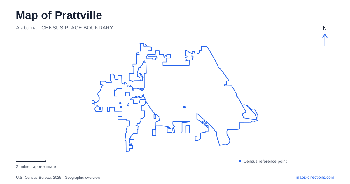
Street tiles load from OpenStreetMap when opened. The blue line shows the 2025 Census boundary.
- State
- Alabama
- Population · July 2025
- 40,582
- Land area
- 35.7 sq mi
- Water area
- 0.9 sq mi
Prattville developed around Autauga Creek, and the waterway still provides the clearest thread through its historic center. Factory buildings, the mill dam, creek-side public space, and a canoe route occupy different parts of the same landscape. Farther away, Wilderness Park and Cooters Pond introduce two additional settings: a bamboo-filled walking area and a recreation site on the much larger Alabama River. Distinguishing these places helps explain both the town's industrial beginnings and its present outdoor geography.
Manufacturing beside Autauga Creek
Daniel Pratt established mills along the creek before developing the cotton-gin manufacturing business that made the settlement nationally important. The Library of Congress engineering record identifies grist, lumber, and shingle mills at the site and records a cotton-gin plant operating by 1844. In 1899, the company combined with other manufacturers to form the Continental Gin Company.
The creek was therefore a source of industrial power, not merely an attractive boundary beside downtown. The relationship among water, mill structures, and factory buildings belongs at the center of any historical reading of Prattville. A cotton-gin factory produced machinery used to process cotton; it was distinct from a textile mill making cloth, even though both industries formed part of the local economy.
The factory's later history also matters. The Autauga County Heritage Association dates the closure of the manufacturing facility to 2012 and preserves records from its long operation. Describing the old complex as a historic industrial site avoids carrying earlier accounts of active production into the present.
A museum and an engineering archive
The Prattaugan Museum occupies the 1848 McWilliams-Smith-Rice House at 102 East Main Street. The Heritage Association opened the museum in 1995 and uses the Greek Revival building to interpret local family history, Daniel Pratt's work, and the wider county. Its domestic setting adds another scale to the much larger industrial structures nearby.
The association's collections include engineering drawings of cotton gins, buildings, and dams, along with photographs, ledgers, contracts, patents, and other business records. These materials connect the visible creek-side architecture to the machinery and working systems once associated with it.
For someone exploring Prattville, the museum address supplies a downtown point of reference while the archive explains why the industrial landscape is historically significant. The story extends beyond one founder or one surviving building to manufacturing technology, workers, water management, and the businesses that succeeded the original enterprise.
The four-mile canoe route
The established four-mile canoe trail begins behind City Hall and ends at Canoe Trail Park behind the animal shelter. Alabama Scenic River Trail identifies the downstream take-out at 1134 Reuben Road. These two access points define a one-way creek journey rather than a circular park route.
The downtown Creekwalk provides a land-based way to experience the same waterway. It is useful to distinguish the walking route from the blueway: the former follows public space beside the creek, while the latter uses the water itself. Their shared setting can make their names appear interchangeable even though they describe different forms of travel.
A longer trip continuing to the Alabama River has another geographic complication. The state conservation department explains that reaching a landing at Cooters Pond requires paddling upstream on the river after leaving the creek. The river confluence is therefore not equivalent to reaching the canoe trail's established take-out. For a map of Prattville, identifying the intended endpoint is particularly important because the local four-mile route and a river extension have different arrival arrangements.
Bamboo and recreation along Upper Kingston Road
Wilderness Park is listed at 800 Upper Kingston Road, with a hiking trail surrounded by giant bamboo. Its dense vegetation gives this park a character quite unlike the open water and industrial frontage downtown. It is a separate walking destination, rather than a continuation of the Creekwalk.
Farther along the same road, Upper Kingston Park and its community center occupy 1309 Upper Kingston Road. The municipal park inventory identifies a soccer complex, walking track, playground, and pavilion there. Keeping the two addresses in view clarifies the difference between a wooded walking park and a sports-oriented recreation site along the same corridor.
Cooters Pond and the wider river
Cooters Pond Park lies along the Alabama River in the southeastern part of the community, at 1844 Cooters Pond Road. The city's planning material identifies boat launches and other recreation facilities, while regional fishing events use it as a river-access venue.
This larger-water setting completes a useful picture of Prattville. Autauga Creek explains the historic industrial center and the local paddle route; Upper Kingston Road connects two different park experiences; and Cooters Pond opens onto the regional river system. The map becomes easier to read when those three landscapes retain their individual identities.
Map and statistics: U.S. Census Bureau, 2025 Gazetteer, January 2025 generalized place boundaries and Vintage 2025 population estimates. Local references: Library of Congress; Autauga County Heritage Association; Alabama Department of Conservation and Natural Resources; Alabama Scenic River Trail; Alabama Recreation Trails; City of Prattville; Alabama Bass Trail. Article prepared by Maps & Directions.