Map of Poway
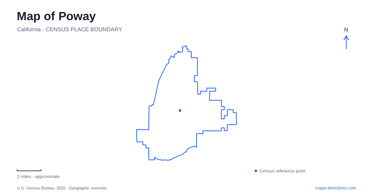
Street tiles load from OpenStreetMap when opened. The blue line shows the 2025 Census boundary.
- State
- California
- Population · July 2025
- 49,180
- Land area
- 39.1 sq mi
- Water area
- 0.1 sq mi
Poway combines a developed valley with historical sites and substantial canyon and hillside landscapes. Midland Road provides a heritage focus, Espola Road leads to Blue Sky Ecological Reserve, and several trailheads offer very different approaches to the surrounding heights. These features give a local map more than one scale: streets organize everyday destinations, while trail junctions and elevation changes become essential once an outing leaves the developed valley.
Old Poway Park and the railroad that did arrive
At 14134 Midland Road, the heritage park combines a museum, the Nelson House, landscaped grounds, and a small railroad. The house presents early twentieth-century domestic life, while the museum interprets the wider community. These are distinct parts of the same park, so a visit can move between buildings and grounds without treating the whole place as a single exhibit hall.
The railroad has a particularly useful historical distinction. A nineteenth-century proposal for a line through the valley encouraged a land boom and the subdivision called Piermont, but the planned railway went through Escondido instead. Street names including Midland, Adrian, Aubrey, and Edgemoor survive from that development period.
The park’s later recreational railway has a different origin. Colonel John Porter acquired an existing collection of railway equipment in 1966 and offered community rides at his Midland Road amusement park. After his death, the city purchased the land and railroad. The present attraction therefore should not be read as a surviving passenger station from the abandoned nineteenth-century proposal. It is a later collection that became part of the public heritage landscape.
Pauwai and the Indigenous landscape
The Kumeyaay-Ipai Interpretive Center at Pauwai addresses a much longer history than the railway-era settlement. The archaeological site developed as a partnership involving municipal government, Friends of the Kumeyaay, and the San Pasqual Band of Indians. Its physical address is 13104 Ipai Waaypuk Trail, with general parking identified separately at 13104 Carriage Road and accessible parking at the site.
The center’s displays and trails connect artifacts, native plants, ramadas, and milling areas. Bedrock grinding stations help explain how local resources supported daily life, while reconstructed elements demonstrate forms of shelter. The interpretation also emphasizes that Kumeyaay communities continue today; the site is not evidence of a people who simply disappeared.
This is a managed interpretive destination with scheduled public access, rather than an unrestricted neighborhood trail. The distinction matters when adding it to a map-based itinerary alongside parks that have ordinary daily opening arrangements.
Blue Sky's canyon entrance
Blue Sky Ecological Reserve protects a seven-hundred-acre canyon with creekside habitat, oak woodland, coastal sage scrub, and chaparral. Its public entrance is at 16275 Espola Road. The office address is elsewhere, so searching specifically for the reserve entrance avoids confusing administration with the start of a walk.
The habitat changes help explain the reserve’s appeal. Woodland and creek settings occupy different parts of the canyon from the scrub-covered slopes, making the route an opportunity to observe environmental transitions within a relatively compact area. The Green Valley Truck Trail is the principal corridor identified in the reserve literature, with other paths allowing closer exploration of selected areas.
Access rules also distinguish this landscape from a general cycling network. Bicycles and motor vehicles are prohibited, and the Creekside Trail and Oak Grove have additional restrictions on dogs and horses. Those limits reflect the reserve’s habitat purpose and should remain visible in how a visitor interprets its paths.
Lake Poway and the surrounding climbs
The municipal trail map separates the lake loop from routes climbing Mount Woodson and Iron Mountain. A line around the water represents a different outing from one continuing uphill toward a summit. The map provides route attributes and elevation profiles precisely because distance alone does not describe the effort or setting.
Mount Woodson has mapped approaches from the lake, Blue Sky, and Highway 67. Iron Mountain likewise has a direct route and a longer option involving Ellie Lane. These are not interchangeable starting points. Selecting a mountain name without selecting an approach can obscure substantial differences in route length and terrain.
The reserve brochure also identifies a wilderness picnic area below the dam, outside the reserve itself. Together with the recreation grounds reached by Lake Poway Road, this illustrates how adjacent outdoor destinations can have separate entrances and management purposes. A well-read map of Poway connects heritage, Indigenous interpretation, protected canyon habitat, and hillside recreation while retaining those important distinctions.
Map and statistics: U.S. Census Bureau, 2025 Gazetteer, January 2025 generalized place boundaries and Vintage 2025 population estimates. Local references: City of Poway. Article prepared by Maps & Directions.