Map of Post Falls
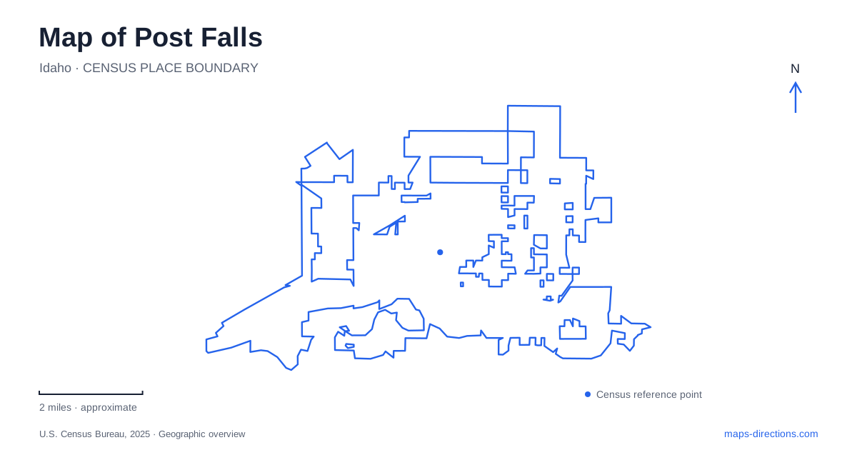
Street tiles load from OpenStreetMap when opened. The blue line shows the 2025 Census boundary.
- State
- Idaho
- Population · July 2025
- 46,715
- Land area
- 19.2 sq mi
- Water area
- 0.0 sq mi
Post Falls has a dramatic contrast between the Spokane River's rocky corridor and the more open prairie setting beyond it. Falls Park, Q'emiln Park and the Community Forest reveal different parts of that river landscape. The dam adds an engineered feature to the natural gorge, while the broader trail network connects recreation to the developed city. These places share a river but are not simply consecutive lawns along one level waterfront promenade.
Falls Park makes the dam and gorge visible
The city's park material describes Falls Park as a place to view the Avista dam, falls and gorge from paved paths and viewpoints close to the city center. This is a distinctive kind of urban park: the principal attraction is the relationship between moving water, rock and infrastructure. The view is not just of an undeveloped river, because the dam actively shapes the setting.
Interpretive signs and the arrangement of viewpoints help explain why the site matters. A map focused only on the water's outline would miss the structures and observation areas that organize a visit. Conversely, a road-only map would miss the gorge itself. Retaining both the river features and the park paths gives a much more informative picture of this central landscape.
Spokane Street crosses to Q'emiln
Q'emiln Park lies south of the river at the end of the Spokane Street Bridge. The city lists its address as 12201 West Parkway Drive and identifies swimming, launching, picnic areas and access toward climbing and forest trails. This places it in a different geographic role from the dam viewpoints: it is an activity hub on the south side of the crossing.
For Post Falls, the bridge is an important reference because it connects the developed street network with that south-bank recreation setting. The park's beach, launch and inland trail access also represent different uses within the same property. Water levels and dam-related conditions affect the waterfront operations; the city and Avista publish opening information for those facilities rather than treating them as permanently available just because they appear on a map.
The forest follows a rocky southern shore
The Community Forest extends along the southern shore of the Spokane River, facing the Avista Islands. The comprehensive plan describes granite cliffs, rock outcrops, native vegetation and an extended river frontage. Those features explain why a trail map here must show terrain and junctions, not merely a straight route beside the water.
Access is identified from Q'emiln on the eastern side and from trailheads along West Riverview Drive. The same planning material places Corbin Park across the river toward the west. This arrangement allows a map of Post Falls to show several public recreation areas around one corridor while still distinguishing their banks and approaches. Looking across the river at another park is not the same as having a direct path connection to it.
Open space can serve infrastructure as well
The city's water-recycling information describes the Community Forest as a multi-use property combining recreation and education with a planned role for highly treated reclaimed water applied through drip irrigation. This adds an important layer to the green area shown on the map. Its purpose is broader than a conventional ornamental park, and not every part of the property should be interpreted as an unrestricted activity area.
The same municipal information describes a separate Prairie Property on the Rathdrum Prairie for open space and recycled-water land application. These are distinct landscapes with a related infrastructure purpose. The river forest's cliffs and shoreline differ from the prairie setting, even when both appear under the same city program. Reading the land-use description alongside the map makes that relationship visible.
Trails extend beyond the gorge setting
Post Falls also participates in the North Idaho Centennial Trail network. The city's recreation guide distinguishes that broader context from local routes such as the Karen Streeter Trail north of Seltice Way, between Pleasant View and Chase Road, and the Prairie Trail on the northern side of the city. These references show that not every recreational line belongs to the river gorge.
The contrast is useful when choosing an outing. A northern multi-use route, a paved dam-viewing path and a forest trail among rock outcrops provide different terrain and surroundings. The shared word “trail” does not describe one uniform surface or experience. Use the route's specific map and allowed activities to select the right setting rather than assuming that all city trails can be joined into the same kind of ride or walk.
A river-centered city with a wider landscape
A map of Post Falls becomes most revealing when the city-center dam views, the Spokane Street crossing, the south-bank forest and the northern prairie routes are visible together. That picture explains both the concentration of recreation along the water and the different open-space roles beyond it. Choose the particular landscape first, then resolve the facility or trail access within that part of the city.
Map and statistics: U.S. Census Bureau, 2025 Gazetteer, January 2025 generalized place boundaries and Vintage 2025 population estimates. Local references: City of Post Falls; Avista. Article prepared by Maps & Directions.