Map of Portland
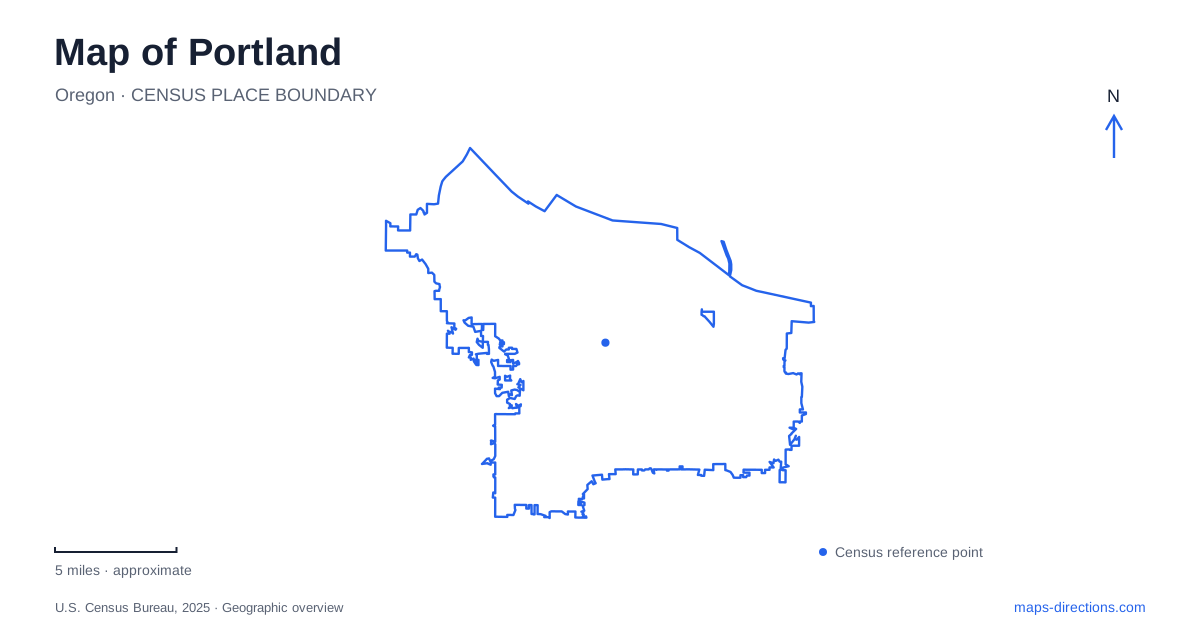
Street tiles load from OpenStreetMap when opened. The blue line shows the 2025 Census boundary.
- State
- Oregon
- Population · July 2025
- 635,109
- Land area
- 133.5 sq mi
- Water area
- 11.5 sq mi
Portland's local geography is easiest to read through two contrasts: east and west across the Willamette River, and the central street network compared with the wooded hills. Bridges make the first connection; trails, park roads, and transit stops organize the second. The address prefix supplies another important clue. Together, these features explain why a destination that looks close on a citywide map may belong to a different travel corridor or a different level of the landscape.
Address prefixes carry location information
The city uses six addressing districts, commonly called sextants: North, Northeast, Northwest, South, Southeast, and Southwest. The addition of the South sector in 2020 changed part of the former Southwest addressing area. This matters when an older address appears in a saved itinerary or historic document. The prefix should be treated as part of the location, not as an optional description.
Burnside Street forms the baseline from which numbering extends north and south. The river provides the most visible central east–west division, but the full six-sector system contains more detail than a simple four-quadrant diagram. On a Portland map, retaining the complete street name, number, and directional prefix makes it possible to move from the broad sector to the correct block without relying on a neighborhood name alone.
The riverfront has a paired path system
The Vera Katz Eastbank Esplanade extends between the Hawthorne Bridge and Steel Bridge, passing the Morrison and Burnside bridges. Across the river, Gov. Tom McCall Waterfront Park occupies the west bank. These two shorelines can be understood together, with bridge connections making a loop possible rather than leaving each path as an isolated out-and-back route.
The Eastbank route includes a floating walkway and connections to the eastside street network. Its urban markers identify corresponding streets, tying a waterside journey back to the grid above and inland. The Steel Bridge RiverWalk provides a pedestrian and bicycle crossing at the northern end. The city's suggested waterfront walk uses the Steel and Hawthorne bridges, which shows how named crossings define the extent of a particular loop.
This is a useful distinction from following a river line on a general road map. A shoreline path, a bridge deck, and a connecting ramp may be separate pieces even when they appear close together. Showing the path network reveals how those pieces actually meet.
Tilikum Crossing changes the bridge question
Farther along the river, Tilikum Crossing carries MAX Orange Line trains, buses, streetcars, people walking, and people cycling. General car traffic does not use it. The bridge therefore belongs on a Portland transit or walking itinerary in a way that differs from a driving route.
This is a concrete reason to choose a travel mode before interpreting a suggested crossing. A continuous line over the Willamette does not mean every vehicle can follow it. The bridge also makes the river a connection between transportation networks: rail, bus, bicycle, and foot routes share a crossing while retaining their own approaches and stops. For a local journey, its value lies in those connections as much as in the view from the span.
Washington Park is a collection of destinations
Washington Park contains the Oregon Zoo, World Forestry Center, Hoyt Arboretum, International Rose Test Garden, and Japanese Garden. Its destination groups are spread across a hilly landscape. The zoo and forestry center are near the MAX plaza at the south end, while the rose and Japanese gardens form a northern group. The arboretum adds a trail landscape between and around the larger attractions.
That arrangement makes the park's internal map important. Arriving at Washington Park station places a traveler near one group of destinations rather than at the entrance to every garden. The park map distinguishes sidewalks, paved paths, trails, stairs, roads, and shuttle stops. Those distinctions allow a visit to combine attractions according to their actual connections instead of assuming that one park name means one shared entrance.
For Portland visitors interested in trees and gardens, the contrast between the arboretum's collection and the formal gardens is also geographic. One is explored through a network of trails; the others occupy more defined destination areas within the same larger park.
Forest Park follows a creek and ridge network
Lower Macleay provides a specific approach to Forest Park at NW Upshur Street. Its trail follows Balch Creek and meets the Wildwood Trail after about 0.8 miles. A short paved segment extends into the creek canyon, while the wider trail system continues through natural terrain.
The Barbara Walker Crossing carries the Wildwood connection over West Burnside Road, linking the Washington Park and Forest Park landscapes. This small crossing helps explain how two large green areas connect without implying that all trails within them have the same surface or grade.
A map of Portland becomes more useful when these networks remain legible together: the address sectors locate the street, the river bridges determine cross-bank movement, and named trailheads establish entry into the hills. The resulting view reflects a city whose local routes depend as much on water and terrain as on the street grid.
Map and statistics: U.S. Census Bureau, 2025 Gazetteer, January 2025 generalized place boundaries and Vintage 2025 population estimates. Local references: City of Portland; TriMet; Explore Washington Park. Article prepared by Maps & Directions.