Map of Port Orange
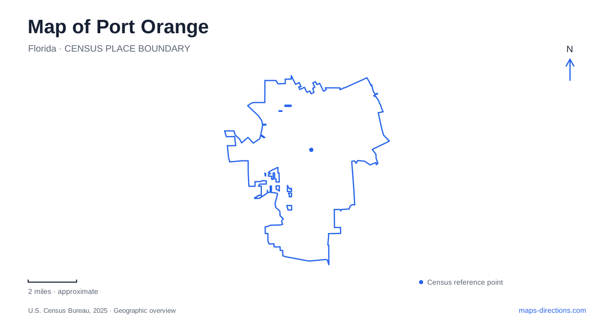
Street tiles load from OpenStreetMap when opened. The blue line shows the 2025 Census boundary.
- State
- Florida
- Population · July 2025
- 66,395
- Land area
- 26.8 sq mi
- Water area
- 2.0 sq mi
Port Orange lies south of Daytona Beach with the Halifax River shaping its eastern recreation landscape. Dunlawton Avenue and Ridgewood Avenue provide familiar road references, but the places worth distinguishing range from riverfront lawns to historic garden grounds and marsh trails. A useful map reveals those changes of setting. It also separates the history of plantation industry from the later community established by formerly enslaved people.
Two sections of Riverwalk Park
Riverwalk Park, at 3459 South Ridgewood Avenue, occupies two sections on either side of Riverside Pavilion along the Halifax River. The northern section emphasizes water access, with a launch for canoes, kayaks and paddleboards, boardwalk and fishing piers. The southern section has a playground, splash pad, event lawn, stage, picnic pavilions and a riverfront promenade.
That north-south arrangement gives the park a useful internal geography. Someone arriving to paddle has a different focus from a family meeting near the playground or a group attending an event on the lawn. A quarter-mile loop encircles the lawn, creating a short walking circuit within the larger riverfront setting.
For Port Orange, the park is a place to experience the Halifax directly rather than simply cross toward the Atlantic beaches. The riverfront, with its launches and piers, supports a different outing from an ocean beach visit. This distinction is visible in the park's facilities and helps explain why water access is distributed among several kinds of destinations.
Freemanville and a surviving community landmark
The city traces an important part of its post-Civil War history to John Milton Hawks, an abolitionist and Union Army surgeon, and the Florida Land and Lumber Company. In 1866, the company brought formerly enslaved people to lands along the Halifax north of Spruce Creek. The settlement faced difficulties, but some families remained and formed the community remembered as Freemanville.
Municipal history locates that community around Orange Avenue and Charles Street. Mount Moriah Baptist Church on Orange Avenue, dating to 1911, remains an important physical connection to its story. This is a neighborhood history that should be read through the people who built and sustained the community, not only through the ambitions of a lumber enterprise.
On a Port Orange map, Freemanville adds depth to the streets behind the river corridor. Its significance is not measured by the size of a park or the visibility of a major attraction. A church and a street intersection can preserve a community reference that a broad recreation map would otherwise overlook.
A sugar factory, gardens and concrete dinosaurs
Dunlawton Sugar Mill Gardens is at 950 Old Sugar Mill Road. The site contains a nineteenth-century sugar factory associated with the former Dunlawton Plantation, now within botanical grounds managed by a nonprofit organization. Its surviving industrial features belong to the area's plantation history, while the present paths and plant collections reflect a later use of the property.
There is another layer between those two periods. During the twentieth century, the property became Bongoland, an amusement park whose concrete dinosaurs still survive among the gardens. Their presence can seem unexpected until the site's successive uses are understood: industrial plantation, visitor attraction and botanical landscape.
The garden operator describes collections including palms, succulents, ferns, azaleas and camellias, as well as an Asian garden and a Florida-shaped herb garden. Those planted areas reward a slower walk around the grounds, while the mill and dinosaur figures mark very different historical episodes. Port Orange's local history is especially tangible here because several periods occupy the same parcel rather than separate museum rooms.
Spruce Creek and Rose Bay
Spruce Creek Park is farther along Ridgewood Avenue at number 6250. Volusia County describes a boardwalk connecting to nature trails, an observation tower overlooking marsh near the creek, and a trail continuation toward Rose Bay. It also provides a canoe launch, picnic areas and a playground.
This landscape is less formally urban than Riverwalk's lawn and promenade. The boardwalk and tower allow visitors to read the marsh at different heights, while the water and trails connect the immediate park to a larger estuarine setting. The county credits a school-led Rose Bay Legacy project with developing low-impact trails, planting native vegetation and supporting environmental work in the area.
Reading these places together gives Port Orange several distinct outdoor and historical routes. Riverwalk concentrates riverfront recreation, Freemanville anchors community memory, the sugar mill grounds preserve successive uses of one historic property, and Spruce Creek opens onto a marsh landscape. Ridgewood Avenue and the named cross streets help organize the journey, while each destination supplies a different reason to stop.
Map and statistics: U.S. Census Bureau, 2025 Gazetteer, January 2025 generalized place boundaries and Vintage 2025 population estimates. Local references: Visit Florida; City of Port Orange; Volusia County; Botanical Gardens of Volusia. Article prepared by Maps & Directions.