Map of Port Arthur
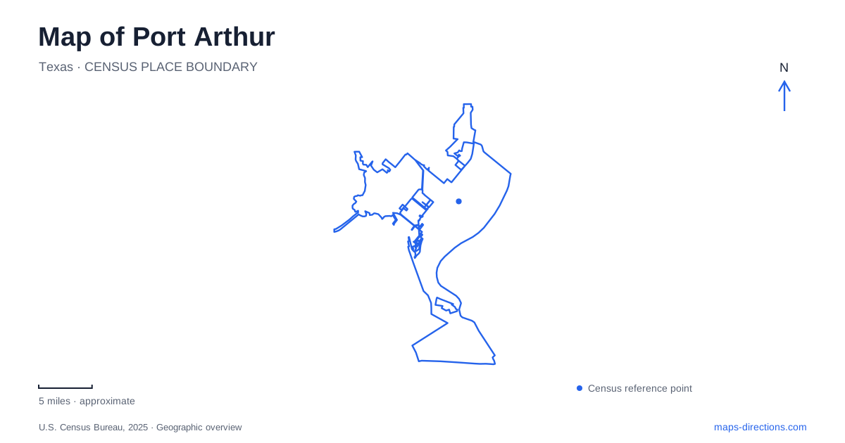
Street tiles load from OpenStreetMap when opened. The blue line shows the 2025 Census boundary.
- State
- Texas
- Population · July 2025
- 55,804
- Land area
- 75.6 sq mi
- Water area
- 47.2 sq mi
Port Arthur's geography is inseparable from water, but its waterways serve very different purposes. Downtown faces a shipping landscape, Pleasure Island separates broad Sabine Lake from the navigation corridor, and Sabine Pass leads toward the Gulf Coast. Farther west, Sea Rim State Park brings beach and marsh into the same outing. These places spread across a much larger area than a downtown street map suggests. Understanding the lake, channel, island, and coastal highway makes the city easier to explore as a series of connected environments.
Downtown history beside the shipping corridor
The Museum of the Gulf Coast is at 700 Procter Street, with parking and its entrance along Lakeshore Drive. That arrangement places a major cultural destination close to the working waterfront. Its collections cover the region's biology and history, while halls of fame highlight musicians, athletes, and other notable figures. Janis Joplin is among the musicians represented, giving visitors a familiar cultural connection to this industrial coastal setting.
Port Arthur's port history helps explain what lies outside the museum. The city's account describes a canal cut along the western edge of Sabine Lake to reach deep water at Sabine Pass. Seagoing trade began with the arrival of the British steamer Saint Oswald in 1899. The waterfront therefore reflects engineering intended to connect an inland town site with ocean shipping, not simply a settlement built beside an open beach.
Lakeshore Drive is a useful reference for exploring that relationship. The museum interprets the region indoors, while the seawall setting makes the proximity of maritime activity visible. An outing centered here can focus on history and the urban waterfront without requiring a trip all the way to the Gulf shoreline.
Pleasure Island between lake and channel
Pleasure Island is an elongated, artificial landform extending from the Neches River mouth toward the Sabine Causeway. The tourism bureau describes it as lying between Sabine Lake and the Intracoastal Waterway. Its length is an important part of the map: a destination at one end should not be treated as interchangeable with a marina or fishing point elsewhere on the island.
The Martin Luther King Jr. Bridge provides a recognizable approach from the city. On the island, the marina at 520 Pleasure Pier Boulevard and the fishing pier along Martin Luther King Jr. Drive are distinct anchors. The route between them follows the island landscape rather than a compact downtown grid. Water on both sides creates expansive views, but the named facilities give a visit a specific purpose.
For visitors exploring Port Arthur, the island also shows how industrial changes can produce recreation land. Dredged material from the navigation waterway helped create the landform. Fishing, boating, and birdwatching now occupy parts of a setting whose origins are closely tied to shipping. That combination is more informative than treating the island as a natural barrier beach.
Sabine Pass and a strategic water entrance
Sabine Pass Battleground State Historic Site stands at 6100 Dowling Road. It interprets the September 1863 Civil War battle in which Confederate defenders repelled a Union naval assault. The site's position near a vital shipping entrance explains its military importance: control of the pass affected access to regional ports and supplies.
Memorials address both the Confederate defenders and Union casualties. The place can therefore be read as a landscape of conflict around a water route, with the geography of the pass helping explain the historical event. This is a separate destination from the downtown museum, even though both illuminate the maritime history associated with Port Arthur.
A coastal itinerary can combine the battleground area with natural destinations farther west, but the roads require attention. From Sabine Pass, Highway 87 continues toward the marsh and beach landscape of Sea Rim. That movement shifts the outing from the ship channel entrance to a more exposed coast.
Sea Rim's road and habitat boundaries
Sea Rim State Park is ten miles west of Sabine Pass, with its address at 19335 South Gulfway Drive. Texas Parks and Wildlife identifies the park as a meeting place of coastal marsh and beach. Boardwalk and paddling routes give different ways to experience wetlands, while the beachfront offers a separate view of the coast. The park's name describes this transition between land, shallow water, and sea.
The most consequential road fact is that Highway 87 is closed between Sea Rim and High Island. It cannot be used as a continuous coastal drive westward from the park. That break changes the structure of a day trip and should be understood before connecting distant coastal destinations on a map.
A map of Port Arthur is thus best read through its different water settings: downtown's shipping edge, the long island beside Sabine Lake, the strategic entrance at Sabine Pass, and the marsh-and-beach environment at Sea Rim. Each reveals a different relationship between people, engineering, and the Gulf Coast.
Map and statistics: U.S. Census Bureau, 2025 Gazetteer, January 2025 generalized place boundaries and Vintage 2025 population estimates. Local references: Museum of the Gulf Coast; City of Port Arthur; Port Arthur Convention and Visitors Bureau; Texas Historical Commission; Texas Parks and Wildlife Department. Article prepared by Maps & Directions.