Map of Pontiac
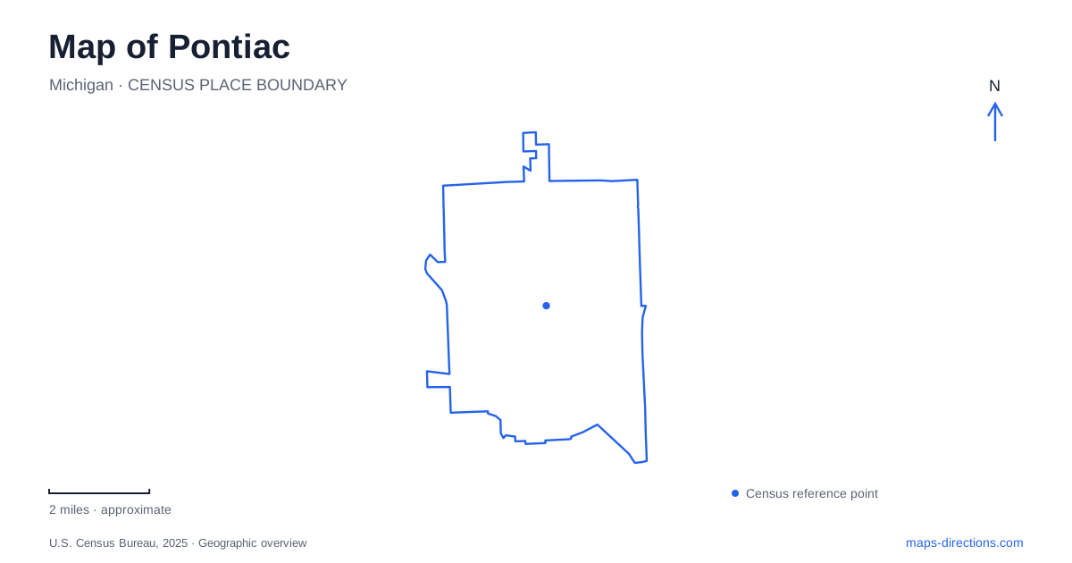
Street tiles load from OpenStreetMap when opened. The blue line shows the 2025 Census boundary.
- State
- Michigan
- Population · July 2025
- 62,077
- Land area
- 19.9 sq mi
- Water area
- 0.4 sq mi
Pontiac has an unusually revealing downtown map: the major road forms a loop around a smaller street network, while part of the river that shaped the settlement is hidden underground. Saginaw Street, Huron Street, Pike Street and Orchard Lake Road help explain the center inside and around that loop. Farther out, Telegraph Road and lakeside parks present another landscape. Understanding the relationship between those features makes the city more legible than following the largest highway line and assuming it passes every destination directly.
Woodward reaches the city as a regional corridor
The Michigan Department of Transportation identifies Woodward Avenue as M-1 and defines its corridor study from downtown Detroit to the Woodward Loop. This places Pontiac at the northern end of a recognizable metropolitan road axis. At the local scale, however, the loop and the streets inside it have different roles: one organizes through movement around the core, while streets such as Saginaw and Pike address the buildings within it.
The downtown transportation assessment maps Huron as M-59, along with the connections toward Orchard Lake Road and Auburn Road. These names are useful when comparing approaches from different directions. A visitor arriving along Woodward is following the metropolitan spine; someone approaching on Huron encounters a cross-city corridor. The final downtown destination can sit between those larger movements rather than directly on either of them.
Saginaw and Pike provide an identifiable center
The Crofoot locates its entertainment complex at the southeast corner of Pike and Saginaw, with the published address 1 South Saginaw. That corner offers a concrete reference within the loop and illustrates the scale of the older downtown: named streets and individual corners become more useful than regional highway shields once the trip reaches the center.
The venue also distinguishes rooms within the same complex. This is a local example of how the street pattern supports several activities in a compact area. For a show, retain the room or event name alongside the corner. On a broader map, Saginaw supplies the center's familiar north–south reference, while Pike identifies the cross street that makes this particular destination unambiguous.
The Clinton River is partly absent from the surface
The municipal master-plan material explains that the city developed around the Clinton River and that underground tunnels were built in the early 1960s to carry it beneath downtown. This is one of the most important facts for interpreting Pontiac: the absence of an open watercourse on an aerial view does not mean the river bypasses the urban center.
It also explains why the downtown experience differs from a town organized around visible riverbanks. A visitor looking for a continuous waterfront promenade beside the historic core would be reading the setting incorrectly. The river remains part of the city's physical history and drainage, but streets and buildings occupy the surface above part of its course. Older maps and present-day maps can therefore show the same place with strikingly different visual emphasis.
The plan separately identifies a downtown spur of the Clinton River Trail using designated sidewalks. A trail named for the river need not sit on an exposed riverbank throughout its length. That distinction connects the hidden-water story with the visible pedestrian network and helps explain why the trail's urban sections have a different character from a rural waterside path.
Telegraph Road leads to a two-lake park setting
Pontiac Oaks, formerly Hawthorne Park, is listed by Oakland County at 1400 Telegraph Road. The county describes shorelines on Creger Lake and Upper Silver Lake, with a dock and boat launch serving water recreation. The former and current park names refer to the same site, which is useful when comparing an older map with a current reservation or description.
The park adds another geographic pattern to the city: open water, trees and recreational space along a major road corridor rather than the compact downtown blocks. Creger and Upper Silver are specific lake references, not interchangeable names for one body of water. Locating both helps explain the park's setting and the distribution of shoreline facilities.
Orchard Lake Road gives another park reference
Beaudette Park's municipal recreation listing places its pavilion at 786 Orchard Lake Road. This ties a local recreation destination to one of the roads visible in the downtown transportation framework. It provides a useful additional anchor when a trip combines the center with a park visit, without suggesting that every park lies near the Telegraph Road lakes.
The map of Pontiac thus records several layers at once: Woodward's regional importance, the loop around the historic core, Saginaw and Pike at street scale, the concealed river beneath downtown and the separate lakeside landscape along Telegraph. Reading these together gives the city a coherent shape while retaining the distinct addresses needed for an actual visit.
Map and statistics: U.S. Census Bureau, 2025 Gazetteer, January 2025 generalized place boundaries and Vintage 2025 population estimates. Local references: Michigan Department of Transportation; City of Pontiac; The Crofoot; Oakland County Parks; City of Pontiac Recreation. Article prepared by Maps & Directions.