Map of Pleasanton
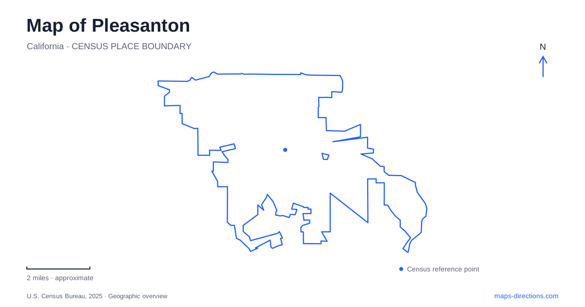
Street tiles load from OpenStreetMap when opened. The blue line shows the 2025 Census boundary.
- State
- California
- Population · July 2025
- 74,556
- Land area
- 24.1 sq mi
- Water area
- 0.1 sq mi
Pleasanton, California, combines a historic Main Street, a foothill heritage site, recreation lakes formed from quarrying, and rail stations serving different regional systems. These places do not line up around a single downtown transit hub. The older commercial center, northern freeway corridor, and open-space destinations each provide a different point of orientation. Reading those relationships first makes the city map useful for both a short downtown visit and a wider journey through the surrounding landscape.
Main Street and the local museum
Museum on Main stands at 603 Main Street beneath the downtown arch. Its interpretation follows the region from Native American habitation through later settlement and modern community life. The museum provides a historical reference point within the commercial district rather than a detached campus outside town.
The city identifies downtown as a concentration of nineteenth- and early-twentieth-century buildings, independent shops, and restaurants. This makes Main Street a useful place to read successive layers of development at a walkable scale. Museum exhibits add context to the buildings outside, while the street itself shows that the district remains a place for ordinary shopping and dining. A map of Pleasanton should therefore retain the individual cross streets and addresses here instead of treating the entire center as one attraction.
Alviso Adobe on the foothill side
Alviso Adobe Community Park is listed at 3465 Old Foothill Road. The adobe dates to 1844 and is identified by the city as its oldest surviving structure. It sits west of Foothill Road, north of Bernal Avenue, placing this historic landscape apart from the Main Street commercial core.
The park includes the homestead, an interpretive milking-barn building, and a reconstructed bunkhouse. These elements allow the site to address domestic and agricultural life as well as the age of the adobe walls. Its foothill position and views over the city provide a wider setting for that history. The museum downtown and the adobe park are complementary ways to understand the area, but they preserve different kinds of evidence: one gathers interpretation and collections, while the other retains a historic place within its landscape.
A former quarry on Stanley Boulevard
Shadow Cliffs Regional Recreation Area lies at 2500 Stanley Boulevard. Formerly a gravel quarry, it was donated by Kaiser Industries and opened as a park in 1971. The main lake and surrounding recreation grounds show how an extractive landscape can become a public destination rather than simply disappearing beneath later development.
For outdoor visits near Pleasanton, the distinction between the main lake and the smaller arroyo ponds is useful. The park district permits designated recreation on the main lake, while swimming and boating are not allowed in the quieter chain of smaller water bodies. Picnic areas, shoreline paths, and an interpretive pavilion provide other ways to experience the grounds. The lake outline alone does not reveal that difference in use, so the named areas matter when deciding which part of the park to explore.
The park also illustrates why old photographs should not be treated as a complete guide to present facilities. Solar carports now shade portions of the parking area, and the former quarry supports both habitat and developed recreation. Conditions and trail availability can change, but the quarry history remains central to understanding the unusual arrangement of water and land.
Two rail systems, separate locations
Dublin/Pleasanton BART station is at 5801 Owens Drive, straddling the municipal boundary along Interstate 580. Its position connects the northern part of the city to the regional rapid-transit network and local and regional buses. The freeway setting is a clear geographic clue that this station is outside the historic Main Street core.
The ACE station occupies 4950 Pleasanton Avenue, across from the main entrance to the Alameda County Fairgrounds. It belongs to a different railway service and sits in a different part of the city. For someone arranging a pickup, the operator name is therefore as important as the destination city: BART on Owens Drive and ACE by the fairgrounds are separate arrival points. A saved station label without the service name can conceal a substantial difference in the intended route.
Choosing a geographic focus
The city offers several coherent starting points rather than one compulsory circuit. Main Street concentrates commercial and museum activity; Old Foothill Road leads to the adobe's historic landscape; Stanley Boulevard identifies the quarry-lake recreation area; and the rail stations connect different parts of the city to wider travel networks.
These settings also reveal distinct stages in local development: an adobe homestead, an established downtown, industrial extraction reused for recreation, and modern regional commuting. Keeping those layers visible creates a more informative map than emphasizing only restaurants or only trailheads. Each place contributes a specific part of the community's story, and its road or station address shows how that story connects to the city around it.
Map and statistics: U.S. Census Bureau, 2025 Gazetteer, January 2025 generalized place boundaries and Vintage 2025 population estimates. Local references: Museum on Main; City of Pleasanton; East Bay Regional Park District; BART. Article prepared by Maps & Directions.