Map of Plant City
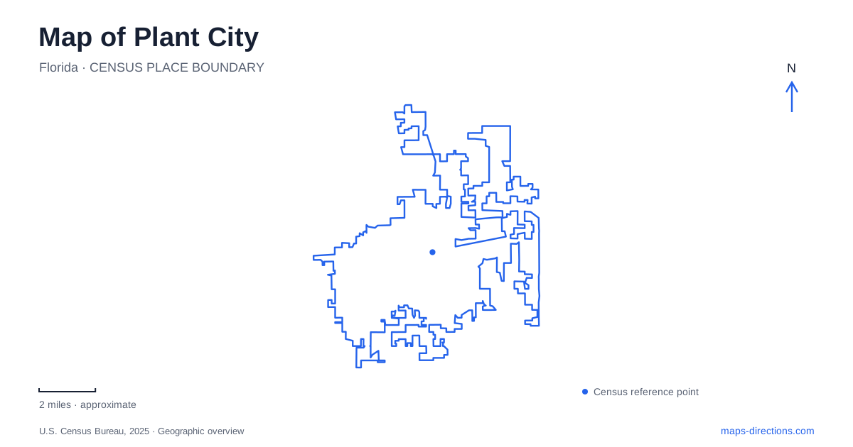
Street tiles load from OpenStreetMap when opened. The blue line shows the 2025 Census boundary.
- State
- Florida
- Population · July 2025
- 44,118
- Land area
- 30.2 sq mi
- Water area
- 1.0 sq mi
Plant City grew around a railroad junction, and that origin remains the most useful starting point for understanding its map. The downtown depot, festival grounds, and northern conservation lands represent different parts of an economy shaped by agriculture and transportation. Following those relationships reveals more than a list of attractions: it explains why a major historic building stands beside intersecting tracks, why strawberries have a dedicated event district, and why water management belongs in the discussion of local green space.
Begin with the junction
The Union Depot opened in 1909 to serve the Atlantic Coast Line and Seaboard Air Line railroads. Its shared use explains the word “Union.” The building was already serving competing companies decades before their eventual corporate merger, so that later merger should not be mistaken for the origin of its name.
At 102 North Palmer Street, the depot occupies the location that made the town an important shipping point. Hillsborough County describes the nearby track arrangement as a double diamond, where two sets of tracks cross another track. That geometry makes the rail corridor a particularly useful feature to identify on a close street map. The crossing is the reason for the building's position, rather than an incidental line passing a museum.
The station now houses the Robert W. Willaford Railroad Museum. Its collections include a restored Seaboard caboose and a Whitcomb locomotive, while a viewing platform stands across from the depot. Together they make the junction legible at two scales: the preserved equipment explains individual railway operations, and the surrounding tracks explain the town's connection to a wider distribution system.
An agricultural center with several industries
A map of Plant City becomes more informative when the railroad is read as commercial infrastructure. Farming, lumber, and phosphate mining all depended on rail transportation. The depot also received mail and housed Western Union telegraph service. It therefore concentrated communication as well as freight and passenger movement.
The National Register documentation records farmers being paid by buyers on the station platform as berries arrived for shipment. This detail connects the familiar strawberry identity to a specific piece of downtown ground. The platform was part of a working transaction between growers and distant markets, rather than simply a place where travelers waited for trains. Keeping that relationship in mind gives the railway museum and festival a shared historical context without treating them as the same destination.
Allen Street and the history of accommodation
Another essential point on the Plant City map is the Bing Rooming House at 205 Allen Street. Florida's Black Heritage Trail identifies it as a boarding house built in 1926 by Janie and E. L. Bing. During segregation it provided lodging for African American visitors, including traveling baseball players who could not rely on unrestricted access to local hotels.
The state's preservation account places the house within a former African American business district and describes its role in anchoring the Laura Street Restoration District. Stores, restaurants, family life, and the nearby Marie B. Ellis Park formed the broader neighborhood setting. Reading the building only as an isolated historic residence would miss that commercial and social geography.
The house also expands the transportation story. A railway connection could bring a person into town without guaranteeing equal access to accommodation after arrival. Placing the depot and boarding house within the same historical map helps explain that difference through actual locations.
The festival's own street geography
The Florida Strawberry Festival brings another scale of activity to Plant City. The festival's visitor material identifies a main ticket gate on West Oak Avenue and a parade route from downtown along Reynolds Street; check the event's arrival guidance for the edition you plan to attend. Those street references distinguish the fairgrounds from the older rail center while showing how an event can connect them.
Agricultural exhibits remain central to the festival, alongside entertainment. The published program includes livestock shows, youth plant activities, poultry, and rabbits. A useful festival map therefore includes exhibition and livestock areas as well as performance venues. The event's office address alone does not describe that arrangement; the grounds map supplies the internal geography for a particular year's visit.
Northern land and the water system
McIntosh Preserve adds a different dimension to Plant City. Municipal planning documents identify it as conservation land and connect future wetland expansion with water-quality management. The city's financial reporting describes an integrated water plan in which treated recycled water and wetland processes have a role, alongside study of additional water-supply options.
This is a landscape with environmental infrastructure beneath the recreational label. It deserves to be read separately from downtown blocks and festival streets. Proposed canal-trail connections in planning studies also represent future possibilities, not proof of a continuous completed walking route. Keeping existing places and proposed connections distinct produces a more useful picture of how the city is developing around its historic core.
Map and statistics: U.S. Census Bureau, 2025 Gazetteer, January 2025 generalized place boundaries and Vintage 2025 population estimates. Local references: Hillsborough County; Robert W. Willaford Railroad Museum; National Park Service; Florida Department of State; Florida Strawberry Festival; City of Plant City. Article prepared by Maps & Directions.