Map of Placentia
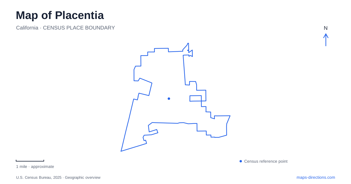
Street tiles load from OpenStreetMap when opened. The blue line shows the 2025 Census boundary.
- State
- California
- Population · July 2025
- 54,911
- Land area
- 6.7 sq mi
- Water area
- 0.0 sq mi
Placentia preserves its agricultural history in several different kinds of places. Old Town contains the commercial and civic buildings associated with a growing citrus community, while two historic homes retain more personal connections to ranch life. Farther north, Tri-City Park provides a lake-centered recreation landscape near neighboring municipal boundaries. A map that distinguishes these places tells a richer story than one focused only on present shopping streets. Bradford Avenue, Santa Fe Avenue, Bastanchury Road, and Kraemer Boulevard provide useful starting references.
Citrus shipments shaped Old Town
The city's historical account identifies 1910 as an important moment, when local leaders persuaded the Santa Fe Railroad to route tracks through the community to carry agricultural shipments. A station and packing houses followed. This relationship between groves, packing operations, and rail transport explains why the older commercial center developed where it did. Santa Fe Avenue's name is a reminder of that connection, rather than an incidental street label.
Bradford and Melrose avenues also preserve names associated with laying out the town's main streets. The community incorporated in 1926, when its municipal area was much smaller than it is today. That history helps explain why Old Town is a specific district within the modern city, not a description of all its developed land. Later expansion surrounded a relatively compact original center with other neighborhoods and land uses.
A civic cluster on Bradford Avenue
Old Town Placentia can be explored through the historic addresses along South Bradford Avenue. The city's revitalization plan identifies the former library at 143 South Bradford, the old city hall at 120, and the telephone exchange at 125. These buildings form a recognizable cluster of earlier public and civic services, with Spanish Colonial Revival architecture contributing to their shared character.
The Kraemer Building at 238 and 240 South Bradford adds a commercial landmark dating to 1914. Along Santa Fe Avenue, the plan identifies further historic commercial blocks connected with the town's formation and citrus economy. The practical value of these addresses is that they turn a broad historic-district label into a sequence of actual streets and buildings. North Bradford Avenue leads to another public destination, Kraemer Park, whose picnic shelters are addressed at 201 North Bradford.
Bradford House on Palm Circle
The Bradford House introduces another part of Placentia's history at 136 Palm Circle. Built in 1902, the two-story residence was designed by James Stafford for Albert Sumner Bradford. Its National Register documentation describes a substantial ranch home with fifteen rooms, a basement, an attic, and a broad veranda. The architecture reflects the prosperity that agricultural business could bring to an individual household.
This domestic landmark offers a different perspective from the packing and civic buildings of Old Town. One setting explains public commerce and municipal development; the other shows how a prominent ranch family lived. The house also makes Palm Circle a distinct destination on the map. Bradford Avenue's historical association does not mean the Bradford residence is located on that avenue, an easy assumption to make when navigating by names alone.
An orange grove beside a historic home
George Key Ranch is another surviving agricultural site in Placentia, at 625 West Bastanchury Road. OC Parks maintains a historic house built in 1898, a collection of farm tools and equipment, an orange grove, and a garden. Keeping the planted landscape alongside the home allows visitors to understand the property as a ranch remnant rather than only an architectural exhibit.
The house was damaged in the March 2014 earthquake and reopened after extensive repairs in November 2021. Its restoration is a reminder that these buildings survive through active preservation work. The county offers scheduled access and tours, so this is a focused historic visit rather than an unrestricted neighborhood park. Bastanchury Road provides the essential arrival reference, separating the ranch from both Palm Circle and the Old Town civic cluster.
The lake and approaches at Tri-City Park
Tri-City Park adds a recreation destination to a map of Placentia. The county map lists 2301 Kraemer Boulevard as its address but marks the main entrance on Golden Avenue and a secondary entrance on Rolling Hills Drive. This is a concrete example of why the entrance drawing is more useful than the street address alone for a large public property.
Paths circle the central lake, with picnic shelters, play space, bridges, and parking distributed around the grounds. The park's setting near Fullerton and Brea explains its regional name. Together with Old Town and the two ranch houses, it gives the city several complementary places to explore: commercial history, domestic architecture, surviving agriculture, and public open space. Following their named roads reveals how those layers fit into the present urban landscape.
Map and statistics: U.S. Census Bureau, 2025 Gazetteer, January 2025 generalized place boundaries and Vintage 2025 population estimates. Local references: City of Placentia; National Park Service; OC Parks. Article prepared by Maps & Directions.