Map of Pittsburgh
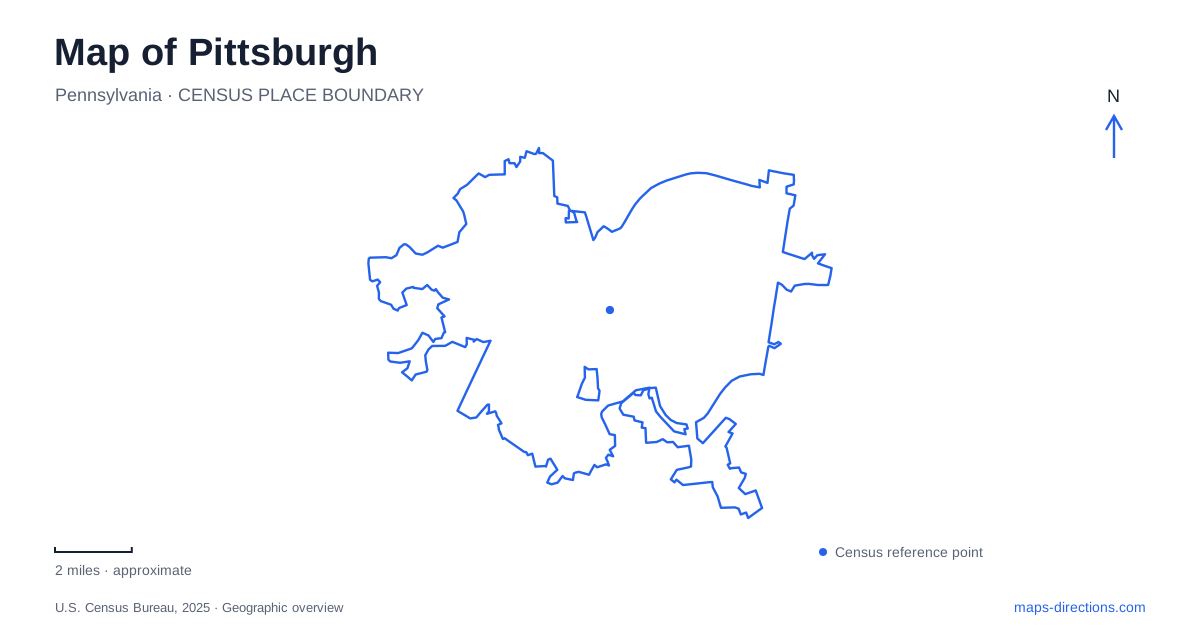
Street tiles load from OpenStreetMap when opened. The blue line shows the 2025 Census boundary.
- State
- Pennsylvania
- Population · July 2025
- 307,632
- Land area
- 55.4 sq mi
- Water area
- 3.0 sq mi
Pittsburgh's map becomes intelligible when the rivers and slopes are read before the streets. The Allegheny and Monongahela meet to form the Ohio, placing downtown within a triangular piece of land. Bridges connect that center with other riverbanks, while inclines climb toward Mount Washington. Farther along the urban corridors, former produce infrastructure and established cultural landscapes reveal different chapters of development. These features explain why a short straight-line distance can cross water, climb a hillside, or pass between neighborhoods with quite different forms.
The point where the rivers meet
Point State Park occupies 36 acres at the tip of the Golden Triangle. The park commemorates the strategic importance of the Forks of the Ohio during the French and Indian War. Its open landscape, fountain, and interpretation of the fort sites make the confluence both a geographical landmark and a historical destination.
The rivers define the downtown peninsula rather than simply passing through a continuous grid. A route leaving the triangle may cross the Allegheny, the Monongahela, or the Ohio depending on its direction. The Fort Pitt and Fort Duquesne bridges consequently play different roles even though their approaches converge near the same downtown end.
For a map of Pittsburgh, the Point is a particularly useful starting reference because it establishes the relationships among all three rivers. It also explains why this location became strategically significant long before the modern skyline: control of the confluence meant control of connected waterways extending into a much larger region.
The Three Sisters have numbered identities too
The closely spaced Three Sisters bridges cross the Allegheny at Sixth, Seventh, and Ninth streets. Their commemorative names are Roberto Clemente, Andy Warhol, and Rachel Carson respectively. Recognizing both naming systems makes addresses, bridge signs, and historical descriptions easier to connect.
The Seventh and Ninth Street bridges opened in 1926, while the Sixth Street crossing followed in 1928. Their related self-anchored suspension designs create a recognizable family of structures along the downtown waterfront. The similarity is visually striking, but the individual street connections still determine where a crossing leads.
These bridges also make the opposite bank part of a closely connected central-city landscape. Looking across the river does not necessarily mean looking toward a distant district. The repeated crossings provide several links, each aligned with a different downtown street and therefore a different approach to surrounding destinations.
Inclines connect the river level with Mount Washington
The Monongahela Incline opened in 1870. Its lower station stands on West Carson Street near Station Square and the Smithfield Street Bridge, while its upper station reaches Grandview Avenue. This is a transport route defined by elevation: the two ends occupy distinct levels of the same hillside setting.
The Duquesne Incline is a separate facility, owned by the regional transit agency and operated by a preservation organization. Both inclines overlook the central city, but they should be identified by name when choosing an approach. The Monongahela route's connection with Station Square makes it part of the wider light rail and bus network as well as a viewpoint experience.
The inclines make Pittsburgh's terrain unusually visible in its transportation system. A flat street map can show their short horizontal alignment, but the purpose of the railway becomes clear only when the steep relationship between riverbank and hilltop is understood.
Produce trade shaped the Strip District
The Strip District borders downtown and retains a concentration of grocers, food shops, produce sellers, and restaurants. Penn Avenue and Smallman Street provide important commercial references. The Terminal opened in 1929 as the Pennsylvania Railroad Fruit Auction & Sales Building, serving the surrounding region as a produce distribution hub.
Its long building form and the district's warehouse architecture reflect that freight and wholesale history. Contemporary shops and dining now occupy a setting whose street patterns were shaped by moving and selling goods. The Heinz History Center on Smallman Street adds a place to explore the region's industrial and cultural development within that same district.
Reading the Strip as a former distribution landscape gives its scale and buildings a reason. It is a useful counterpart to the civic and office setting of downtown, showing another way commerce organized land beside the rivers in Pittsburgh.
Schenley Park and the Oakland cultural landscape
Phipps Conservatory and Botanical Gardens stands in Schenley Park within Oakland. Henry Phipps gave the conservatory to the city in 1893, creating a public garden during the industrial era. The historic glasshouse and later additions place cultivated plant collections within a much larger green setting.
Panther Hollow adds a different environmental feature to the park, with streams draining toward its lake. Restoration work has addressed runoff and erosion in that watershed, demonstrating that the park's slopes continue to influence how water moves through it. Together, the confluence, bridges, inclines, produce district, and park landscape show Pittsburgh as a city whose form remains closely tied to waterways, terrain, and the infrastructure built around them.
Map and statistics: U.S. Census Bureau, 2025 Gazetteer, January 2025 generalized place boundaries and Vintage 2025 population estimates. Local references: Pennsylvania DCNR; Library of Congress HAER; Allegheny County; Pittsburgh Regional Transit; Visit Pittsburgh; Strip District Terminal; Strip District Neighbors; Phipps Conservatory; Pittsburgh Parks Conservancy. Article prepared by Maps & Directions.