Map of Pittsburg
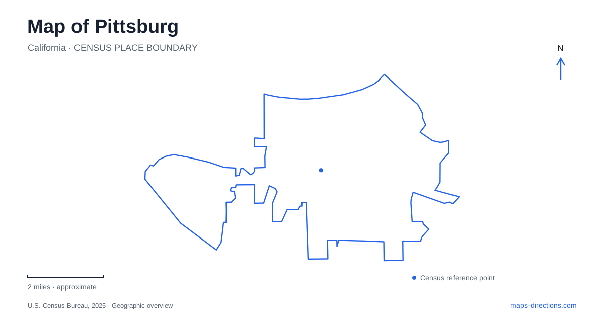
Street tiles load from OpenStreetMap when opened. The blue line shows the 2025 Census boundary.
- State
- California
- Population · July 2025
- 77,542
- Land area
- 18.6 sq mi
- Water area
- 2.1 sq mi
Pittsburg's geography connects the waterfront with the hills to the south. Coal once traveled along the corridor now called Railroad Avenue to ships waiting at the shore, while fishing, canning, and later manufacturing gave the city other economic foundations. Today that relationship is visible through Old Town, the marina, the rail stations near Highway 4, and the regional mining landscape beyond the neighborhoods. Following these connections gives the map a clear structure from water to foothills.
Railroad Avenue explains the old center
The waterfront settlement was once known as New York Landing. Fishing and canning became important industries, while the discovery of coal in the southern hills brought the name Black Diamond into local use. The city's history describes coal cars moving along present-day Railroad Avenue to a waterfront loading station. The street name therefore records a physical link between extraction inland and shipping at the shore.
Pittsburg adopted its current name in 1911, reflecting its association with steel manufacturing and the better-known industrial city in Pennsylvania. The spelling without a final “h” distinguishes the California city. The historical society museum at 515 Railroad Avenue offers a useful place to investigate this sequence of names and industries within the old commercial district itself.
Old Town's planning documents focus on Railroad Avenue between Third and Tenth streets, with Cumberland and Black Diamond streets helping frame the area. John Buckley Square occupies the block defined by Railroad Avenue, Fifth, Sixth, and Black Diamond. These street references reveal a compact district where the industrial history can be related to a walkable collection of blocks rather than an abstract citywide story.
The marina at the edge of the Delta
The marina's published address is 51 East Marina Boulevard. California State Parks identifies its waters with the Sacramento–San Joaquin Delta and Suisun Bay, placing this local waterfront within a much larger navigable system. Boat berths, a launch, and support facilities give the shore a working recreational role alongside its historical shipping associations.
A marina view also changes the scale of the map. The streets of Old Town form a closely spaced land grid, while the water opens toward channels and destinations far beyond the city. This contrast is part of the waterfront's character: the end of a local street can also be the beginning of a journey through the Delta.
The marina and Old Town are adjacent, but they have different layouts. The numbered streets and Railroad Avenue organize the older district, while Marina Boulevard and the harbor facilities organize the waterside arrival. Reading both patterns together makes it easier to combine time in the commercial center with a waterfront stop.
Two rail stations with different addresses
Pittsburg Center station is at 2099 Railroad Avenue. It uses the train service connecting toward Antioch, with a transfer platform where riders change between those trains and the larger BART vehicles. BART specifically notes that this transfer platform can be reached only by train, so it is not an additional street-access station or a place to arrange a vehicle pickup.
Pittsburg/Bay Point station is a separate destination at 1700 West Leland Road. Its name and position distinguish it from the Railroad Avenue station even though both belong to the Yellow Line corridor. The two addresses are especially useful when comparing a driving arrival with a rail itinerary: the desired station determines which local street network the trip uses.
These modern connections echo the city's long relationship with transportation while serving a different purpose from the coal route. Railroad Avenue now links the historical district with a contemporary passenger station, allowing one street to make several periods of local development visible.
Harbor Street recreation and the southern hills
Small World Park at 2551 Harbor Street is an eight-acre family recreation destination with play structures, picnic areas, ponds, and small amusement attractions. Buchanan Park, farther along the same named street at 4150 Harbor Street, is another municipal park location. Their addresses place them within the inland neighborhood landscape rather than the marina district.
Beyond the developed area, Black Diamond Mines Regional Preserve connects the local story back to the coalfields. The preserve lies south of the city and Antioch, but its main vehicle entrance is approached from Somersville Road in Antioch. This is a useful regional distinction: proximity to the hills does not mean every neighborhood road provides a public park entrance.
The Greathouse Visitor Center occupies an underground chamber excavated during the sand-mining era of the 1920s. Its exhibits connect nineteenth-century coal mining with twentieth-century sand extraction. Above ground, trails pass grassland, woodland, and other foothill habitats, while former mining places give the terrain a historical layer. Seen alongside the waterfront loading corridor, this preserve helps explain Pittsburg as part of a connected landscape of mines, rail movement, industrial work, and waterborne trade.
Map and statistics: U.S. Census Bureau, 2025 Gazetteer, January 2025 generalized place boundaries and Vintage 2025 population estimates. Local references: City of Pittsburg; California State Parks; BART; City of Pittsburg Recreation; East Bay Regional Park District. Article prepared by Maps & Directions.