Map of Phenix City
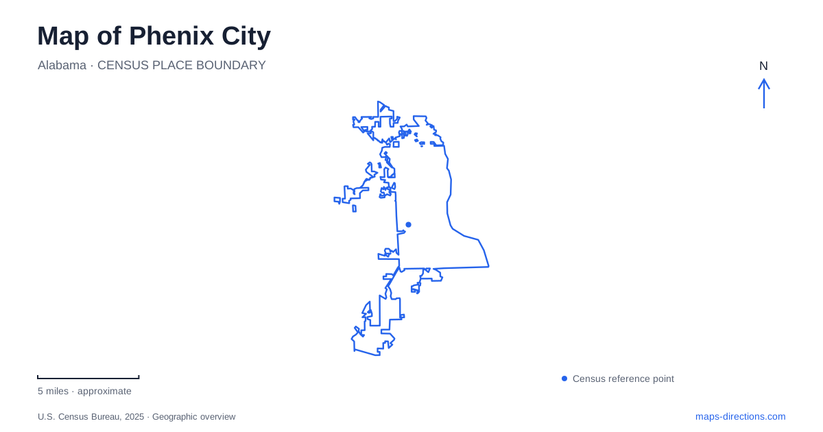
Street tiles load from OpenStreetMap when opened. The blue line shows the 2025 Census boundary.
- State
- Alabama
- Population · July 2025
- 38,344
- Land area
- 28.1 sq mi
- Water area
- 0.1 sq mi
Phenix City occupies the Alabama side of the Chattahoochee River opposite Columbus, Georgia. The river is both a state boundary and the central feature of a shared urban landscape. Bridges connect workplaces, neighborhoods and recreation areas across it, but the two banks retain separate street systems and civic histories. An accurate map begins with that distinction rather than treating everything visible from the waterfront as part of one municipality.
Girard and the communities behind the current name
The municipal history describes the area as part of the territory of the Coweta branch of the Creek Nation before the growth of the later river towns. Brownville incorporated in 1883, and Girard merged with its neighboring municipality in 1923. Older references to Girard, Brownville, Lively and Knight's Station reflect different civic, postal and railway naming practices. They are not all current neighborhoods with neatly matching boundaries.
Columbus State University's archival account adds an economic connection: many residents on the Alabama bank crossed the bridge to work in the Eagle and Phenix Mill. The river separated their homes from employment without preventing close daily ties. This relationship helps explain why the history of Phenix City cannot be read solely within its municipal outline. Industrial work across the water shaped settlement on this side as well.
The western riverwalk and the crossing points
The city's riverwalk begins at the open-air amphitheater and follows the western bank northward. Its published description gives the established route a length of about 1.21 miles. Concrete, brick, decked sections and small bridges produce a changing relationship with the river rather than one uniform promenade. Portions incorporate older dam structures and stand higher above the water.
Dillingham Street Bridge and the Fourteenth Street pedestrian bridge are recognizable crossing points. Their roles should remain distinct on a route map: a pedestrian connection is not interchangeable with a through road for vehicles. Across the river, the Columbus trail system continues along the Georgia bank. That longer network does not change the length or ownership of the Alabama riverwalk.
River recreation and the older industrial setting
A map of Phenix City places the amphitheater, bridge approaches and whitewater viewing areas within the same waterfront setting. Municipal project material dates the urban whitewater course's opening to 2013. The riverfront consequently contains both remnants of an industrial water landscape and newer recreational uses. Looking at the river only as a blue boundary line misses that transformation.
Watching the water from a path and entering it for whitewater recreation are separate activities. The riverwalk provides land-based viewpoints; the course involves a different environment and operating arrangements. Similarly, a line following the bank does not imply that every riverside parcel offers unrestricted access down to the water. The map is most informative when it distinguishes the public path, bridges, developed activity areas and river channel.
Moon Lake is a separate inland destination
Idle Hour Park surrounds Moon Lake at 900 Airport Road. The municipal facilities list includes a children's learning trail, a jogging path, nature trail, picnic areas and playground. This is an inland park setting with its own paths and shoreline, rather than another name for the Chattahoochee waterfront. Its lake and surrounding recreation grounds create a different spatial experience from the long river corridor.
The 2023 comprehensive plan proposes stronger links between the riverwalk and Idle Hour Park, along with other pedestrian and bicycle routes. Those lines describe planning intentions. They should not automatically be represented as completed, continuous trails. Keeping a proposed connector separate from an existing path is especially useful here because both destinations already have their own established walking areas.
A changed university landmark
Older descriptions of Phenix City may direct readers to Troy University's riverfront campus. The university's information-technology report records completion of the building in July 2015, ahead of classes that August. However, Troy announced in March 2025 that its trustees had voted to end campus operations by December 31 of that year. The later closure announcement supersedes older campus-opening and visitor material.
This is a reminder that a recognizable building can outlast the activity for which it first became known. Historic references to the riverfront campus remain useful for understanding waterfront development, but they should not be presented as evidence of an operating university campus today. New ownership or reuse requires its own current confirmation; a familiar map label alone cannot establish either.
The clearest map of Phenix City brings these distinctions together: former river towns behind the modern municipality, Alabama and Georgia banks joined by specific bridges, a public riverwalk beside a changing recreation landscape, and Moon Lake's separate inland park. The result is a connected picture of the city without erasing its different places or confusing future projects with routes already on the ground.
Map and statistics: U.S. Census Bureau, 2025 Gazetteer, January 2025 generalized place boundaries and Vintage 2025 population estimates. Local references: City of Phenix City; Columbus State University Archives; Troy University. Article prepared by Maps & Directions.