Map of Pharr
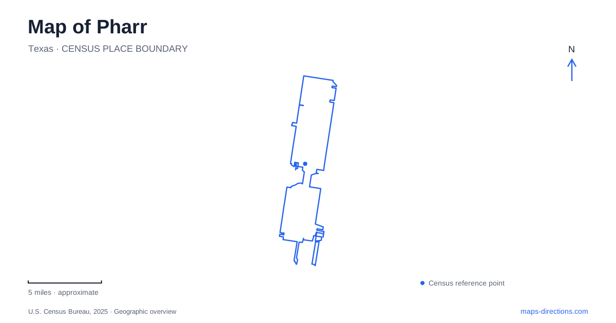
Street tiles load from OpenStreetMap when opened. The blue line shows the 2025 Census boundary.
- State
- Texas
- Population · July 2025
- 80,830
- Land area
- 24.4 sq mi
- Water area
- 0.0 sq mi
Pharr's geography combines a central civic district with transportation corridors that extend far beyond it. Cage Boulevard appears in the addresses of City Hall, a major swimming facility, and the international bridge, but those addresses refer to very different portions of the city. The local map also contains quieter destinations on Cherokee Avenue, Richmond Drive, and Kelly Avenue. Understanding the length of the main corridor is the first step toward keeping these places distinct.
A transportation history behind the street map
The Texas Historical Commission connects the town's development with irrigation, rail transportation, and highway crossings. The railroad arrived in 1905, and the canal company organized in 1910 helped supply water for agriculture. Together, water distribution and produce shipping supported a shift from ranching toward crop production.
That history explains why transport infrastructure has such a strong presence in Pharr. The community was not simply a residential settlement that later acquired major roads. Shipping, irrigation, and regional connections were central to its development. The historical marker also identifies incorporation in 1916 and the later international bridge as part of the city's commercial role.
Today, TxDOT identifies the I-2 and I-69C interchange as a major regional transportation junction. It belongs to a different scale of movement from the local streets around civic buildings. Reading the highway junction and the older city streets as separate layers helps distinguish a regional approach from the final few blocks of a local visit.
Cage Boulevard and the civic addresses
City Hall is at 118 South Cage Boulevard. The municipal department directory places several administrative offices in that building, while the Municipal Court and Police Department use 1900 South Cage Boulevard. The common road name therefore does not mean that every government visit begins at City Hall.
Memorial Library is at 121 East Cherokee Avenue. Its own programming materials distinguish this main library from the Development and Research Center at 850 West Dicker Road. A calendar marked with the library's initials and a calendar marked for the research center refer to different venues, even when the same activity appears in both places.
For a map of Pharr, these addresses create useful civic reference points. Cage Boulevard organizes several government destinations, Cherokee Avenue identifies the main library, and Dicker Road identifies a separate program location. The complete venue name matters as much as the activity name when choosing where to go.
Two swimming destinations and a recreation center
The city's facility directory lists the Natatorium at 3001 North Cage Boulevard and the Aquatic Center at 1000 South Fir Street. These are separate locations. A search for swimming facilities can return both, so the distinction should remain explicit rather than collapsing them into one generic pool destination.
The Jose “Pepe” Salinas Recreation Center is at 1011 West Kelly Avenue. The park directory also places the tennis complex and skatepark at that address. Here the shared address has a different meaning: several recreation functions belong to one local destination, rather than two similarly named facilities occupying separate streets.
This contrast is especially useful in Pharr because municipal recreation listings combine buildings, parks, and programs. North Cage Boulevard, South Fir Street, and West Kelly Avenue identify three different settings. The map becomes clearer when the particular facility is retained instead of using a broad label such as recreation center for all of them.
Native habitat on Richmond Drive
The Vanguard Academy Nature and Birding Center occupies eight acres at 1025 South Richmond Drive. The city describes native habitat, a walking trail, stationary viewing equipment, interpretive signs, and an amphitheater. Its purpose differs from the courts and swimming facilities: the path is organized around observing and interpreting the landscape.
The park's modest footprint is part of its character. It provides a local nature destination embedded within the city, rather than requiring a journey to a large regional refuge. Richmond Drive is the relevant street reference, while the trail and viewing stations explain the activity within the property. The city's rules identify it as a walking setting rather than a bicycle route.
The bridge at the southern end of the corridor
The international bridge's own contact page gives 9900 South Cage Boulevard. That address should be distinguished from the much smaller street numbers used by civic buildings. The bridge is a border transportation destination, so following the shared boulevard name without noticing the number can conceal the scale of the journey.
Pharr is more understandable when its map holds these different scales together: the highway interchange for regional travel, central civic addresses for local services, separate recreation properties, a compact native-habitat park, and the bridge corridor extending south. The transportation history ties them together, while precise street and facility names keep each visit focused on the intended place.
Map and statistics: U.S. Census Bureau, 2025 Gazetteer, January 2025 generalized place boundaries and Vintage 2025 population estimates. Local references: Texas Historical Commission; Texas Department of Transportation; City of Pharr; City of Pharr International Bridge. Article prepared by Maps & Directions.