Map of Pflugerville
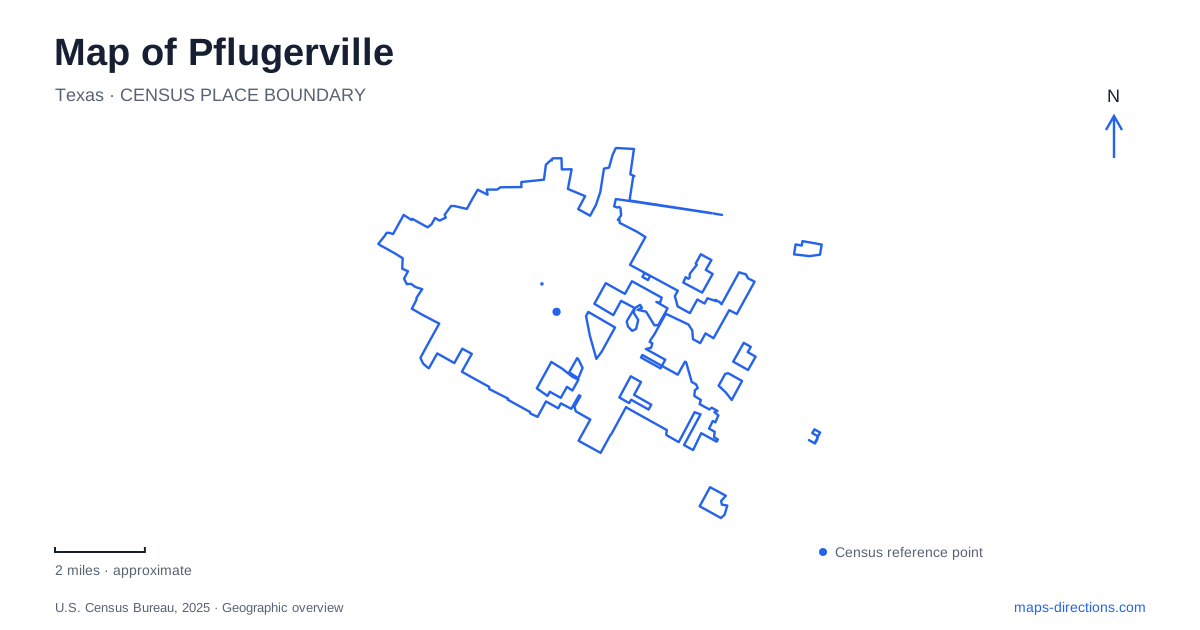
Street tiles load from OpenStreetMap when opened. The blue line shows the 2025 Census boundary.
- State
- Texas
- Population · July 2025
- 68,316
- Land area
- 26.2 sq mi
- Water area
- 0.0 sq mi
Pflugerville becomes easier to understand when its historic farmhouse, creekside parks, lake, and large sports complex are treated as different chapters of the landscape. Their names can look similar in a search result, but their purposes and approaches differ considerably. Old Austin Hutto Road leads to a preserved domestic property, Railroad Avenue serves a municipal swimming facility, and Sun Light Near Way provides the address for a county recreation complex. These street names give the map useful structure before any individual outing is planned.
A farmhouse that stayed on its own ground
The Heritage House Museum at 901 Old Austin Hutto Road occupies the Bohls House. A county historical survey dates the building to 1913, when it was constructed for Gottlieb William Bohls and Bertha Timmerman on their farm. It survives in its original location within what is now Heritage Park. That continuity distinguishes it from a historical building moved into a collection of unrelated structures.
The house's Queen Anne character includes a prominent roof, dormers, and a wraparound porch. Its domestic scale gives a physical reference for the agricultural community that preceded much of the surrounding development. The county survey also connects later owner Otto Bohls with soil-conservation practices. Seen through that history, the property is about more than the appearance of an old house: it recalls how families managed both a home and productive land. A map of Pflugerville can use this one surviving site to introduce a much broader farming landscape without suggesting that the original farm remains intact.
A park junction with a civic role
Pfluger Park has long served as a setting for Deutschen Pfest, connecting public recreation with the community's German heritage. The city also identifies the park as an important junction in its trail network and as part of the character of the historic downtown area. Its significance therefore comes partly from the way people gather and move through it, rather than only from the equipment within its boundaries.
The Fallen Warrior Memorial occupies the junction of Pfluger Park and Gilleland Creek Park. Three generations of service members are represented by life-sized bronze figures before a granite pentagon bearing names. This location makes the memorial a particularly clear reference point between the two park names. In Pflugerville, a creekside recreation corridor can also be a place of remembrance; the recreational and ceremonial uses share the landscape without being interchangeable activities.
A swimming pool beside the creek corridor
Gilleland Creek Pool is a separate aquatic facility at 700 North Railroad Avenue. Despite the name, swimming here means entering a managed pool, not swimming in the creek. The city distinguishes summer general-swim operation from off-season lap swimming and continuous-movement activities. That distinction matters for someone using a map to find a family swimming destination outside summer.
The pool illustrates how one geographic name can identify several connected but different things: the watercourse, a park, and a programmed facility. A trail outing does not imply that general swimming is available, and a pool visit does not describe the whole creek corridor. Railroad Avenue provides the useful street-level reference for the aquatic facility, while the memorial and park junction explain the wider recreational setting.
The lake creates a longer waterside outing
Lake Pflugerville is identified by the state parks agency as a roughly 180-acre body of water with fishing piers and an approximately three-mile walking and jogging trail. The state travel guide places its park at 18216 Weiss Lane and lists a beach, playgrounds, docks, and a boat launch. These features create a different kind of destination from the enclosed municipal pool.
The scale of the water and perimeter trail is important. A complete circuit is a sustained walk, whereas a stop beside a dock or playground uses only a small portion of the property. The lake name should therefore be read together with the chosen activity. Weiss Lane anchors the park geographically; the shoreline and trail explain how the outing expands after arrival. This is an open-water recreation setting, with the different considerations that entails, rather than another branch of the pool system.
County recreation along Sun Light Near Way
Northeast Metropolitan Park uses the address 15500 Sun Light Near Way. The county's site map shows separate parking areas, sports fields, a skate park, a BMX race track, and Gilleland Creek passing through the property. It also distinguishes the natural area from the organized sports facilities. These components occupy a much larger and more varied layout than the word park alone conveys.
For Pflugerville, this county complex adds a regional recreation layer to the smaller historical and civic places. The farmhouse preserves a particular household's setting; the central park junction supports community traditions; the lake organizes activity around its shoreline; and the county grounds accommodate multiple sports alongside a creek corridor. Keeping those differences visible produces a more useful reading of the city than a list of attractions detached from their geography.
Map and statistics: U.S. Census Bureau, 2025 Gazetteer, January 2025 generalized place boundaries and Vintage 2025 population estimates. Local references: Travis County; City of Pflugerville; Texas Parks and Wildlife Department; Texas Department of Transportation; Travis County Parks. Article prepared by Maps & Directions.