Map of Petaluma
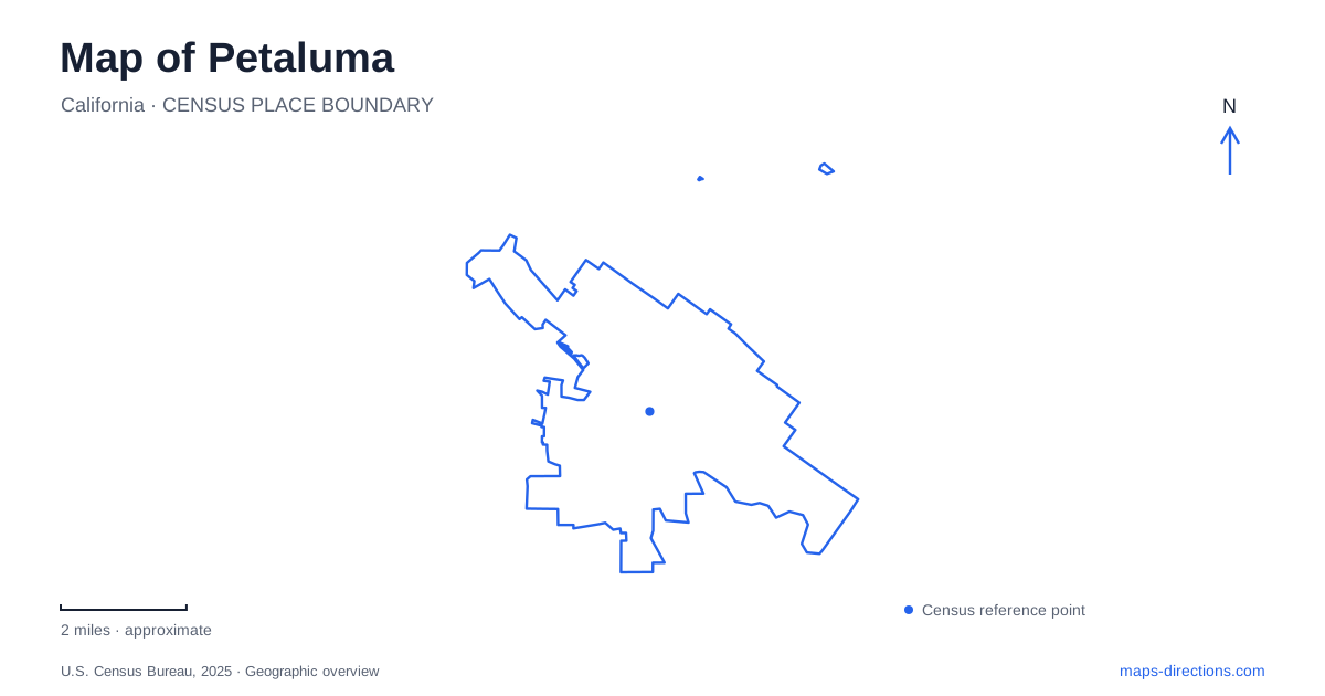
Street tiles load from OpenStreetMap when opened. The blue line shows the 2025 Census boundary.
- State
- California
- Population · July 2025
- 59,688
- Land area
- 14.4 sq mi
- Water area
- 0.1 sq mi
Petaluma's river is the best starting point for understanding the relationship between downtown, the rail station and the wetlands farther downstream. Around the Turning Basin, water sits beside a compact commercial district. Beyond that central setting, marshes and recreation paths reveal a much broader river landscape. To the southwest, the hills of Helen Putnam Regional Park provide a contrasting view of the same region from higher ground.
The Turning Basin and the downtown crossing
The Turning Basin is a recognizable widening of the river beside downtown. Weller Street identifies one side of the waterfront, while Water Street and Western Avenue help locate the Balshaw Bridge. Built as a pedestrian connection between the downtown district and shops and restaurants east of the river, the bridge makes the two banks part of one walkable outing.
That crossing is particularly useful when reading the center at close range. The river creates a strong visual division, but the bridge provides a specific connection within the commercial area. Instead of treating the east bank as a separate destination requiring another drive, a visitor can organize a stroll around the crossing and the streets on either side.
The downtown map also identifies the Theatre District, River Plaza and Steamer Landing Park as separate places around this river-centered setting. Their names describe different parts of the central landscape, not interchangeable labels for one attraction. Keep the Turning Basin visible while looking at those districts; it provides a physical reference that remains useful even when the purpose of the visit shifts from shopping to the waterfront.
Two rail stations serve different parts of town
Petaluma Downtown station is at 220 Lakeville Street, beside the transit mall on Copeland Street. Those two street names establish the rail and bus arrival area. The station is a useful gateway to the central district, but its Lakeville address is distinct from the riverfront streets and the main commercial blocks.
Petaluma North station is at 320 Corona Road. The directional name matters: this is a second station serving another part of the community, rather than another entrance to the downtown platform. A regional rail journey should therefore be planned around the intended part of town, with the final local destination retained alongside the station choice.
The station pair adds a north–south reference to the river's more irregular course. A map can show how rail arrival and a riverfront visit fit together without assuming every place carrying the city name lies in the central walking district. For visitors combining a train journey with several stops, keeping both stations visible can prevent the wrong neighborhood from becoming the starting point.
Shollenberger and the connected marsh landscape
Shollenberger Park brings the map into a different environment. Its loop trail follows a former dredged-material containment area that became a public park, with freshwater and seasonal wetland features beside the tidal river landscape. The river's working history and the park's habitat are therefore physically connected: the place was shaped partly by maintaining navigation in the waterway.
Alman Marsh lies between the park to the south and the marina to the north. A trail crosses Adobe Creek and links the park with this marsh-and-marina sequence. Ellis Creek's wetlands lie south of Shollenberger, with their own trail system and an approach from Cypress Drive. Together, these names identify a series of neighboring landscapes rather than a single undifferentiated birdwatching site.
A wetland outing near Petaluma can be organized around the kind of walk desired. The park loop provides a defined circuit, while the marina connection creates a more linear experience through Alman Marsh. Ellis Creek introduces the relationship between water recycling and constructed wetland habitat. The terrain here rewards looking closely at channels, ponds and levees instead of expecting the street pattern to explain everything.
Hills southwest of the center
Helen Putnam Regional Park, at 411 Chileno Valley Road, contrasts with those low-lying wetlands. Its trails cross grassy hillsides and oak woodland, and higher paths provide views over the city and southern Sonoma County. The looped trail system permits different combinations, while the pond, playground and picnic area supply destinations nearer the main arrival area.
This is a useful distinction when choosing a walk. A downtown stroll emphasizes buildings and the river crossing; a wetland walk emphasizes level waterside habitat; a hillside outing introduces sustained changes in elevation and wider views. They are different geographic experiences, even though all can form part of the same visit.
A map of Petaluma is most informative when it preserves those contrasts. The Turning Basin explains the central waterfront, Lakeville and Corona identify separate rail arrivals, the downstream marsh sequence shows how public paths follow the river landscape, and Chileno Valley Road leads toward the hills. Each reference adds a specific layer to an otherwise deceptively simple city map.
Map and statistics: U.S. Census Bureau, 2025 Gazetteer, January 2025 generalized place boundaries and Vintage 2025 population estimates. Local references: Visit Petaluma; Sonoma-Marin Area Rail Transit; Petaluma Wetlands Alliance; Sonoma County Tourism. Article prepared by Maps & Directions.