Map of Perris
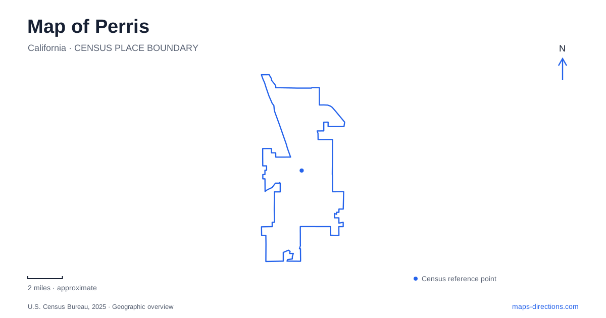
Street tiles load from OpenStreetMap when opened. The blue line shows the 2025 Census boundary.
- State
- California
- Population · July 2025
- 83,237
- Land area
- 31.6 sq mi
- Water area
- 0.1 sq mi
Perris has several railway-related destinations that can be confused on a small map: a historic depot, a modern downtown commuter station, a second commuter station farther south, and a large railway museum. Its lake recreation area introduces another set of similarly named roads and entrances. Understanding these distinctions gives the city a practical geographical structure, with a historic street grid, regional transport stops and separate recreation approaches.
D Street anchors the historic downtown
The Riverside County Transportation Commission describes the downtown station area as a traditional street grid with historic buildings and pedestrian-oriented features. It identifies D Street as the Downtown Promenade. This gives a useful starting point for a close-scale map: the lettered streets and numbered cross streets form a recognizable central district rather than an indistinct area around the railway.
The historic Santa Fe depot was built in 1892, replacing an earlier wooden structure. The city's account explains that it served both passengers and the agricultural traffic associated with the surrounding valley. It later became a local-history museum. That sequence helps explain why the depot is both a railway landmark and a cultural destination, while modern commuter services use their own station information.
Reading the depot in relation to the street grid makes its historical role more visible. It is evidence of a town shaped by rail connections and agricultural shipping. A current transit map answers where to board a train; the depot's history explains why a rail-oriented district developed here in the first place. Those are complementary uses of a map rather than competing descriptions of one facility.
The commuter stations have different street addresses
Metrolink lists the downtown station at 121 South C Street. Its station information also identifies connections with Riverside Transit Agency buses. The southern station is listed at 1304 Case Road. These addresses separate a stop within the central street network from another station serving a different part of the corridor.
For a rail trip, keep the station qualifier with the destination. “Downtown” and “South” are meaningful geographical distinctions, especially when arranging a pickup or comparing the final portion of a journey. South C Street provides an urban-grid reference; Case Road provides a different road-corridor reference. Choosing a train by its route alone does not resolve which local station best matches the intended destination.
The distinction also matters when combining rail travel with a historical visit. The presence of a historic depot does not mean that the museum building supplies the same arrival instructions as the commuter platform. Use the operating station's address for transit and the heritage site's information for a museum visit.
South A Street leads to the railway museum
The Southern California Railway Museum gives its visitor address as 2201 South A Street. It is a separate attraction from the downtown depot. Its grounds, collections and operating exhibits require their own site map, rather than the assumption that a railway museum will be found beside whichever commuter station appears first in a search.
This creates three different rail-related ideas within the local geography: the historic depot records the town's development, the commuter stations serve regional journeys, and the museum presents railway heritage as a visitor destination. Their shared subject can make them sound interchangeable in casual conversation. Their street addresses show why they should be located separately before planning a combined outing.
The lake approach has an easily confused road name
California State Parks locates Lake Perris State Recreation Area at 17801 Lake Perris Drive. Its directions explicitly warn visitors not to confuse that road with Perris Boulevard. The southern approach uses Ramona Expressway from Interstate 215 before turning toward the recreation-area entrance. This is a specific naming distinction, not a minor variation that can be ignored when selecting a route.
The agency also describes a northern approach from Highway 60 using Moreno Beach Drive and Via Del Lago to the Moreno Valley entrance. The two approaches reach the same larger recreation area from different road systems. Someone arriving from the north and someone arriving from the south may therefore receive different directions without either route being inherently incorrect.
Select the entrance that corresponds to the intended arrival plan, then compare its road sequence. The lake's outline is too broad a target for understanding the drive. A route ending at an entrance road has a different purpose from a trail or campground map showing movement after entering the grounds. Keeping these map scales separate is particularly useful for an outing involving a reserved campsite or a meeting within the recreation area.
Put each destination in its own geographical category
A useful Perris map distinguishes the D Street historic district, the South C Street transit stop, the Case Road station, the South A Street museum and the lake's separate entrance corridors. The railway connections explain several important destinations, but they do not collapse them into one place. The same is true of the recreation area: a shared lake name does not remove the distinction between its approach roads. Specific street references turn those broad themes into an understandable local itinerary.
Map and statistics: U.S. Census Bureau, 2025 Gazetteer, January 2025 generalized place boundaries and Vintage 2025 population estimates. Local references: Riverside County Transportation Commission; City of Perris; Metrolink; Southern California Railway Museum; California State Parks. Article prepared by Maps & Directions.