Map of Peoria
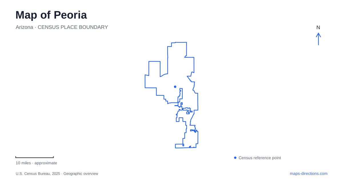
Street tiles load from OpenStreetMap when opened. The blue line shows the 2025 Census boundary.
- State
- Arizona
- Population · July 2025
- 200,881
- Land area
- 176.7 sq mi
- Water area
- 3.2 sq mi
A map of Peoria, Arizona, spans very different settings: a historic town center, a major spring-training complex, urban creek trails and the desert reservoir landscape around Lake Pleasant. These places do not form one compact downtown attraction area. Their relationship is better understood through the roads and watercourses that organize them, particularly 83rd Avenue, Grand Avenue, New River and the northern lake approaches. The result is a city map that needs both neighborhood detail and a wider regional view.
Old Town's street and railway pattern
The historic center is organized around 83rd Avenue and Peoria Avenue. Grand Avenue and the parallel railroad introduce a diagonal line through the otherwise more regular street pattern. That transportation corridor helps explain why the older town has a different geometry from later residential areas.
Osuna Park is the city's oldest park, dating to the early twentieth century. Its modern features include walking paths, trellises, public art and an interactive musical area. A restroom building designed to resemble a railroad depot recalls the town's railway connections, while the neighboring jail was built by the Works Progress Administration in 1939.
Other surviving downtown buildings include the 1906 Central School, the 1899 Presbyterian church and the 1919 Women's Club. Together they record the institutions of a smaller community before the surrounding urban area expanded. The park and buildings make Old Town a place to read civic history through a short sequence of streets, rather than through a single monument.
A different center along 83rd Avenue
Peoria Sports Complex opened in 1994 as a shared spring-training facility for the Seattle Mariners and San Diego Padres. The 145-acre property includes a stadium, separate team facilities and practice fields. Its scale is much larger than the historic blocks of Old Town, even though 83rd Avenue provides a common street reference.
The main complex address is 16101 North 83rd Avenue. The operator also lists separate addresses for the Mariners and Padres facilities, including the latter on West Paradise Lane. The complex map shows team practice areas, clubhouses and parking arranged around the stadium. These distinctions are useful for visitors attending a game, looking for a practice field or meeting at an administrative facility.
The site also hosts activities beyond spring training, including player development and other events. Its geography reflects a sports campus with multiple functions, rather than a stadium occupying a single city block. The surrounding P83 area belongs to this newer entertainment setting.
Creek corridors connect the urban parks
New River Trail and Skunk Creek Trail provide another way to move through Peoria. Rio Vista Community Park, with a trailhead at 8866 West Thunderbird Road, is a key meeting point. The Skunk Creek route reaches east toward Glendale and connects with the Arizona Canal Diversion Channel system, while New River forms a longer corridor through the city.
The trails follow waterways and drainage corridors instead of reproducing the street grid. That makes them useful for understanding connections that are less obvious from road names alone. A neighborhood on one side of a creek may be linked to another park through a trail even when the driving route takes a different alignment.
The city distinguishes multi-use river paths from its mountain hiking trails. The latter include areas such as Calderwood Butte, Sunrise Mountain and WestWing Mountain. They represent a different kind of terrain and route planning from the urban creek paths, with named trailheads rather than a continuous roadside sidewalk.
Lake Pleasant as a working reservoir
Lake Pleasant stores both runoff from the Agua Fria River and Colorado River water delivered through the Central Arizona Project. Water is pumped into storage during fall and winter, then released during spring and summer when demand is higher. Its shoreline therefore changes as part of an operating water-supply system.
This explains why a lake map may show a broad water area that looks different on arrival. The reservoir is not maintained at one unchanging recreational level. Its role in balancing supply and deliveries is central to understanding the landscape, alongside boating, camping and trails.
Lake Pleasant Regional Park lists its address as 41835 North Castle Hot Springs Road with a Morristown mailing location. That address can appear unexpectedly in a search focused on the city, but it identifies the county park approach. Individual boat ramps and lake facilities have their own operating notices, so the park's access information matters more than a generic lake-center marker.
A map of Peoria becomes more informative when these systems are read together. The diagonal railway corridor explains Old Town, 83rd Avenue links major urban destinations, creek trails provide recreational connections, and the northern reservoir reveals infrastructure operating on a much larger regional scale.
Map and statistics: U.S. Census Bureau, 2025 Gazetteer, January 2025 generalized place boundaries and Vintage 2025 population estimates. Local references: City of Peoria; Visit Peoria; Sports Complex; Central Arizona Project; Maricopa County Parks. Article prepared by Maps & Directions.