Map of Peachtree Corners
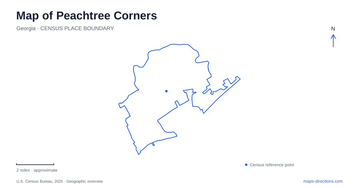
Street tiles load from OpenStreetMap when opened. The blue line shows the 2025 Census boundary.
- State
- Georgia
- Population · July 2025
- 42,519
- Land area
- 16.2 sq mi
- Water area
- 0.1 sq mi
Peachtree Corners is a relatively young municipality built around places that developed before city government began. Its map combines a technology business campus, established residential neighborhoods, a deliberately created downtown and county parks along the Chattahoochee River. These are different kinds of urban space, and their relationships explain more than a search for one traditional Main Street. The parkway pedestrian bridge is especially revealing: it physically joins two commercial destinations across a major road.
A center built around a green
The Town Green opened on April 27, 2019, at 5140 Town Center Boulevard. The city describes it as an open lawn of more than two acres within the larger Town Center. Outdoor performances, play areas, pavilions and café tables give the green a public role alongside the surrounding restaurants, shops, offices and townhomes. The lawn is therefore a civic reference point within a mixed-use development, rather than a detached park at the city's edge.
Across Peachtree Parkway, the Forum is joined to Town Center by a pedestrian bridge at the main entrance. The bridge also connects with the Corners Connector trail system. This is a particularly useful feature to recognize on a map of Peachtree Corners because the road otherwise divides places that are intended to function together. An itinerary using both sides can be organized around that crossing instead of treating the shopping and civic spaces as unrelated stops.
The business campus came first
Paul Duke began planning Technology Park Atlanta in 1967, seeking to attract technology businesses associated with the region's university talent. Early tenants included Scientific Atlanta and Hayes Microcomputer Products. Residential development followed, with Jim Cowart developing Spalding Corners and beginning Peachtree Station in 1979. Municipal operations did not begin until July 2012, after the incorporation vote the previous November.
This sequence explains why Peachtree Corners has several strong centers of activity instead of growing outward from an old courthouse square. The office campus and neighborhoods were already significant parts of the landscape when the municipality formed. The later Town Center supplied a shared gathering place. On a map, those layers should be read chronologically: employment and residential development established the community before its newer public center took shape.
Curiosity Lab extends the technology campus's purpose into the public realm. The city describes it as a place where companies test connected mobility, infrastructure and other technologies in an active community. It is not simply an office building with a science-themed name. Its work involves operating infrastructure and everyday surroundings, adding an experimental role to streets and facilities that also serve ordinary local needs.
Simpsonwood's preserved river landscape
Simpsonwood Park has a very different origin. Gwinnett County acquired the 223-acre property from the North Georgia Conference of the United Methodist Church in 2015. The acquisition preserved a largely wooded property with approximately 2,140 feet of Chattahoochee frontage. The county identified protection of open space in western Gwinnett as an important reason for the purchase.
Today its entrance is at 4511 Jones Bridge Circle. The county lists a 3.1-mile unpaved trail, meadow, chapel and group camping among the facilities. Together these features give Simpsonwood a broader landscape character than a small riverside overlook. Woodland walking, open meadow and the chapel share a substantial property, while the river forms only one part of its boundary. For Peachtree Corners, the park preserves a sizeable green setting alongside the developed campus and neighborhood pattern.
Jones Bridge Park has another role
Jones Bridge Park is at 4901 East Jones Bridge Road. At 30 acres, it is considerably smaller than Simpsonwood, but it combines river overlook areas for fishing with three soccer fields, a playground, pavilions and a meadow. The sports facilities help explain why a river park can draw visitors whose main activity is on land rather than at the water.
The similarity between Jones Bridge Road and Jones Bridge Circle can blur this distinction in a quick search. Simpsonwood's wooded trails and chapel belong to the Circle address; the soccer fields and river overlooks belong to the East Jones Bridge Road park. Comparing these two specific landscapes is more informative than selecting whichever river symbol appears first. County management also explains why their facilities and reservations are documented separately from the city-operated Town Green.
Reading the whole community
A useful map of Peachtree Corners keeps the campus, Town Center and river parks in the same frame without flattening their differences. The campus records the employment-led development of the area; the green and bridge show a later effort to connect public life across the parkway; Simpsonwood and Jones Bridge preserve distinct opportunities beside the Chattahoochee. Those relationships provide a grounded way to choose a destination and understand the place around it.
Map and statistics: U.S. Census Bureau, 2025 Gazetteer, January 2025 generalized place boundaries and Vintage 2025 population estimates. Local references: City of Peachtree Corners; Gwinnett County. Article prepared by Maps & Directions.