Map of Pasco
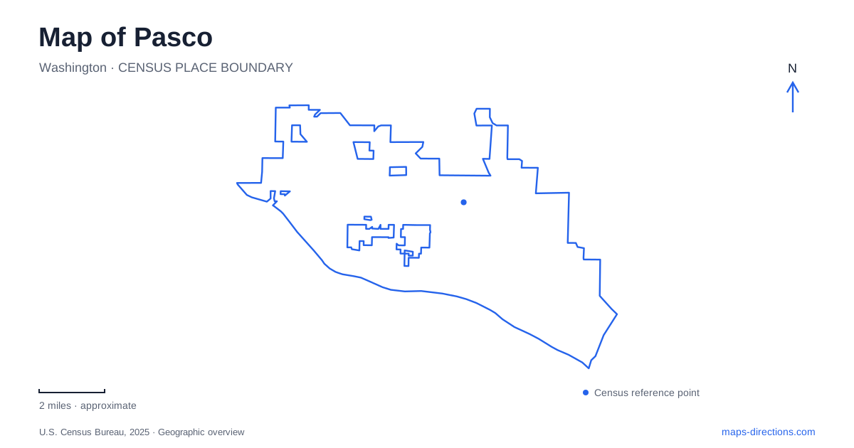
Street tiles load from OpenStreetMap when opened. The blue line shows the 2025 Census boundary.
- State
- Washington
- Population · July 2025
- 82,848
- Land area
- 39.0 sq mi
- Water area
- 3.5 sq mi
Pasco's geography brings together two major rivers, a substantial railway corridor and an airport serving the wider Tri-Cities area. These features create different kinds of boundaries and connections. The Columbia riverfront provides a long recreation landscape, the Snake River confluence gives a particular historical setting, and Lewis Street connects across the rail yard. Reading those relationships first makes individual streets and destinations easier to place.
The confluence is a specific historical landscape
Sacajawea Historical State Park is at 2503 Sacajawea Park Road, where the Snake and Columbia rivers meet. Washington State Parks describes its interpretive center as presenting the meeting of cultures at that confluence. This is more specific than a generic riverfront park: its meaning depends on the junction of two waterways and the people who traveled and lived around them.
For a Pasco map, keep both river names visible when examining this area. A close view of the park grounds explains the visitor setting, while a wider view explains the confluence itself. Looking only at a shoreline segment can hide the reason this location became a place of encounter and interpretation. The two-river relationship is the central geographical fact.
The park's history also extends beyond a single commemorated expedition. State Parks documents later claims and trading ambitions associated with the site, as well as its eventual transfer into the state park system in 1931. These layers show how a strategic river junction can acquire different meanings over time. A historical map and a modern recreation map therefore describe different uses of the same important location.
Chiawana is reached from West Court Street and Road 88
Chiawana Park is listed at 2020 Road 88. The city's directions approach it by turning south from West Court Street onto Road 88. It is a Columbia riverfront park with a boat launch, dock, picnic facilities, playground and walking trail. The city manages the property under an agreement with the Army Corps of Engineers.
This provides a different Pasco waterfront destination from the confluence park. Road 88 identifies the local approach, while the Columbia identifies the landscape being visited. Someone planning to meet at a launch or picnic shelter should retain the Chiawana name rather than describing the destination only as “the river.” The broader waterfront contains multiple public places with different approaches.
The city's photo-tour information identifies the Sacajawea Trail passing through Chiawana along the Columbia. That adds a linear connection to a park otherwise reached by a short road approach. Arriving by road and traveling along the waterfront are different ways of using the same site. The park's position on the trail is useful when planning a longer walk rather than a stationary picnic or boat launch.
Lewis Street crosses a railway barrier
The Lewis Street Overpass project joins Second Avenue on the west with Oregon Avenue on the east. The city describes a concrete structure crossing the BNSF railway yard and a separate span over First Avenue. These are important details because the route crosses both rail infrastructure and a local street, rather than simply continuing at ground level through an ordinary intersection.
On a Pasco street map, the rail yard explains why a short east-west connection can require a substantial structure. The overpass links areas divided by that corridor. Its approaches and spans should be read together, especially when comparing the modern road arrangement with older mapping that emphasizes the underpass.
The National Park Service's account dates the earlier Lewis Street Underpass to 1937 and explains its connection with the city's history of racial segregation. The crossing was therefore more than an engineering feature. It marked a division within the community as well as providing a route across the railway. Historical interpretation adds a social dimension that a contemporary road line alone cannot convey.
The airport belongs to the regional travel network
Tri-Cities Airport publishes its address as 3601 North 20th Avenue. Its regional name can be useful for finding flights, but the specific street address locates the passenger destination within the city. The airport should be understood as another major node in the local map, separate from the river parks and downtown rail crossing.
For a Pasco arrival by air, North 20th Avenue is the relevant street reference for the airport facility. From there, a trip to a waterfront park or the historic center becomes a separate local journey. The regional airport name does not imply that the terminal sits equally close to every destination carrying a Tri-Cities label. Using the actual address makes the beginning of that journey clear.
Connect the large features before choosing local detail
The confluence, Columbia waterfront, rail yard and airport create a useful framework for the city. Sacajawea Park Road reaches a two-river historical setting; Road 88 reaches Chiawana; Lewis Street crosses the railway; North 20th Avenue locates the airport. These concrete relationships explain the map more effectively than a collection of isolated attraction names. Once the relevant landscape or transport node is identified, its local streets and paths become much easier to interpret.
Map and statistics: U.S. Census Bureau, 2025 Gazetteer, January 2025 generalized place boundaries and Vintage 2025 population estimates. Local references: Washington State Parks; City of Pasco; National Park Service; Tri-Cities Airport. Article prepared by Maps & Directions.