Map of Parker
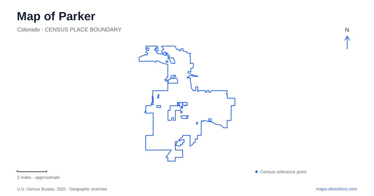
Street tiles load from OpenStreetMap when opened. The blue line shows the 2025 Census boundary.
- State
- Colorado
- Population · July 2025
- 65,985
- Land area
- 22.4 sq mi
- Water area
- 0.0 sq mi
Parker's historic core is closely tied to routes through the landscape. The Twenty Mile House served travelers on nineteenth-century trails, while today's Sulphur Gulch path connects neighborhoods with the regional Cherry Creek corridor. Mainstreet contains former educational and religious buildings now used in the town's cultural life. Farther away, Rueter-Hess Reservoir introduces a larger landscape of water, bluffs and managed recreation. Each setting explains a different way people have gathered or moved through this part of Douglas County.
The Twenty Mile House survives only in part
The local historical society connects the Twenty Mile House with the crossing of Tallman Gulch and the Cherokee Trail. Its name referred to the distance from Denver, and the establishment provided meals, lodging and supplies to travelers. The property grew beyond a small early structure to include a larger house and outbuildings.
The surviving feature is not the complete inn. Much of the building was demolished in 1946, leaving the old post-office portion. Later redevelopment removed a replacement cinderblock house, and the smaller historic remnant was restored within a pocket park. This distinction matters when interpreting a map of Parker's early settlement. A historic-site marker identifies the location and remaining evidence of a larger operation; it does not mean that the whole nineteenth-century complex is still standing. The modest surviving building carries a history that was once spread over more space.
Mainstreet's school became a cultural venue
The Schoolhouse opened in 1915 and served students until 1967. The town acquired it in 1995 for community cultural and recreation uses. Its current role includes a theater and event spaces, retaining a public function while changing the activities accommodated inside.
The building offers a clear example of civic reuse in Parker. The same Mainstreet location that once organized school days now supports performances and gatherings. It should also be distinguished from the separate PACE Center: the arts operator presents events at both, so the institution's name alone does not identify the correct venue. The older school and newer arts center belong to the same cultural program while occupying different buildings. Their coexistence adds depth to the town's public landscape rather than replacing one era with another.
Ruth Memorial Chapel represents another community effort
Construction of Ruth Memorial Chapel began in February 1912. The first gathering in the building took place that June, followed by formal dedication in May 1913. The historical society records that the chapel was named for a daughter of Dr. Walter Heath who had died young. Donations of land and community organizing made the project possible.
The chapel and schoolhouse represent different purposes within the historic core: religious gathering and public education. Their dates also show a period when the community was investing in substantial shared buildings. Neither needs to be treated simply as a picturesque backdrop. Their significance lies in the activities they supported and the effort required to establish them. Reading their locations together helps reconstruct the scale and priorities of the early town center.
Sulphur Gulch provides an east–west connection
The Sulphur Gulch Trail runs for approximately four and a half miles. It meets the Cherry Creek Trail in Bar CCC Park, passes beneath the main north–south road and continues east along the southern side of Mainstreet. Connections include the Tallman Gulch Trail through the Rowley Downs, Hidden River and Canterberry Crossing neighborhoods.
This gives Parker a recreation network shaped by drainage corridors as well as roads. Cherry Creek supplies the longer regional direction, while Sulphur Gulch carries movement toward the town's eastern neighborhoods. The undercrossing is particularly important to the relationship between these routes: the trail does not simply stop at the major road and begin again on the other side. The named junction at Bar CCC Park provides a useful reference for understanding how the local and regional paths fit together.
Discovery Park changes with the seasons
Discovery Park occupies a compact 1.4-acre site beside the library at 20115 East Mainstreet. Its programmed spaces include summer fountains, a winter ice trail and a performance stage. Christopher Weed's oversized Ball and Jacks sculpture helps mark the eastern end of downtown with a playful public-art reference.
The park's small size contrasts with the longer creek corridors. Its purpose is concentrated civic gathering rather than a lengthy nature outing. Seasonal uses occupy the same place at different times, so a photograph of the ice trail and one of the fountains can describe the same park without implying simultaneous operation. The library setting reinforces its role as part of an everyday town-center visit.
Rueter-Hess has separate recreation approaches
Douglas County lists reservoir access at 9343 Double Angel Road and the incline trailhead parking at 13930 Ancestry Drive. The reservoir requires advance online reservations, while the incline does not. These are separate arrangements within the same broader recreation landscape, not alternative street addresses for one entrance.
Keeping that distinction visible completes a useful map of Parker and its surroundings. Mainstreet's historic buildings belong to a compact civic setting, the creek trails connect neighborhoods, and the reservoir's managed areas require their own approach. Their differences reveal the town's development through travel, community institutions and recreation, with geography continuing to shape how each place is used.
Map and statistics: U.S. Census Bureau, 2025 Gazetteer, January 2025 generalized place boundaries and Vintage 2025 population estimates. Local references: Parker Area Historical Society; Parker Arts; Town of Parker Parks and Recreation; Douglas County. Article prepared by Maps & Directions.