Map of Park Ridge
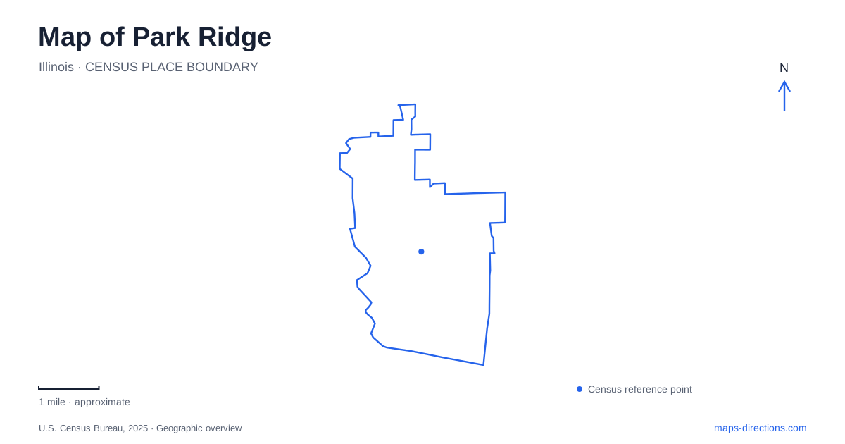
Street tiles load from OpenStreetMap when opened. The blue line shows the 2025 Census boundary.
- State
- Illinois
- Population · July 2025
- 38,463
- Land area
- 7.1 sq mi
- Water area
- 0.0 sq mi
Park Ridge has a local history that reaches beyond its familiar suburban streets. Earlier community names, artists' working spaces and preserved institutional buildings explain how different parts of the city developed. Its parks add another layer: some occupy reused historic grounds, while others interpret small areas of woodland, pond and restored prairie. The Historical Society records three successive names: Pennyville in 1854, Brickton from 1857 and the present name from 1873. The village later became a city in 1910. An old document using Brickton may therefore refer to this same community rather than a vanished neighboring town. That naming sequence is a useful first clue when comparing historical and modern maps.
Artistic work along Northwest Highway
Iannelli Studios stands at 255 North Northwest Highway. The Smithsonian's Archives of American Art identifies it as the former studio of designers Alfonso and Margaret Iannelli, now maintained by the Kalo Foundation. This was a working creative place, not simply a house later associated with a famous name.
The studio's significance lies partly in the collaboration it represents. Sculptural, graphic and architectural work could develop together within a commercial art practice. The building provides a specific place from which to understand that wider artistic activity, even though the resulting works are dispersed across other sites.
For Park Ridge visitors, the foundation's approach instructions are useful. It asks people to use the municipal lot across Northwest Highway rather than nearby residential streets to the north. The address locates the studio, while this separate guidance explains how the surrounding neighborhood affects a visit.
A heritage-center label should also be kept distinct from unrestricted access to every part of a property. Exhibitions and events are organized uses of the former studio; the building's history does not turn the surrounding residential blocks into a museum campus.
Prospect Park's preserved social history
Prospect Park occupies land formerly known as the Youth Campus. The Park District acquired and developed the property following a successful 2013 referendum, and the park opened in May 2016. Its recreation facilities now share the grounds with buildings retained for their historical significance.
Solomon Cottage, the first cottage built there in 1908, was named for Hannah Greenebaum Solomon. It now houses the Historical Society under a long-term lease. The Emery Building also survives, preserving another element of the former institution. The district connects the property's National Register status with both its architecture and its social history.
This gives Park Ridge a park that can be read as more than a collection of new amenities. Paths, play spaces and gathering areas occupy an older institutional landscape. The surviving cottages explain that earlier layer even where other uses have changed.
The park's general address is 733 North Prospect Avenue, while the History Center identifies its own address as 721 North Prospect. Those nearby numbers refer to different destinations within the broader setting. Someone attending a museum event should use the center's information rather than assume the park's main label identifies the correct building.
Wildwood's small habitats
Wildwood Nature Center interprets a much smaller natural landscape around Maine Park's ponds. The Park District describes a five-acre setting with two ponds, restored native prairie and a woodland walk. Its paths lead around these habitats and to observation and fishing features.
The prairie is a restoration project, with work beginning in 2001. That detail matters because the presence of native plants does not mean the site has remained untouched. The landscape reflects deliberate ecological management within a developed community.
For Park Ridge map reading, the contrast with Prospect Park is useful. One site combines historic buildings and recreation on a former campus; the other organizes outdoor learning around habitat patches. A green polygon alone cannot communicate those different purposes.
The woodland path, prairie paths and pond margins also offer different experiences within the same compact grounds. A nature-center building pin is only one element of the visit. The surrounding outdoor areas are central to what the place is designed to explain.
A classroom with shared use
The outdoor nature classroom associated with Wildwood's preschool program has public access outside scheduled preschool and camp use. The district specifically distinguishes those periods, rather than describing the fenced area as continuously available.
That is a small but practical example of shared space. A feature may belong to a public park while still having dedicated program times. The grounds and the classroom should therefore not be treated as identical access zones.
Keeping the local places distinct
A map of Park Ridge gains meaning when its labels are tied to their actual roles: the former artists' studio on Northwest Highway, the historical cottages on Prospect Avenue and the managed habitats around Wildwood. Each offers evidence of a different kind of change.
The city's earlier names supply a historical framework, but individual sites explain how that framework became a lived place. Reading both together makes the map useful for local exploration without reducing the community to a single landmark or a generic suburban description.
Map and statistics: U.S. Census Bureau, 2025 Gazetteer, January 2025 generalized place boundaries and Vintage 2025 population estimates. Local references: Park Ridge Historical Society; Smithsonian Archives of American Art; Kalo Foundation; Park Ridge Park District. Article prepared by Maps & Directions.