Map of Palmdale
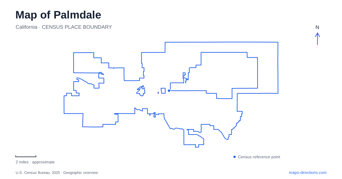
Street tiles load from OpenStreetMap when opened. The blue line shows the 2025 Census boundary.
- State
- California
- Population · July 2025
- 161,845
- Land area
- 106.1 sq mi
- Water area
- 0.2 sq mi
Palmdale occupies an Antelope Valley landscape where transportation, water engineering, and aerospace development have repeatedly changed the meaning of open desert land. The San Gabriel Mountains frame the valley to the south and southwest, while the Tehachapis separate it from the San Joaquin Valley to the northwest. Within that larger setting, the railway corridor, aircraft facilities, reservoirs, and creek trails provide a more revealing map than a list of shopping destinations. Each shows a different response to the opportunities and limits of the high desert.
The town center moved with the railway
Two earlier communities, Harold and Palmenthal, underpin the modern city. Harold stood where the Southern Pacific Railroad met Fort Tejon Road, now Barrel Springs Road. This crossing made it a plausible settlement site, but railway operating needs eventually favored flatter land farther north for a larger booster-engine station. Engines assisting trains across the mountains needed a suitable place to assemble and begin their work.
That relocation helped pull settlement toward the present central area. Palmenthal, established by Swiss and German families in 1886, also declined during the difficult drought years of the 1890s. The familiar story about settlers mistaking Joshua trees for palms belongs to local tradition; the more practical geographical lesson is that neither the first road crossing nor an optimistic farming colony guaranteed a permanent town center. Railroad operations and water availability mattered more.
For Palmdale, this history explains why an early settlement label may appear away from the later civic center. The map records a sequence of choices rather than a town expanding evenly around one unchanged founding square.
Aircraft heritage beside Plant 42
Air Force Plant 42 gave the area a major aerospace role during the 1950s. Manufacturing and flight-test facilities introduced a scale of development very different from farm plots and small railway settlements. Long runways and large industrial properties are an unmistakable part of the valley's physical organization.
Joe Davies Heritage Airpark interprets that history through aircraft associated with work at Plant 42. At 2001 East Avenue P, between Twentieth and Twenty-Fifth streets east, its public display area provides a grounded view of machines otherwise associated with restricted industrial and military settings. The collection includes aircraft that were designed, tested, produced, flown, or modified locally, rather than an assortment connected only by being airplanes.
The B-52 and C-46 displays, along with a scale model of the B-2, show the breadth of that story. Palmdale’s aviation identity is therefore tied to making and testing aircraft as much as to flying them. The airpark is a public heritage destination beside a working aerospace landscape; it does not imply general visitor access to the surrounding production facilities.
Water storage made a different economy possible
The lake and water-conveyance features on the local map are infrastructure with a long history. The water district traces the construction of a storage dam to the irrigation companies of the 1890s, when ditch systems alone could not meet agricultural needs. Later, a public irrigation district formed in 1918 to support farming within its boundaries.
The transition toward aerospace employment also changed water demand. The district describes a shift from agricultural supply toward domestic use during the 1950s, followed by a 1963 State Water Project contract. Local storage consequently became part of a system combining imported aqueduct water, mountain runoff, and groundwater.
Today, Palmdale Lake receives surface water associated with the state aqueduct and Littlerock Reservoir before treatment and distribution. That relationship is useful when reading the blue shapes and narrow channels on a map: they connect a desert community to mountain catchments and a much larger California water network. Their presence is not simply evidence of a recreational lake district.
A creek corridor with several purposes
Amargosa Creek Trail, at Elizabeth Lake Road and Twenty-Fifth Street West, offers a closer look at the desert landscape within the city. The corridor combines passive recreation with habitat and groundwater-recharge functions. Municipal descriptions identify mature Joshua and juniper trees, interpretive information, and paths through the natural setting.
The city's enhancement program adds another layer of use through seating, trailhead improvements, fitness features, and bicycle repair facilities. Public art has also been proposed through a rotating sculpture program. These additions should be understood within the creek's environmental role: the site is not only a landscaped strip for exercise but part of local efforts to conserve water and maintain natural habitat amid development.
A contemporary rail connection
The transportation center at 39000 Clock Tower Plaza Drive serves Metrolink's Antelope Valley Line and bus connections. Its location continues the railway's importance in everyday movement, although passenger travel now serves a city with very different industries and neighborhoods from the original settlement.
A map of Palmdale is most informative when these systems remain visible together. The station explains regional passenger access, the airpark introduces the aerospace landscape, and the lake and creek reveal the water relationships supporting life in the valley. The result is a city shaped by infrastructure as well as by the desert surrounding it.
Map and statistics: U.S. Census Bureau, 2025 Gazetteer, January 2025 generalized place boundaries and Vintage 2025 population estimates. Local references: City of Palmdale; Palmdale Water District; Metrolink. Article prepared by Maps & Directions.