Map of Palm Springs
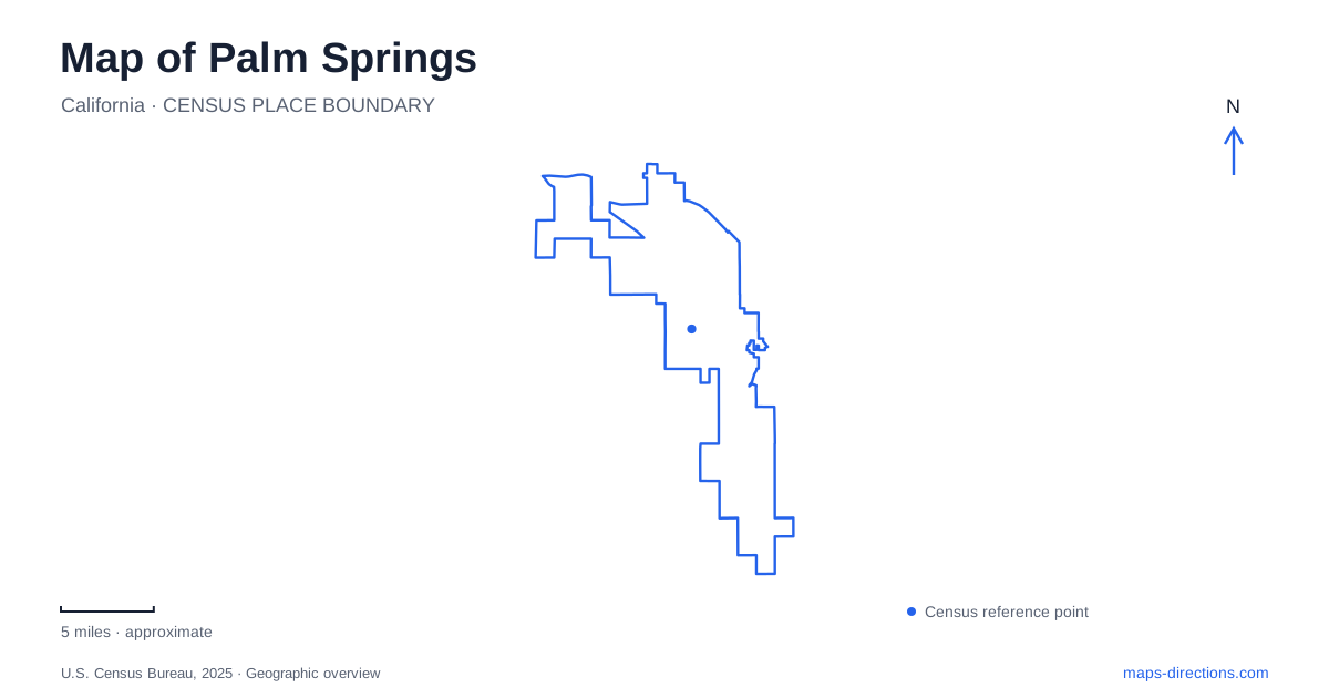
Street tiles load from OpenStreetMap when opened. The blue line shows the 2025 Census boundary.
- State
- California
- Population · July 2025
- 45,315
- Land area
- 94.5 sq mi
- Water area
- 0.1 sq mi
Palm Springs sits against a mountain landscape that gives even a simple street map a strong sense of direction. The San Jacinto slopes frame neighborhoods near downtown, while canyon destinations and the aerial tramway lead into very different terrain. At the same time, the Agua Caliente Band of Cahuilla Indians' cultural sites explain a history that predates the resort city. Streets, neighborhood boundaries, tribal places, and elevation all belong in a useful reading of the area.
The mountain edge behind the neighborhood streets
The Historic Tennis Club neighborhood is tucked against the San Jacinto Mountains. The city's neighborhood history places Belardo Road on its eastern side, Tahquitz Road to the north, and Ramon Road to the south. Its name comes from the club founded in 1937, but settlement in the area is older. The 1925 O'Donnell House overlooks the neighborhood from the hillside.
This is a particularly clear example of how Palm Springs changes character across a short stretch of map. A regular street network meets rising ground, and the terrain becomes part of the setting of individual buildings. Reading the neighborhood from the mountain side toward Belardo is more revealing than treating it as an arbitrary polygon. The street boundaries describe where it lies; the hillside explains why its western setting looks and feels different from the flatter urban blocks beyond.
Neighborhood names have a local purpose
The city recognizes organized neighborhoods including The Movie Colony, Movie Colony East, Twin Palms, and Vista Las Palmas. These names identify residential areas with their own organizations. They also appear on neighborhood blade signs mounted with street signs, through a program established in 2008.
For someone exploring Palm Springs, those signs provide useful confirmation when moving between districts. The Movie Colony and Movie Colony East are separate recognized neighborhoods, for example. A neighborhood name is therefore a more precise locator than a general reference to the city's architecture or celebrity history. It helps place a particular street within the local pattern without implying that the whole neighborhood is a publicly accessible attraction. Houses remain homes even when their surroundings have architectural or historical associations.
Agua Caliente history in the urban center
The Agua Caliente Cultural Museum stands at 140 North Indian Canyon Drive. Its permanent gallery presents the history and culture of the Agua Caliente people through five exhibition areas. The opening area introduces the reservation and its varied landscapes.
The museum gives a city visit a different starting point from the familiar resort narrative. It provides cultural context for the canyons as well as the built environment, encouraging visitors to understand those places through the people whose homeland they form. In Palm Springs, a museum stop and a canyon visit can consequently complement one another without reducing the canyon landscape to scenery. The museum's urban street address also makes clear that tribal history is present within the contemporary city, not confined to remote land outside it.
Two canyon approaches with distinct addresses
Tahquitz Canyon's visitor center is at 500 West Mesquite Avenue. The site includes cultural exhibits and introduces a canyon known for its waterfall, rock art, and evidence of irrigation. Indian Canyons uses a separate address, 38520 South Palm Canyon Drive. The Tribe identifies those canyons as ancestral homeland and describes surviving traces of homes, food preparation, water management, and trails.
Those water-management features are especially important to interpretation. Ditches, dams, and reservoirs show a worked and inhabited landscape, rather than wilderness without human history. Tahquitz's waterfall is seasonal, so photographs of flowing water should not be read as a guarantee of conditions. Plan the two approaches as specific visits with their own admission and access arrangements, and follow tribal guidance about protecting the sites and remaining on designated routes.
The tramway adds a vertical dimension
The aerial tramway travels through Chino Canyon from a Valley Station at 2,643 feet to a Mountain Station at 8,516 feet. It opened in 1963, and rotating tramcars entered service in 2000. The route connects the desert-side approach with the high country of Mount San Jacinto State Park.
This large elevation change is easy to underestimate on a flat map of Palm Springs. The upper station is a mountain destination reached by the tram system, not another neighborhood stop along the valley streets. Its relationship to hiking terrain also differs from the lower canyon visits. Choose clothing and any walking plans for the upper elevation, and check operating notices before driving up: the tramway uses scheduled maintenance closures. A mountain outing should use the tramway's operating calendar rather than the reopening date in an older maintenance announcement.
Map and statistics: U.S. Census Bureau, 2025 Gazetteer, January 2025 generalized place boundaries and Vintage 2025 population estimates. Local references: City of Palm Springs; Agua Caliente Band of Cahuilla Indians; Visit Palm Springs; Palm Springs Aerial Tramway. Article prepared by Maps & Directions.