Map of Palm Desert
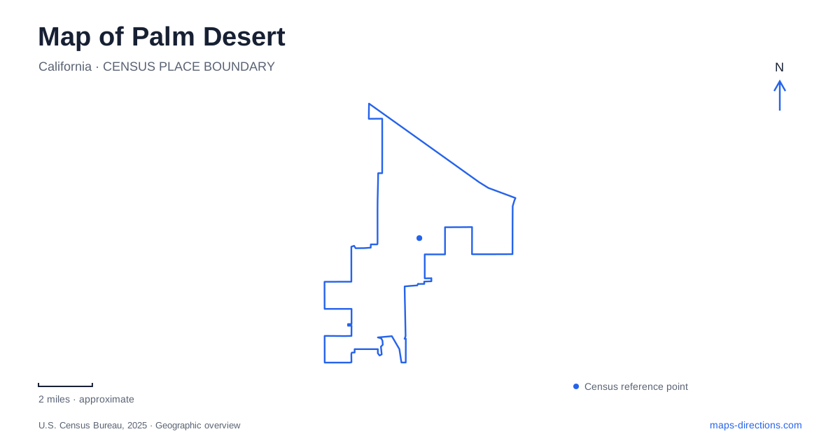
Street tiles load from OpenStreetMap when opened. The blue line shows the 2025 Census boundary.
- State
- California
- Population · July 2025
- 53,259
- Land area
- 26.8 sq mi
- Water area
- 0.2 sq mi
Palm Desert is easiest to understand as a sequence of places between the Coachella Valley floor and the mountain foothills. El Paseo provides a recognizable shopping and art district near Highway 111. Farther north, Fred Waring Drive connects civic and cultural destinations. Southward, Portola Avenue leads to The Living Desert, while Highway 74 climbs toward the national monument. These corridors organize quite different outings, from a walk among storefronts to an excursion into rocky desert terrain.
El Paseo and the older development pattern
The main El Paseo shopping district extends roughly a mile between Highway 74 and Portola Avenue, with additional sections beyond those ends. Its length matters when choosing a meeting point: the street is a district rather than one compact plaza. Public sculpture, shops, galleries, and restaurants create a sequence of stops, so it helps to organize a visit around a particular section before deciding how much of the corridor to walk.
El Paseo was planned as a prominent shopping street during the early development of Palm Desert. Landscape architect Tommy Tomson's plan also used curving neighborhood streets, a pattern that contrasts with a rigid rectangular grid. That design history helps explain why residential routes around the commercial corridor do not always form straightforward extensions of the main shopping street. The curves are part of the community's planned landscape, while Highway 111 supplies the broader valley connection.
Fred Waring Drive and the civic district
Civic Center Park is listed at 43900 San Pablo Avenue, and its recreation facilities include playgrounds, courts, and a skate park. This is a public recreation setting distinct from the El Paseo retail corridor. San Pablo Avenue is therefore a useful local reference when switching from shopping or dining to a park outing. Within the larger grounds, the particular facility determines which portion of the park will be most useful.
McCallum Theatre stands at 73000 Fred Waring Drive, on the northeast corner of Monterey Avenue and Fred Waring. It opened in January 1988 following a community effort to establish a performing arts venue. The theater's relationship with the College of the Desert campus gives this part of the map an educational and cultural focus. For an evening performance, use the theater's own parking directions; adjacent college property has its own restrictions. This keeps a theater visit tied to the correct corner of a larger campus area.
Portola Avenue and The Living Desert
The Living Desert Zoo and Gardens is at 47900 Portola Avenue. Its exhibits and planted gardens interpret desert environments, but the property also includes trails into a natural preserve. Those two experiences should be distinguished when planning the day. A zoo map describes the exhibit pathways, while the nature-trail map extends the outing into washes and foothill terrain.
The Discovery Loop is a short, sandy route through desert woodland. The longer Wilderness Loop includes rocky terrain, steeper sections, and boulders. They are not equivalent walking choices simply because both begin within the same property. The operator publishes a seasonal hiking window from October through May, and trail access is included with park admission or membership. For Palm Desert visitors interested primarily in a gentle garden visit, the existence of the longer preserve route need not determine the whole itinerary.
Highway 74 at the mountain boundary
The Santa Rosa and San Jacinto Mountains National Monument visitor center is at 51-500 Highway 74, about four miles south of its intersection with Highway 111. It provides an orientation point at the monument boundary rather than a destination in the El Paseo shopping district. The change in landscape becomes the main subject here: the valley's developed streets give way to the foothill environment protected within the monument.
The Ed Hastey Garden Trail circles the visitor center with a concrete path and interpretation of local desert plants and wildlife. The Randall Henderson Trail starts from the southern parking area and offers several loop combinations through the surrounding terrain. These are separate trail experiences, with different surfaces and levels of effort. The garden is a useful introduction for someone who wants to understand the local environment without committing to a longer foothill hike.
Matching the outing to the landscape
A map of Palm Desert should preserve the distinction between these four areas: El Paseo, the Fred Waring civic and cultural district, the zoo on Portola, and the monument approach on Highway 74. Combining nearby stops can make an itinerary coherent, but their settings are not interchangeable. A shaded performance venue, an open shopping street, and an exposed desert trail call for different amounts of outdoor time.
Seen together, these places explain Palm Desert's identity through both design and terrain. Planned retail streets and public cultural facilities occupy the developed valley, while gardens and trails interpret the desert at its southern edge. The most useful route follows the experience being sought, with the valley-to-mountain transition providing the larger geographic framework.
Map and statistics: U.S. Census Bureau, 2025 Gazetteer, January 2025 generalized place boundaries and Vintage 2025 population estimates. Local references: City of Palm Desert; McCallum Theatre; The Living Desert; Bureau of Land Management. Article prepared by Maps & Directions.