Map of Palm Beach Gardens
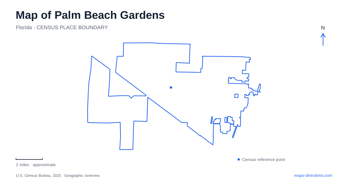
Street tiles load from OpenStreetMap when opened. The blue line shows the 2025 Census boundary.
- State
- Florida
- Population · July 2025
- 63,883
- Land area
- 59.2 sq mi
- Water area
- 0.6 sq mi
Palm Beach Gardens has a landscape shaped by two different ideas of open space. Planned residential and recreational development introduced landscaped streets, golf grounds and community facilities. Protected natural areas preserve wetland systems and native habitats with their own patterns of water and vegetation. Reading those landscapes together gives a fuller understanding of the city than treating every green patch as a park or every water feature as a recreational lake.
The garden-city idea left a physical legacy
The municipal history dates John D. MacArthur's development announcement to March 1959. His proposed community occupied former dairy grazing land, and his plans emphasized trees, foliage and waterways. The account describes efforts to retain mature trees while laying out construction and streets. This origin helps explain why landscape design belongs in an account of the city's physical form rather than appearing only as decorative background.
Golf became another early influence. The same history records the PGA's arrival at a completed clubhouse in 1965 and its departure from that property in 1972. The former site subsequently became J.D.M. Country Club and is now known as BallenIsles. Historical PGA references therefore need their dates and property context. A familiar sporting name can persist in local geography after the organization or use associated with it changes.
Burns Road and Military Trail identify a civic cluster
The Burns Road Campus combines the community center, aquatics facilities, Lakeside Center, a playground, and walking and fitness facilities. The city's directory places the community center at 4404 Burns Road and Lakeside at 10410 North Military Trail. The two street addresses describe components of a connected municipal recreation setting rather than two unrelated centers elsewhere in the county.
For Palm Beach Gardens, this campus provides a useful reference beyond the best-known golf destinations. Its mixture of indoor rooms, water recreation and outdoor paths represents everyday community activity. The different facility names are worth retaining on a detailed map because the campus label alone does not say which building hosts a class or meeting.
A person looking at the area can first identify Burns Road and Military Trail, then distinguish the particular facility within the campus. This is a more informative reading of the local map than assuming that all city recreation happens at one large sports field or one clubhouse.
Frenchman's Forest preserves a smaller water landscape
Frenchman's Forest Natural Area is listed at 12201 Prosperity Farms Road. Palm Beach County identifies seven ecosystems within the preserve, including low ground that once formed part of the headwaters of Lake Worth Creek. That creek flowed north toward the Loxahatchee River. The historical water connection reveals a landscape whose drainage relationships extend beyond the surrounding street pattern.
The county distinguishes the paved Blazing Star Trail from sandy routes such as Saw Palmetto, Staggerbush and Archie's Creek. Its listed features include a cypress-swamp boardwalk and an observation platform overlooking tidal swamp. These are different ways to encounter the preserve's habitats; they are not interchangeable surfaces on a single uniform walking circuit.
The preserve is part of Palm Beach Gardens' ecological geography, but availability needs a separate check. At this article's review, the county carried a temporary trail-maintenance closure notice. The location and habitat description remain useful while that notice prevents a map label from being mistaken for confirmation that the trails are open today.
Loxahatchee Slough operates at a much larger scale
Farther inland, Loxahatchee Slough protects headwater landscapes of the Loxahatchee River. The county describes nine native ecosystems across the natural area, ranging from flatwoods and hammocks to marshes and swamps. Its location extends north and south of PGA Boulevard, west of Florida's Turnpike. This is a broad conservation landscape, not a small neighborhood garden suggested by the city's name.
The main entrance is at 11855 Beeline Highway. Karen T. Marcus Sandhill Crane Access Park uses 8175 PGA Boulevard, and the separately identified kayak and canoe launch is at 8311 PGA Boulevard. Those addresses explain why a single large preserve can generate several legitimate map results.
For visitors exploring Palm Beach Gardens, the C-18 Canal supplies another useful reference. The county describes a multiuse route on the eastern berm and a paddling route on the western side. Wet ground and canal edges influence how movement works here. Road access, a walking trail and a water trail describe different networks within the same natural setting.
Similar names can describe different recreation properties
Sandhill Crane Golf Club is distinct from Karen T. Marcus Sandhill Crane Access Park. The municipal golf site lists a championship course and The Nest par-three course, with its current contact address on Sandhill Crane Drive. The access park belongs to the wetland trail system on PGA Boulevard. Keeping those full facility names prevents the shared bird name from merging separate destinations.
A map of Palm Beach Gardens can consequently be read as a set of landscape relationships: planned greenery, municipal recreation, managed golf grounds and protected wetland systems. The particular road, property and habitat identify what kind of place lies behind each green area on the screen.
Map and statistics: U.S. Census Bureau, 2025 Gazetteer, January 2025 generalized place boundaries and Vintage 2025 population estimates. Local references: City of Palm Beach Gardens; Palm Beach County Environmental Resources Management. Article prepared by Maps & Directions.