Map of Palatine
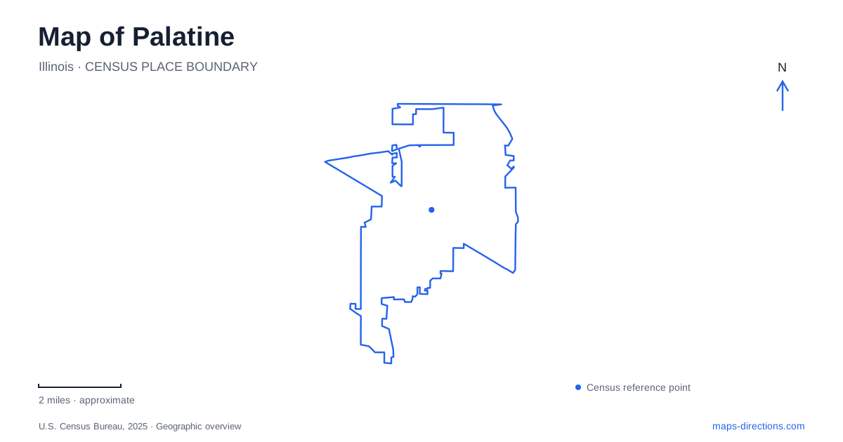
Street tiles load from OpenStreetMap when opened. The blue line shows the 2025 Census boundary.
- State
- Illinois
- Population · July 2025
- 65,842
- Land area
- 14.1 sq mi
- Water area
- 0.2 sq mi
Palatine grew from a railroad-era village into a larger suburban community, but its map still reveals earlier patterns of settlement and land use. The historic core contains a nineteenth-century house museum, while recreation land includes both a reservoir park and a much larger forest-preserve landscape. Harper College represents another transformation, occupying land once associated with farming and stables. Together these places explain how transportation, education and conservation shaped different parts of the community.
The railroad helped organize the village
The village's comprehensive plan records that the settlement was surveyed and laid out in 1855, following the arrival of the railroad in the early 1850s. Incorporation followed in 1866. Earlier settlers had established homes around groves with names such as Deer Grove, Plum Grove and Englishman's Grove, reflecting the contrast between wooded areas and surrounding prairie.
That sequence gives Palatine two useful historical layers. The groves describe an earlier landscape of settlement, while the railroad helped concentrate a more organized village. Later suburban growth expanded far beyond that core, particularly during the middle decades of the twentieth century. On a map, the older center and the wider residential area should therefore be read at different scales. One reflects the compact requirements of an early rail community; the other records the much larger population and development pattern that followed.
Clayson House preserves a domestic setting
The Clayson House was built in 1873 for George Clayson, a nurseryman who also served on the village board. Its restoration became a community bicentennial project, and the museum opened to the public in October 1979. The house is listed on the National Register of Historic Places and remains the historical society's home.
Its institutional history continued after restoration. The public library district owned the property from 1976 until 2024, when the park district became its owner. This gives the house a second story beyond its nineteenth-century residents: several local organizations have shared responsibility for preserving and interpreting it. The museum is therefore both a surviving domestic building and a product of sustained civic effort. Its place within the community is not explained solely by its construction date.
Riemer Park combines recreation and prairie habitat
Margreth Riemer Park occupies 91 acres at 745 West Wood Street. Its reservoir landscape supports an 18-hole disc-golf course across rolling ground, alongside a skate park and other recreation spaces. The park district describes two small ponds and substantial changes in elevation within the course, features that distinguish this landscape from a flat neighborhood playing field.
A smaller protected prairie lies in the northwest portion of the reservoir property. Although only 2.5 acres, it includes a transition from relatively dry prairie soils to wetter prairie, sedge meadow and marsh conditions. The district records more than 100 native plant species there. Palatine's open spaces therefore contain ecological variation at a much finer scale than a single green map symbol suggests. The reservoir's recreation facilities and prairie habitat occupy related ground but have different purposes and management needs.
Deer Grove is a larger conservation landscape
Deer Grove was Cook County's first forest preserve and now contains nearly 2,000 acres of upland woods, ravines, wetlands and prairie. Its eastern and western portions are related but distinct landscapes. County restoration work has sought to improve ecological health rather than simply maintain recreational scenery.
The contrast between forest and open habitat is central to understanding the preserve. A wooded ravine, restored wetland and prairie area may be close together while supporting different plants and drainage conditions. A preserve map is useful precisely because it makes those relationships visible. Deer Grove also places Palatine within a regional conservation system whose boundaries and responsibilities extend beyond the village itself. This is a larger landscape than the individual municipal parks, with a different history and scale of stewardship.
Harper College replaced a farm and stables
Harper College's permanent campus opened in September 1969 on the former Biddle farm and Tri-Color Stables site. The initial campus consisted of six buildings accommodating administration, instruction, utilities and learning resources. The college had begun teaching students earlier, so the institution's opening and the arrival at its permanent campus are separate milestones.
The campus illustrates another major shift in Palatine's land use. Agricultural property became an educational center, with buildings and circulation designed for a regional student population. The college also maintains the Craig Stettner Prairie, created through decades of work by faculty, staff and students on a former farm field. That prairie is a restoration and teaching landscape, distinct from the remnant habitats protected elsewhere in the area.
Reading these places together reveals several kinds of continuity. The rail-era village supplied an urban center, Clayson House preserved a domestic building, Riemer Park combines recreation with a small ecological remnant, and Deer Grove protects a broader habitat system. Harper's campus adds education and deliberate landscape restoration. The result is a map of successive decisions about land, with each district retaining evidence of the uses that preceded it.
Map and statistics: U.S. Census Bureau, 2025 Gazetteer, January 2025 generalized place boundaries and Vintage 2025 population estimates. Local references: Village of Palatine; Palatine Park District; Forest Preserves of Cook County; Harper College. Article prepared by Maps & Directions.