Map of Owasso
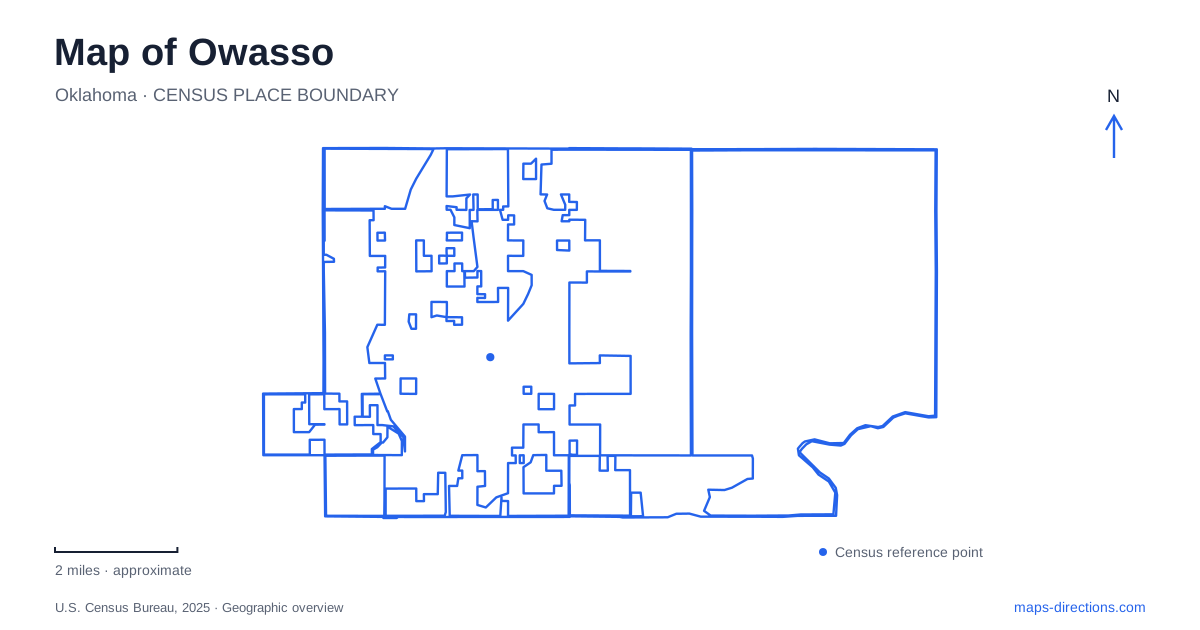
Street tiles load from OpenStreetMap when opened. The blue line shows the 2025 Census boundary.
- State
- Oklahoma
- Population · July 2025
- 43,117
- Land area
- 17.0 sq mi
- Water area
- 0.0 sq mi
Owasso has two early settlement locations to consider, not just one historic center. The original Elm Creek community stood near present-day Sixty-Sixth Street North and North 129th East Avenue. The railway later established a depot community several miles to the northwest, drawing businesses and residents toward it. That relocation is a useful starting point for understanding the relationship between older local history and the modern street map.
The settlement followed the depot
The municipal history places Elm Creek within the Cooweescoowee District of the Cherokee Nation, Indian Territory. Its name came from a tributary of Bird Creek. When the railway acquired land for a new alignment in the late 1890s, it also created a water supply by damming a natural spring and built a depot farther south along the line.
Residents moved businesses, including a blacksmith shop and the post office, toward the railway settlement. The new community initially retained the Elm Creek postal name, before the name changed in 1900. This was a movement of local activity across the landscape, rather than simply a new name applied to one unchanged location.
A historical map of Owasso therefore needs to distinguish the creekside settlement from the later depot town. The surviving city center developed through that shift, while Elm Creek remains part of the community's place names and historical identity.
Main Street's museum was a working shop
The historical museum at 26 South Main Street occupies the Komma Building, constructed in 1928. It originally housed the Mapes and Komma Grocery and Market, with other businesses using part of the building. The city's museum history records later commercial uses before the historical society purchased it and volunteers adapted it for museum use.
The museum opened in 1991. This gives the building a double role: it contains objects from local history and is itself a surviving part of the commercial landscape. Its Main Street address makes it a useful anchor for reading downtown as a place of everyday trade rather than only formal civic buildings.
The change from grocery to museum also explains why local heritage is embedded in an ordinary storefront. Preservation kept a familiar business structure in public use, allowing the building's own history to remain part of the interpretation inside.
Redbud keeps gatherings in the downtown district
Redbud Festival Park adds a different public space to central Owasso. The district's official information places it on Main Street between Seventy-Sixth and Eighty-Sixth Streets. It hosts community events, including outdoor movie nights and seasonal gatherings, within the wider downtown business district.
The museum and festival park consequently represent complementary uses of the same general Main Street corridor. One preserves evidence of past community life; the other provides space for present-day gatherings. Their relationship helps explain why downtown remains meaningful even as commercial development spreads along larger roads elsewhere.
The district name should be read as an area label, while the festival park is a particular destination within it. That distinction makes an event notice or business address easier to place on the map.
Numbered roads organize the wider city
The municipal street guide shows a repeated east–west framework of numbered streets, including Seventy-Sixth, Eighty-Sixth, Ninety-Sixth, and One Hundred Sixth. North–south references include Main, Garnett, Mingo, and numbered avenues, with US 169 forming another major corridor.
This combination of named and numbered roads gives Owasso a practical geographic structure. The full directional address matters: an east–west numbered street and a north–south numbered avenue serve different roles. Reading the road designation as well as its number helps connect neighborhood destinations with the wider grid.
The pattern is especially useful for comparing parks. Centennial Park lies on East Eighty-Sixth Street North, while Elm Creek Park is on East Seventy-Seventh Place North. Their names alone convey little about that separation, but the street references immediately place them within different parts of the city.
Parks offer different scales of recreation
Centennial Park combines fishing ponds, a walking and jogging route, a playground, and disc golf. Elm Creek Park offers a smaller-scale setting with a pond, a short walking loop, tennis courts, and picnic shelters. Rayola Park adds another recreation area with a splash pad, walking trail, and pickleball courts.
These facilities show how Owasso's public spaces are distributed rather than concentrated entirely downtown. A pond-centered walk, a festival gathering, and a visit to the historical museum occupy different settings and support different activities. Read together with the original Elm Creek settlement and the railway-driven relocation, the parks and streets reveal a community whose center and public life have changed as its geography expanded.
Map and statistics: U.S. Census Bureau, 2025 Gazetteer, January 2025 generalized place boundaries and Vintage 2025 population estimates. Local references: City of Owasso; City of Owasso Redbud District. Article prepared by Maps & Directions.