Map of Oswego
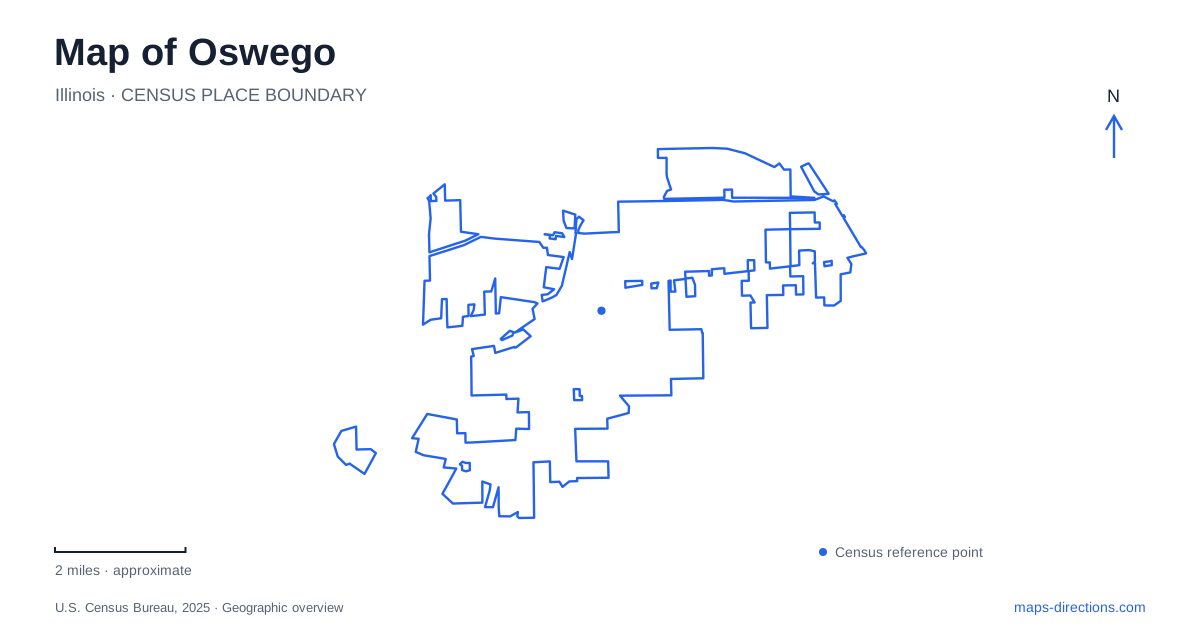
Street tiles load from OpenStreetMap when opened. The blue line shows the 2025 Census boundary.
- State
- Illinois
- Population · July 2025
- 39,948
- Land area
- 16.2 sq mi
- Water area
- 0.2 sq mi
Oswego, Illinois developed where a tributary meets the Fox River and a limestone shelf made an early crossing possible. That physical setting helps explain the village's older center more clearly than its modern suburban boundaries alone. Downtown streets, a preserved church-turned-school, riverside parkland and a former quarry each show a different relationship between settlement and the landscape. They also occupy different kinds of spaces, from compact blocks to an irregular network of woodland trails.
A crossing at the creek mouth
The local museum's history describes a smooth limestone riverbed just above the mouth of Waubonsie Creek. Native Americans used the ford before American settlers arrived in the 1830s. Roads serving later travelers took advantage of the same crossing, and stagecoach service began through the village in 1836. The meeting of watercourses was therefore also a meeting of overland routes.
This gives a map of Oswego a clear starting point: the river crossing and creek mouth explain why the settlement formed where it did. The old ford is a historical geographical feature, not a recommended present-day way to cross the river. Bridges and current paths belong to a later transportation network, even when they serve movements through the same general area.
Main Street and a formally recognized historic center
The village recognizes a Downtown Historic District, preserving attention to the older commercial streets amid later growth. Main Street's historic buildings and nearby civic sites make the central area more than a collection of current businesses. Their placement reflects the earlier settlement around the river crossing, while subsequent road improvements and development expanded the community far beyond it.
The municipal architectural survey identifies the 1850 Methodist Episcopal church as a surviving building from an early period of religious organization. This is a useful example of how one structure can connect the street map with several stages of community life. Its present name, Little White School Museum, describes its later uses rather than its first purpose.
A church, school and museum in one building
The Little White School stands at Polk and Jackson streets. After its religious use, the building accommodated classes as the local school system grew. First through third grades and junior high classes used it at different points before the school closed in 1964. The museum now interprets the area's development in the same recognizable structure.
For Oswego, the building's changing role makes it a particularly informative landmark. A photograph labeled as a church, a classroom memory and a modern museum address may all refer to this one place. The sequence avoids a common misunderstanding created by the current name: it was not originally constructed as a small schoolhouse. Its survival also allows the scale of an early public building to be compared with the larger institutions serving the present community.
Hudson Crossing and the downtown river setting
Hudson Crossing Park is listed by the park district at 65 North Harrison Street. Its name recalls Hudson, an early name associated with the settlement. The park provides a downtown recreation destination separate from the museum's neighborhood setting, while keeping the river central to the experience of the older village.
The surrounding geography is worth reading at two scales. At the block scale, Harrison Street identifies a specific park destination. At the wider scale, the Fox River and its tributary explain the original settlement location. These are complementary views: the street address provides modern orientation, while the watercourses supply the historical reason for this part of the village's importance.
Quarry ridges at Saw Wee Kee
Saw Wee Kee offers a very different outdoor landscape near Oswego. Its mountain-bike trails occupy a former quarry, where discarded rock and gravel created ridges. The Chicago Area Mountain Bikers organization, a park-district maintenance partner, describes more than eight miles of singletrack with short climbs, loose stone and twisting descents. The terrain's frequent changes matter more than any impression of a broadly flat river valley.
The two main parking areas are reached from Sundown Lane. Trail names such as Vertical Velocity, Anaconda and Colossus identify separate routes within the network. Their compact layout should not be confused with an easy paved riverside promenade: quarry remnants create technical conditions and repeated elevation changes. The recreation landscape is partly an inherited industrial landform.
The park district has also worked with partner agencies on color-coded trail signs, difficulty information and emergency procedures. Those details show why a trail-specific map is useful inside the park, even after a street map has located it. The public trail boundaries remain important because adjoining private properties are outside the recreation network.
Reading Oswego through these places connects the natural ford, historic streets, a reused public building and an altered quarry landscape. The village's identity comes from the relationships among them. A river crossing explains the early town; preservation keeps one building's successive roles visible; and outdoor recreation gives former extraction land a new purpose without removing the terrain that industry left behind.
Map and statistics: U.S. Census Bureau, 2025 Gazetteer, January 2025 generalized place boundaries and Vintage 2025 population estimates. Local references: Little White School Museum; Village of Oswego; Oswegoland Park District; Chicago Area Mountain Bikers. Article prepared by Maps & Directions.