Map of Oshkosh
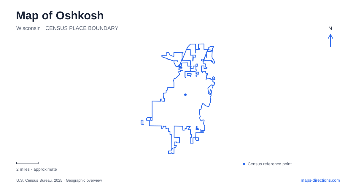
Street tiles load from OpenStreetMap when opened. The blue line shows the 2025 Census boundary.
- State
- Wisconsin
- Population · July 2025
- 67,460
- Land area
- 27.8 sq mi
- Water area
- 1.0 sq mi
Oshkosh occupies the western shore of Lake Winnebago, with the Fox River and Lake Butte des Morts adding other important water edges. Those names describe a connected regional landscape, but they do not identify the same waterfront. A downtown river walk, a lakeside park visit, and a trip to the aviation museum involve different parts of the city. The map becomes more useful when those outdoor and cultural districts are understood separately, then connected through their actual streets and waterways.
The riverfront belongs to the downtown setting
The local visitors bureau describes the Riverwalk along the Fox River beside downtown, with docking opportunities that connect boaters to nearby businesses and events. This gives the river a public role within the urban center. It is a place where walking routes, waterside views, and the activity of adjoining blocks overlap.
Lake Winnebago supplies a much broader water horizon on the city's eastern side. Menominee Park and its zoo occupy that lakeside setting. The municipal zoo is seasonal and contains both changing animal displays and permanent exhibits, including wolves, elk, otters, eagles, and black bears. For Oshkosh, the riverfront and Menominee Park therefore offer different ways to experience water: one follows an urban channel, while the other faces the large lake. They should not be merged into a single generic waterfront stop merely because both appear beside blue areas on a map.
Algoma Boulevard brings two cultural properties close together
The public museum is at 1331 Algoma Boulevard, while the Paine Art Center and Gardens is at 1410 Algoma Boulevard. Their shared street makes them a recognizable cultural pairing, but the properties tell different stories. One incorporates the Sawyer family's actual residence and its interiors; the other presents an estate designed around architecture, gardens, and art.
The Historic Sawyer Home was built in 1908 for Edgar and Mary Sawyer, with local architect William Waters designing the house and Tiffany Studios furnishing its interiors. Stained glass is integral to the setting rather than simply an object placed in a neutral gallery. The landscape window on the grand staircase and the wisteria window show how decorative art was incorporated into the domestic architecture. This gives the building itself an interpretive role alongside the museum's broader collections.
The Paine was designed to suggest an older estate
Bryant Fleming designed the Paine mansion in a Tudor Revival idiom inspired by English country houses. Its varied architectural details deliberately suggest a property developed across several centuries. That appearance should be read as a twentieth-century design choice rather than evidence that the building itself is centuries old.
Nathan and Jessie Paine intended the estate eventually to serve public cultural and educational purposes, but they never lived in the mansion. The original plan separated reception spaces, private rooms, service areas, and a gallery that could accommodate visitors. In Oshkosh, this creates a useful comparison with the Sawyer Home: two substantial properties on one boulevard express different relationships between private life and public culture. The Paine's gardens extend that interpretation outdoors, making the landscape part of the visit rather than a decorative margin around the house.
The aviation museum has its own southern destination
The EAA Aviation Museum uses the address 3000 Poberezny Road and stands adjacent to Wittman Regional Airport. Its collection covers multiple eras of flight, while Pioneer Airport adds a recreation of an early aviation setting with vintage aircraft in period-style hangars. The museum and associated airfield landscape form a separate destination from the Algoma Boulevard institutions.
Pioneer Airport is not a general public-use airfield, despite being a working grass-runway setting. EAA distinguishes it from Wittman for pilots arriving in their own aircraft. Its visitor operation is also seasonal, with aircraft rides dependent on conditions and pilot availability. These distinctions matter for a map of Oshkosh because several aviation names may appear close together. A museum visit, an arrival by private aircraft, and participation in a scheduled flight experience are different activities within the wider aviation campus.
The northern trail is one segment of a larger name
The Wiouwash State Trail offers a crushed-stone rail-trail route extending about 22 miles from the city toward Hortonville. Wisconsin's parks agency describes the overall trail as two separate sections, with another northern segment between Birnamwood and Split Rock. Its total mileage should therefore not be mistaken for one continuous route beginning downtown.
The state identifies a main Winnebago County parking area off Westwind Road near the highways 41 and 45 junction. That provides a different starting point from a short riverfront stroll. For Oshkosh, the trail adds a regional landscape of longer-distance movement to the river, lake park, museums, and aviation grounds. Each has its own scale and physical setting, giving the city a varied map without requiring every outing to follow the same central route.
Map and statistics: U.S. Census Bureau, 2025 Gazetteer, January 2025 generalized place boundaries and Vintage 2025 population estimates. Local references: Oshkosh Convention and Visitors Bureau; City of Oshkosh; Oshkosh Public Museum; Paine Art Center and Gardens; Experimental Aircraft Association; Wisconsin Department of Natural Resources. Article prepared by Maps & Directions.