Map of Orlando
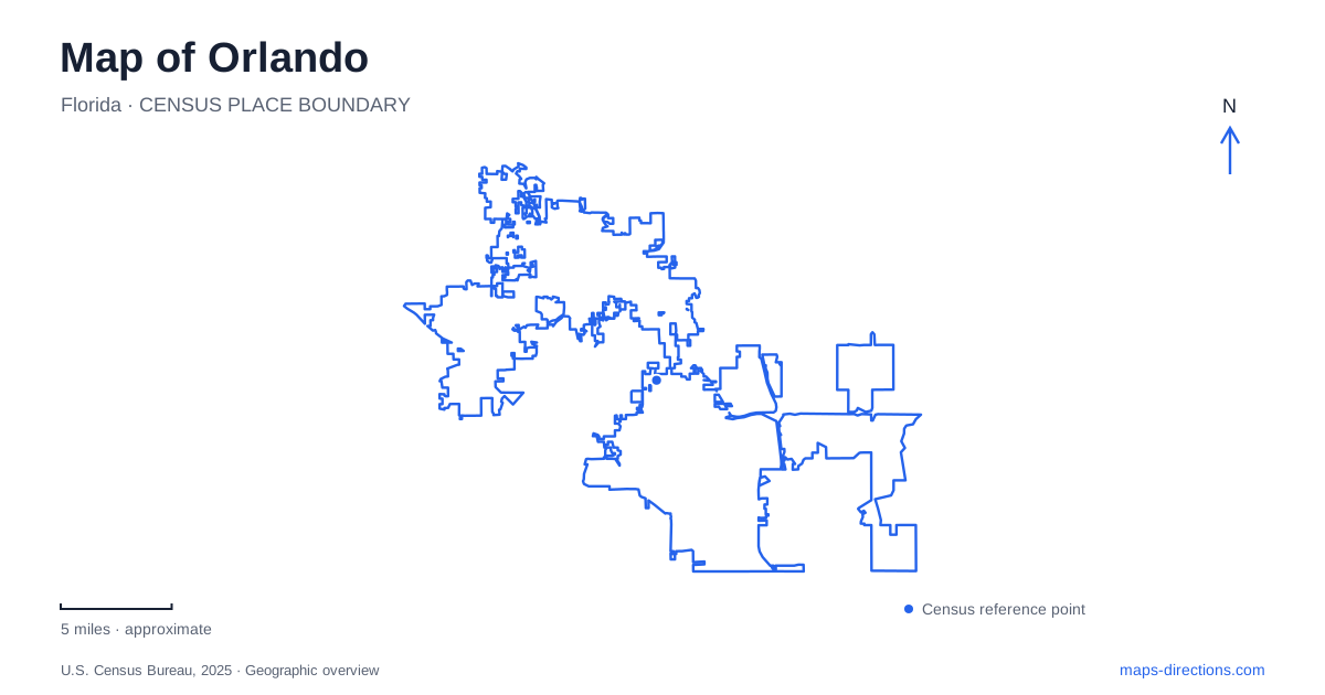
Street tiles load from OpenStreetMap when opened. The blue line shows the 2025 Census boundary.
- State
- Florida
- Population · July 2025
- 333,888
- Land area
- 129.6 sq mi
- Water area
- 8.4 sq mi
Orlando has a lake-centered urban geography that can disappear behind its reputation for theme parks. Downtown streets surround water, public gardens occupy generous green spaces, and a trail connects several lakes with cultural institutions. The historic neighborhoods also preserve stories of land donation, segregation, commerce, and education. A map that includes these features provides a fuller picture of the city than a collection of resort destinations, especially for someone interested in its everyday civic landscape.
A lake that became a public landmark
Lake Eola began with a sinkhole on land purchased by cattleman Jacob Summerlin in 1873. Water from an aquifer and storm runoff contributed to the lake's formation. The Summerlin family donated land around its edge for public use in 1883, and the city recognized the site as a public park in 1888. The history explains why a substantial open waterfront remains embedded within downtown development.
The sidewalk around the lake measures approximately 0.9 mile. Its continuous circuit gives walkers a way to experience the skyline from changing positions rather than a single overlook. The Walt Disney Amphitheater and the 1924 Mediterranean Revival-style Eola House add built landmarks to the shoreline. The house now accommodates park offices and event space, making it part of the park's working landscape as well as its architectural history.
The first fountain was installed in 1912. Its 1957 replacement, the Linton E. Allen Memorial Fountain, became a particularly recognizable civic symbol. Lake Eola's importance to Orlando comes from this combination of natural formation, protected public space, and accumulated community landmarks. The lake is therefore useful as an orientation point and as a starting place for understanding how downtown grew around an established park.
Parramore's commercial and cultural history
Parramore lies west of the central business district. From the 1930s through the 1950s, it served as an important economic center for African American residents of Central Florida, with shops, restaurants, medical practices, and entertainment venues. The neighborhood's history reflects the restrictions imposed by segregation as well as the businesses and institutions residents built within those conditions.
Dr. William Monroe Wells developed the South Street Casino beside the Wellsbuilt Hotel. The entertainment venue hosted prominent musicians, and the neighboring hotel accommodated performers traveling through the region. The hotel later became the Wells'Built Museum of African American History. These sites connect an individual street location with a wider history of touring music, hospitality, and Black entrepreneurship.
Educational development adds another layer. The Academic Center for Excellence opened in 2017, followed by the shared UCF and Valencia College downtown campus in 2019. These institutions appear in the city's Parramore neighborhood planning record. Reading them alongside the historic sites shows a district with continuing residential and educational functions, rather than reducing it to either its past or a single large event venue.
Three lakes around a cultural park
Loch Haven Cultural Park occupies 45 acres around North Mills Avenue and Princeton Street. Lake Estelle borders its northern side, Lake Rowena lies to the east, and Lake Formosa sits to the south. Those three water bodies give the park an unusually clear geographical frame and help explain the arrangement of its cultural buildings and open land.
The park accommodates art, science, theater, ballet, and local heritage institutions. This concentration makes it a distinct cultural destination within Orlando, separate from the lakefront gathering space at Eola. A visitor can recognize the area's purpose from the relationship between museum buildings, performance spaces, and surrounding lakes. The landscape is part of the experience: moving between institutions also means passing through a substantial public green setting.
A trail connects the northern lake landscape
The Orlando Urban Trail runs from Lake Highland through Loch Haven Park toward Mead Garden in neighboring Winter Park. The city describes it as approximately three miles long, with about 85 percent of the route on an off-street path. Connections include six lakes, cultural facilities, and the Gaston Edwards Trail.
The route's combination of lake edges, bridges, and urban sections makes it useful for understanding how the northern neighborhoods fit together. It is not simply a perimeter path around one park. The transition toward Winter Park also demonstrates how a continuous recreational corridor can cross a municipal boundary while retaining its role in the local trail network. Surface and street-crossing details remain relevant because the route is predominantly, rather than entirely, separated from roads.
Botanical grounds within the urban area
Leu Gardens contributes another substantial green destination at 1920 North Forest Avenue. The city identifies the grounds as a 50-acre botanical garden designed to encourage appreciation and understanding of plants. Its planted collections and walking paths offer a different experience from both the open cultural park and the busy lakefront circuit.
Together, these places give an Orlando map a coherent local story: water shaped the open spaces, public institutions established distinctive gathering places, and neighborhoods developed commercial and cultural identities around them. Following that geography reveals a functioning city with its own history beyond the regional visitor attractions.
Map and statistics: U.S. Census Bureau, 2025 Gazetteer, January 2025 generalized place boundaries and Vintage 2025 population estimates. Local references: City of Orlando; Downtown Orlando. Article prepared by Maps & Directions.