Map of Orem
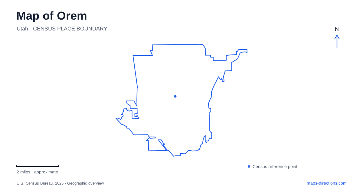
Street tiles load from OpenStreetMap when opened. The blue line shows the 2025 Census boundary.
- State
- Utah
- Population · July 2025
- 95,214
- Land area
- 18.6 sq mi
- Water area
- 0.0 sq mi
Orem’s map becomes clearer when its cultural destinations are separated into their actual settings. Utah Valley University occupies a large campus beside Interstate 15, its art museum stands on a different property near Sandhill Road, and SCERA’s indoor and outdoor theaters use separate addresses. Beyond these buildings, parks extend from the vicinity of Utah Lake toward Provo Canyon. The local street grid helps locate each destination, while freeway crossings and trail junctions explain how the pieces connect.
Crossing the freeway on foot
The pedestrian bridge at Utah Valley University connects the main campus with the west campus and Orem Central FrontRunner station. Unveiled in January 2021, the covered span is approximately 1,000 feet long. Its heated concrete surface and lighting were designed for a connection used throughout the year, rather than an occasional recreational crossing.
Interstate 15 is the major dividing line here. A road map emphasizes interchanges and vehicle lanes, but the pedestrian bridge supplies a separate route across the same corridor. Its position at the campus’s northwest corner matters when comparing the station with a particular university building. The rail arrival and the academic destination are connected by campus circulation, with the bridge acting as the link between two sides of the freeway.
The project also has a longer planning history: a crossing appeared in the university’s master plan in 1993, long before construction. That interval helps explain why older descriptions and maps may show the campus and station as more disconnected than they are today.
The art museum at Lakemount
The UVU Museum of Art at Lakemount is at 260 West 1800 South. Its directions use Sandhill Road and West 1800 South, placing it in a different setting from the main campus. A university name on a map therefore does not automatically identify the academic campus as the destination.
The property includes galleries, gardens, and the Art Haus. Visitors can use the front driveway for drop-off before moving to the parking lot behind the building. A ramp on the northeast side leads toward the gardens and Art Haus, and an elevator serves the galleries. These details reveal the museum’s arrangement as an adapted building and grounds, with several connected spaces rather than one street-facing exhibition hall.
For an Orem arts outing, Lakemount also pairs geographically with the Sandhill Road area’s garden history. It is a useful part of the city to explore through institutions and planted landscapes, rather than through the university’s classroom buildings alone.
Nielsen’s Grove and its formal landscape
Nielsen’s Grove occupies the former homestead of Danish immigrant Jorgen Nielsen in the southwestern part of the city. The park includes replicas of historic buildings, a pond, a reflecting pool and fountain, formal gardens, and open lawns. Those elements distinguish it from a sports park: much of its interest lies in the arrangement of water, planting, and historical references.
The city gives the park’s Sandhill Road address as 1931 South Sandhill Road. Its parterre garden is maintained partly through an Adopt a Spot program in which volunteers help care for individual flower beds. This continuing work is part of the landscape’s character. The formal appearance is sustained by regular cultivation rather than representing untouched natural vegetation.
The replicas and planted spaces also invite different kinds of observation. A building can suggest the homestead’s history, while the garden geometry and water features express the park’s designed setting. Both belong to the same site, but neither should be mistaken for a complete reconstruction of the original farm.
SCERA’s two theater settings
SCERA Center for the Arts is at 745 South State Street. Its main parking lot is behind the center to the east, while the driveway on 720 South serves short pickups and drop-offs. The State Street frontage gives the indoor venue a direct relationship with one of Orem’s principal commercial roads.
The SCERA Shell Outdoor Theatre is within SCERA Park at 600 South 400 East. Its audience sits on a grassy slope. The main entrance, concessions, restrooms, and box office occupy the west side at the top of the hill; a southern entrance provides an accessible sidewalk to level concrete seating. That topography is part of the theater experience, not merely a background detail.
These locations explain why an indoor performance and an outdoor production require different approaches even under the same organization’s name. The park, hill, and surrounding streets form the outdoor venue’s circulation system.
Toward the canyon trails
At 800 North and Canyon Hills Drive, a trailhead provides access eastward to the Provo River Trail and westward to the Murdock Canal–Provo River Connector. This junction gives Orem a clear transition from its street network into longer recreational routes.
Farther into the canyon setting, Mount Timpanogos Park was originally developed for the Timpanogos Storytelling Festival. Walking, hiking, picnic areas, and a hosting center now use that landscape. Its canyon location provides a fitting contrast to the freeway bridge: both are important connections on the local map, but one links a university with regional transit while the other opens toward river and mountain recreation.
Map and statistics: U.S. Census Bureau, 2025 Gazetteer, January 2025 generalized place boundaries and Vintage 2025 population estimates. Local references: Utah Valley University; UVU Museum of Art; City of Orem; SCERA. Article prepared by Maps & Directions.