Map of Olive Branch
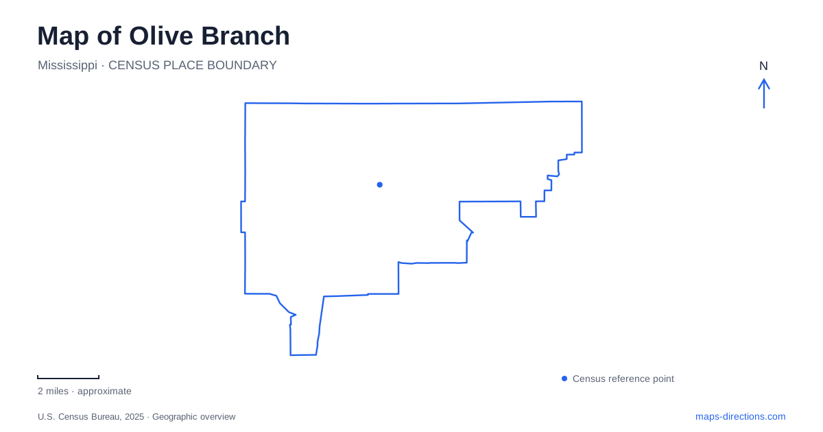
Street tiles load from OpenStreetMap when opened. The blue line shows the 2025 Census boundary.
- State
- Mississippi
- Population · July 2025
- 47,563
- Land area
- 56.1 sq mi
- Water area
- 0.2 sq mi
Olive Branch's public destinations are spread across several street corridors. City Park uses a Goodman Road address, City Hall is on Pigeon Roost Road, and the George M. Harrison soccer complex is on Church Road. These are three different arrival points, even when all appear in the same municipal events calendar. Reading the map with those distinctions in mind prevents a citywide event search from sending you to the wrong public facility.
Goodman Road and City Park
Municipal event listings identify City Park at 8267 Goodman Road. The city has used the park for festivals, outdoor activities and recreational programs, so a park search can return different internal gathering points. A walking event at the track is not necessarily the same destination as a concert or a sports activity elsewhere on the grounds. Keep the activity location supplied by the organizer together with the park's overall address.
Goodman Road also appears under its highway designation, State Route 302, in city information. Recognizing both names helps reconcile a street-address search with a regional road map. The shared name and number do not identify a particular driveway, however. A route ending near the park frontage should still be checked against the entrance intended for the visit, especially when an event has its own parking arrangement.
Pigeon Roost is the civic reference
City Hall is listed at 9200 Pigeon Roost Road. The municipal farmers market uses that location in the city's published event information. This makes the civic address a useful anchor for a different kind of Olive Branch visit from a trip to City Park. If someone says only “the city event,” ask which location appears on the event notice before saving the destination.
The point is especially relevant when arranging a meeting rather than following a preselected route. A market, a park festival and a municipal appointment can all involve city services while taking place on different streets. Keep the venue name visible in the shared directions. An administrative phone number or website footer may identify City Hall even when the activity described on the page happens elsewhere.
Church Road and the soccer destination
The George M. Harrison Municipal Soccer Complex is at 8700 Church Road. City publications have discussed additional fields, parking and a walking-trail connection toward Ross Road. That combination explains why the complex can appear on both sports and recreation maps. It does not turn every nearby trail or field into the same arrival point for a tournament.
For an Olive Branch sports trip, retain the field assignment in addition to the complex address. A general map can bring you to Church Road, but the event or facility map is needed to distinguish the appropriate part of the grounds. Planning documents and construction announcements are useful context for changing layouts; they should not be treated as proof that a proposed connection has opened or that an older parking arrangement still applies.
The state-line roads need their full names
The city's road-program information identifies several distinct portions of Stateline Road, including sections associated with Polk Lane, Forest Hill Irene Road, Malone Road and Pleasant Hill Road. It also describes Forest Hill Irene Road in relation to Kirk Road and the Mississippi–Tennessee state line. Those references show why “near the state line” is a broad orientation phrase rather than a precise destination.
When comparing an Olive Branch address with a regional map, keep the cross street attached to any Stateline Road reference. A street name can cover multiple segments far enough apart to matter for a meeting or delivery. The road-program list is evidence of geographic relationships, not a live closure feed. Use current route information for the actual journey instead of assuming a dated paving announcement describes today's conditions.
College Street is another separate venue
The city identifies its senior center at 8800 College Street in event information. That gives a further example of why municipal destinations should not be collapsed into one civic pin. A program organized by the city may use the senior center even when its promotional notice also includes a general city contact address. Save the venue line, not merely the organization name.
A practical map of Olive Branch can therefore begin with a small set of named anchors: Goodman Road for City Park, Pigeon Roost Road for City Hall, Church Road for the soccer complex and College Street for the senior center. Use the larger road network to connect the relevant anchors only after choosing the actual stops. This produces a plan based on the purpose of the visit rather than a collection of search results sharing the same city label.
Map and statistics: U.S. Census Bureau, 2025 Gazetteer, January 2025 generalized place boundaries and Vintage 2025 population estimates. Local references: City of Olive Branch. Article prepared by Maps & Directions.