Map of Oklahoma
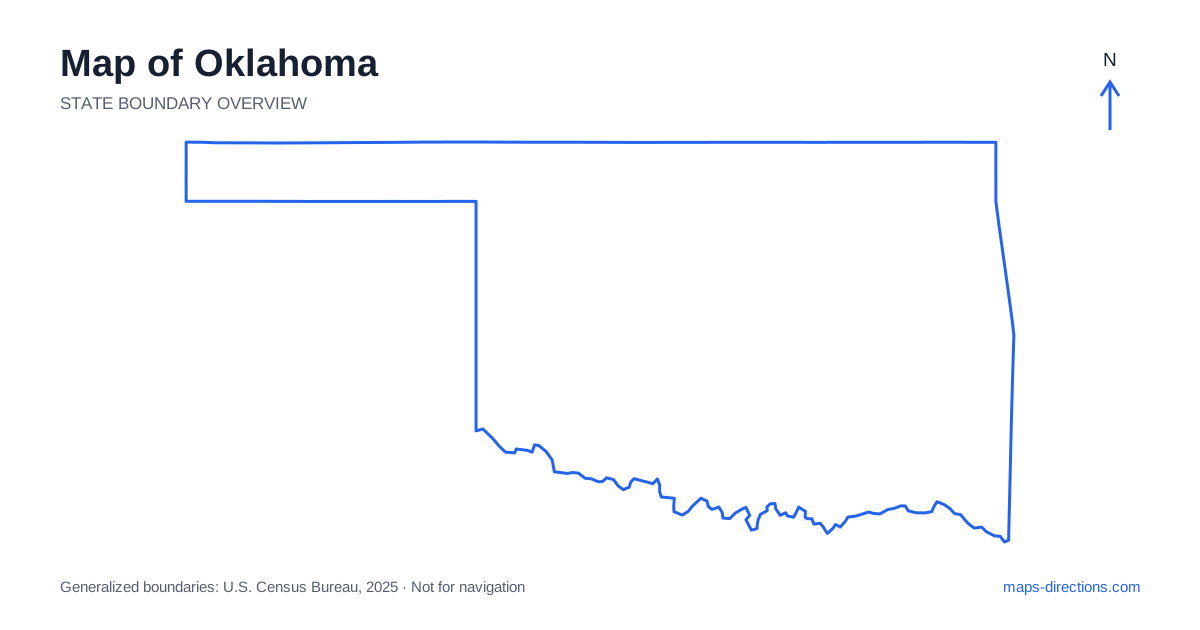
Oklahoma has a broad main body and a long, narrow Panhandle extending west. Oklahoma City anchors the central region, while Tulsa occupies a separate northeastern urban area. Beyond those cities, western plains, southern river country and eastern hills create different road landscapes. A useful map starts with that regional contrast rather than treating the whole state as one open prairie crossed by straight highways. Locate the intended city, lake or rural destination within its actual region before choosing the long-distance corridor and final local approach.
Understand the Panhandle and the southern boundary
The Panhandle of Oklahoma extends far west of the main body, with Guymon and Boise City providing useful town references. Its position is easy to recognize on the outline, but a map centered only on the two largest metropolitan areas can make the extension appear smaller than it is. A visit there should be treated as a separate regional stage with its own road connections.
The Red River shapes much of the southern boundary beside Texas. Unlike a straight land border, the river can require a specific bridge to reach a destination on the opposite bank. Mark that crossing before comparing routes. The statewide shape provides a clear overview of the western extension and southern edge, while the detailed road network explains how towns and rural destinations along them are actually approached.
Place the capital within its wider metropolitan area
Oklahoma City is the state capital and a major meeting point for Interstates 35, 40 and 44. This makes it a useful orientation hub, but the metropolitan region extends well beyond the central district. Norman lies to the south and Edmond to the north, with different local approaches and connections to the main roads. A general city label cannot describe every arrival in that wider area.
For a visit, use the exact venue, accommodation or neighborhood before deciding which highway exit serves it. An airport transfer and a central-city stay are different map tasks. If the route continues across the state the next day, the departure direction should also influence the overnight choice. A base on the appropriate side of the region can avoid repeated crossings that are easy to overlook on a broad overview.
Read Tulsa as a separate northeastern hub
Tulsa sits along the Arkansas River in the northeast and has its own metropolitan network. Interstate 44 is an important regional connection through this area, while other highways lead toward surrounding towns and lakes. The city is not an outer district of the capital region, and a trip involving both needs a genuine transfer between their local road systems.
Within Tulsa, the river creates distinct approaches to destinations on opposite sides. Choose the actual bank and relevant bridge rather than simply the nearest-looking route toward the city center. For a lakeside or rural visit beyond the metropolitan area, identify the specific town or access point serving the destination. A broad northeastern label can otherwise hide whether the final stage heads toward a reservoir, a hill-country community or a different highway corridor.
Follow the plains corridors west and south
Interstate 40 crosses the central part of the state from east to west, while Interstate 35 provides a north-to-south connection through the capital corridor toward the southern border. These roads are strong orientation lines, but destinations beyond them still require local routes. A town appearing close to an interstate may be reached from an interchange some distance from the point that looks nearest on the map.
The southwestern region includes Lawton and the Wichita Mountains, a landscape that differs from the surrounding broad plains. A recreation visit there needs a particular entrance or named destination. Do not use the center of a mountain area as the driving endpoint. The route should show both the main highway transfer and the final smaller-road approach into the terrain, including any return leg required before continuing elsewhere.
Distinguish the eastern lakes and mountain regions
The eastern part contains wooded hills, river valleys and reservoirs with more irregular local connections than a simple plains grid might suggest. The Ozark region in the northeast and the Ouachita Mountains in the southeast are separate landscapes. A trip involving both should show the intervening transfer rather than treating them as one small mountain district.
Lakes such as Eufaula and the Grand Lake area also require a precise shoreline destination. Two accommodations described as being near the same reservoir can lie on different arms or road approaches. Mark the actual marina, campground or entrance before comparing stops. A bridge shown on one part of the lake does not imply another crossing near every inlet, so the water shape is practical route information rather than background scenery.
Arrange the trip by connected regions
A central-city stay, a Tulsa-area visit, a western plains journey, a Panhandle trip and an eastern outdoor itinerary each provide a distinct starting focus. Combining them can produce a large route, particularly when the western extension is included. Place overnight bases along the intended direction of travel before adding optional stops that pull the journey into another region.
For an Oklahoma itinerary, match the statewide outline with a closer map of the final urban district, river crossing or reservoir shore. Keep the highway transfer and local access as separate parts of the plan. This reveals the variety within the state's broad shape and makes its principal roads more useful: a framework connecting specific regions, rather than a promise that every destination lies on a simple straight drive.