Map of Oklahoma City
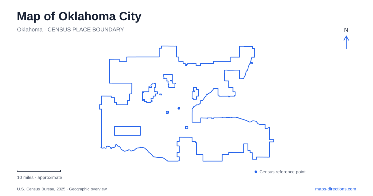
Street tiles load from OpenStreetMap when opened. The blue line shows the 2025 Census boundary.
- State
- Oklahoma
- Population · July 2025
- 719,849
- Land area
- 607.0 sq mi
- Water area
- 14.3 sq mi
Oklahoma City has a central map shaped by reused commercial districts, a deliberately transformed river and new public spaces linking downtown toward the water. Broadway Avenue organizes Automobile Alley to the north, Bricktown preserves a warehouse-area identity near the center, and Scissortail Park stretches across a freeway divide. These are different pieces of urban geography, not interchangeable names for one downtown attraction zone. Their relationships provide a useful starting point for reading the city.
Broadway retains the history of Automobile Alley
The visitor bureau places Automobile Alley north of downtown along Broadway Avenue. Its name comes from the automobile dealerships that formerly occupied the corridor, with historic buildings and neon signs retaining that connection. The district now includes shops, restaurants and arts destinations such as Factory Obscura and Oklahoma Contemporary. The old commercial architecture gives present-day activity a visible historical setting.
On an Oklahoma City map, Broadway is therefore more than a route into the center. It is the street spine of a named district. Following the corridor shows how a former specialized business area has acquired new uses without losing its recognizable built form. That helps explain why the district is described as a place to explore on foot rather than simply a collection of unrelated businesses along a road.
Bricktown has a canal-scale visitor landscape
Bricktown's visitor guide describes a former warehouse district adapted for restaurants and entertainment. The canal and ballpark supply recognizable anchors within it. The canal offers a very different water-side setting from the larger Oklahoma River corridor: it is embedded among central visitor destinations rather than extending as a broad river landscape across the city.
Historic Deep Deuce lies immediately north of Bricktown, according to the same guide. Keeping both names on the map explains a transition between adjacent districts rather than treating all nearby restaurants and buildings as part of one place. A central outing can move between them, but their separate identities remain useful when locating a venue or understanding the district layout.
The Oklahoma River is a modified stretch of a larger river
The city identifies the Oklahoma River as a seven-mile portion of the North Canadian River transformed into a sequence of river lakes. Its stated boundaries run from Meridian Avenue in the west to Eastern Avenue in the east. Dams at May, Western and Eastern avenues maintain water levels, while the project includes locks at May and Western. Those structures explain why the corridor appears differently from an unmodified river channel.
For Oklahoma City geography, this is a particularly useful distinction between a local river name and the larger waterway. The river lakes, landscaped banks, trails and recreational facilities form a coordinated public project. The Boathouse District and whitewater facilities occupy part of this broader corridor. A map showing the river alongside the avenue crossings reveals both its extent and the infrastructure that defines it.
Trails occupy both banks
Municipal information places multi-use trails on the north and south sides of the Oklahoma River. These belong to a wider city network that also includes routes associated with Lake Hefner, Lake Overholser and Lake Stanley Draper. The river trails are therefore one component of a larger recreational geography, rather than the only place where a map can show an extended nonmotorized outing.
The distinction between banks is useful even when both follow the same waterway. An activity at the Boathouse District has a specific relationship to that network, while a route along another part of the river may begin at a different avenue or park access. The full trail map shows the relationship among those segments and the lake routes beyond the central corridor.
Scissortail Park crosses the interstate
Scissortail Park's promenade connects its downtown end with the Lower Park by crossing Interstate 40 on the pedestrian Skydance Bridge. The park's own description makes that crossing central to its design. Instead of terminating public space at the freeway, the promenade carries it across toward the lower portion and the river area. The bridge is therefore both a landmark and a functional link in the park's geography.
An Oklahoma City park map shows a different kind of connection here from the avenue crossings over the river lakes. One bridges a highway barrier inside a public-space sequence; the others organize the broader water corridor. Reading those structures together explains how downtown parks and river recreation relate without pretending that all of them occupy one uninterrupted green rectangle.
A civic center with several kinds of public space
The downtown visitor guide places Myriad Botanical Gardens among the central attractions and identifies the streetcar connection between districts such as Midtown and Bricktown. The gardens, Scissortail Park, the canal and the river lakes each introduce water or landscape into the urban setting, but at different scales and for different purposes.
Oklahoma City is consequently best understood through several linked systems: Broadway's reused dealership corridor, Bricktown's canal and warehouse blocks, the park promenade across I-40, and the avenue-defined river lakes. Their names preserve the history and function of each place, while the streets, bridge and trails explain the connections between them.
Map and statistics: U.S. Census Bureau, 2025 Gazetteer, January 2025 generalized place boundaries and Vintage 2025 population estimates. Local references: Visit OKC; City of OKC; Scissortail Park Foundation. Article prepared by Maps & Directions.