Map of Ogden
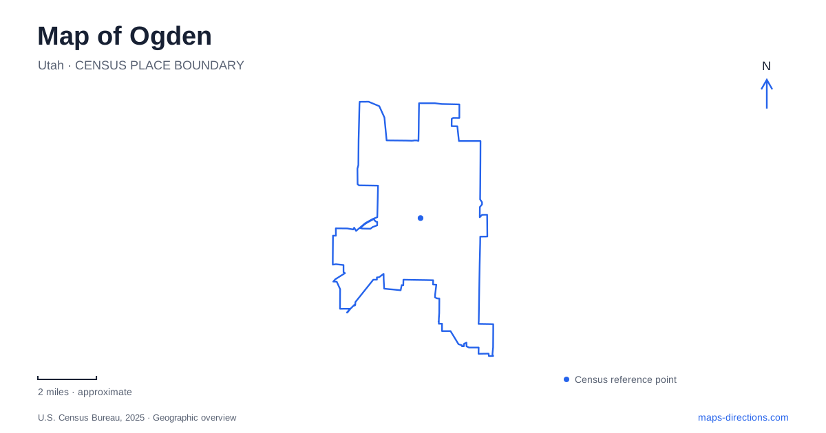
Street tiles load from OpenStreetMap when opened. The blue line shows the 2025 Census boundary.
- State
- Utah
- Population · July 2025
- 89,510
- Land area
- 27.5 sq mi
- Water area
- 0.0 sq mi
Ogden developed where railway connections, river corridors and the Wasatch mountain front meet. Those features still provide a useful structure for reading the city. Union Station anchors the older commercial district, the rivers carry green corridors through developed neighborhoods, and foothill trails introduce a much steeper landscape to the east. The resulting map contains several different kinds of movement: rail travel, ordinary city streets, paved river paths and mountain routes with very different demands.
Union Station at the end of 25th Street
Union Station stands at 2501 Wall Avenue, at the western end of historic 25th Street. Its position explains the relationship between the railway and the business district: shops, lodging and services developed along a street leading directly toward a major arrival point. The city's familiar Junction City identity reflects the importance of interchange between railroads, rather than simply the presence of tracks passing through town.
The current station dates to 1924. It followed an earlier substantial depot completed in 1889 and destroyed by fire in 1923. This sequence matters when reading the building's architecture: the surviving station represents a twentieth-century replacement within a much older railroad setting. Its Spanish Colonial Revival design, including arched openings and a tiled roof, belongs to that rebuilding period.
Museum uses now give the station a different relationship with visitors, preserving railway and other regional collections. The contemporary FrontRunner service uses the Central Station nearby along Wall Avenue. Historic railway interpretation and present-day passenger travel therefore remain close together, but occupy distinct facilities.
Lodging and community around the railway
In Ogden, the history of rail travel also includes the people who worked on trains and the places where they could stay. The Royal Hotel at 2522 Wall Avenue opened in 1914 and served workers and travelers. It later accommodated Basque immigrants connected with the sheep and wool industries, whose work also depended on transportation links.
During segregation, the hotel became one of the few local lodging options available to African Americans. Leager V. Davis purchased it in 1943 and made it an important gathering place for the Black community. That history gives the building significance beyond its commercial facade. It records both discrimination in the travel economy and the institutions residents created in response.
The street's preserved buildings are consequently more informative when read as parts of a working social landscape. Hotels, shops and the station supported overlapping communities whose experiences of the same railroad city differed substantially.
Following the rivers toward their meeting point
The Ogden River Parkway follows a corridor through the city toward the Weber River. Along its course, the Botanical Gardens, Dinosaur Park and Rainbow Gardens near the canyon mouth provide recognizable reference points. These are separate destinations connected by the river landscape, rather than components of one enclosed attraction.
At the confluence, the Centennial Trail continues south along the Weber River Parkway. The meeting of the rivers helps explain the trail network's change in direction. Following the water therefore provides a more coherent understanding of the paths than memorizing a list of park entrances.
The Dinosaur Park began as an outdoor sculpture park, with larger-than-life prehistoric creatures interpreting a world far older than the city's human history. Its placement beside the river parkway creates an unusual combination of recreational movement and educational display. The sculptures are interpreted exhibits, of course, rather than evidence that the riverbank itself contains those animals' excavated remains.
River paths and mountain trails are different terrain
The Centennial route also incorporates parts of the Bonneville Shoreline and Beus Canyon trails. This creates a network with a broad range of surfaces and gradients. Paved river segments suit a gentler walk or ride, while the mountain portions involve steeper, rougher terrain and are described by the local tourism organization as appropriate for more experienced mountain bikers.
For Ogden, that contrast is fundamental. A continuous route on a regional map does not imply consistent conditions along its entire length. The shift from river corridor to mountain slope marks a real change in landscape, even where trail names connect the segments into one larger recreational idea.
A nature preserve within the urban area
The nature center on West 12th Street offers another outdoor setting, separate from the mountain trail network. Established as a nonprofit in 1975, it maintains a 152-acre preserve for environmental education, recreation and observation. Its institutional history emphasizes both natural and cultural connections with the land.
This broad protected parcel has a different purpose from the narrow river parkways or the historic station grounds. It provides space for learning about living habitats within the urban area, while the other locations explain transportation, commerce and the city's physical growth. Reading these places together shows Ogden as a layered landscape: a railroad junction with an enduring commercial center, two connected river corridors and a close relationship with the mountain front.
Map and statistics: U.S. Census Bureau, 2025 Gazetteer, January 2025 generalized place boundaries and Vintage 2025 population estimates. Local references: City of Ogden; American Planning Association; Visit Ogden; Utah Transit Authority; Utah Office of Tourism; Ogden Nature Center. Article prepared by Maps & Directions.