Map of O'Fallon
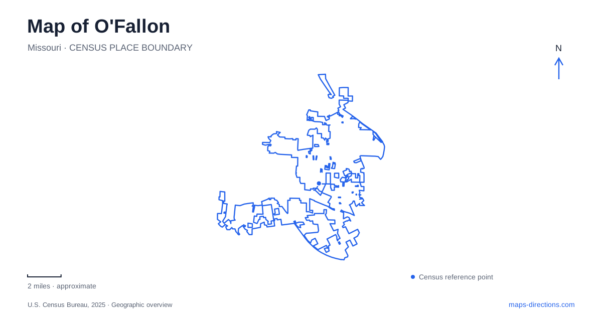
Street tiles load from OpenStreetMap when opened. The blue line shows the 2025 Census boundary.
- State
- Missouri
- Population · July 2025
- 96,101
- Land area
- 31.0 sq mi
- Water area
- 0.0 sq mi
O'Fallon’s historic landmarks tell a story that begins before the suburban road network shown on a modern map. A railroad settlement, a reconstructed settler fort, and a log cabin museum occupy different sites, each preserving a different layer of the community. The local parks are particularly useful for understanding those layers. Some contain historic structures, others organize sports fields around walking paths, and another stretches into countryside off Highway DD. Their names describe distinct places rather than interchangeable green spaces.
The railroad settlement behind the modern city
Nicholas Krekel established his home and store here in 1856. His brother Arnold had purchased land, laid out a town, and donated property for the railroad. Nicholas subsequently became the first postmaster and railroad agent. Those overlapping roles explain the close relationship between the earliest settlement, commerce, and rail transportation: the station gave the growing community an organizing point.
The railroad remains part of O'Fallon’s landscape. Preservation also reaches beyond the tracks, encompassing the depot, former commercial and power-company buildings, and the surviving wings of St. Mary’s Institute. The latter became the Municipal Centre, giving an older educational building a civic function. Reading that history alongside a street map reveals continuity beneath the newer roads. The community did not begin with its present highway connections; those connections were added around an existing place.
Civic Park’s small museum and larger stories
At 308 Civic Park Drive, the Log Cabin Museum contains objects that bring this history down to household scale. Wabash Railroad artifacts sit within a collection that also includes an immigrant’s trunk, clothing, a portable organ, and equipment from a mid-twentieth-century beauty parlor. The range is useful: it moves beyond founding dates to the changing work, travel, and domestic life of local people.
A miniature model of Zumwalt’s Fort connects the museum to a separate historic site. One of the original fort cabin’s surviving logs became the museum’s mantelpiece. That relationship can otherwise be lost when viewing the two places as isolated map labels. Civic Park holds an artifact from the earlier structure; Fort Zumwalt Park contains the reconstruction. Visiting both makes the difference between surviving material and reconstructed architecture tangible.
Lake Whetsel and the buildings above it
Fort Zumwalt Park occupies 48 acres at 1000 Jessup Lane. Its rebuilt War of 1812 fort and restored Heald Home overlook Lake Whetsel. The house dates to around 1884, so the two structures represent different periods despite sharing one park. Wooded grounds, walking paths, and the disc golf course add recreational uses around the historical setting.
The lake itself is younger than either historic building. A spring was dammed during the 1970s to create the 3.5-acre water body, named for parks advocate Ed Whetsel. A 2019 restoration included dredging, restocking, and a new path around the water. Thus the familiar scenic arrangement is partly a product of modern park development, not an unchanged nineteenth-century landscape.
For O'Fallon’s fort reconstruction, archaeological investigation supplied evidence about the original log residence. By the 1970s, only its stone chimney remained. Excavations helped establish how the building had been constructed before the completed reconstruction opened in 2015. The distinction matters when interpreting photographs: the standing log structure is a researched reconstruction on a historic site.
Recreation takes different forms across the parks
Dames Park, at 387 Dames Park Drive, combines playing fields with a one-mile asphalt walking and biking path. Its 59 acres accommodate football, soccer, and lacrosse, while the Omer Dames War Memorial commemorates St. Charles County soldiers killed during the Vietnam War. The path, sports grounds, and memorial give the park several purposes within the same mapped boundary.
A different outdoor setting appears at O’Day Park, off Highway DD. Its 57 acres include paved and natural paths, an adventure playground, and a lodge at the southwest tip. The amphitheater occupies the hillside below the lodge; the Terminus shelter sits at the eastern end. These named features establish an internal geography more informative than the park’s overall outline.
Following the landscape beyond a single address
O'Fallon visitors using O’Day Park can relate the lodge, hillside performance area, and eastern shelter to the trails between them. The playground includes rope climbing and a creek-experience water-play area, while the lodge serves organized gatherings. A family outing and an event visit therefore use different parts of the same grounds.
The contrasts among these parks give O'Fallon a particularly readable public landscape. Civic Park gathers portable evidence of daily life, Fort Zumwalt brings reconstructed and restored buildings together above a modern lake, and O’Day arranges play and gathering spaces through a broader countryside setting. Each contributes a different chapter that remains visible on the map.
Map and statistics: U.S. Census Bureau, 2025 Gazetteer, January 2025 generalized place boundaries and Vintage 2025 population estimates. Local references: City of O’Fallon. Article prepared by Maps & Directions.