Map of Ocala
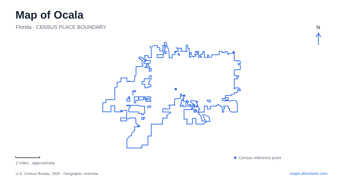
Street tiles load from OpenStreetMap when opened. The blue line shows the 2025 Census boundary.
- State
- Florida
- Population · July 2025
- 71,753
- Land area
- 48.1 sq mi
- Water area
- 0.0 sq mi
Ocala is easiest to understand by separating its courthouse-square origins from the historic military site and spring landscape farther east. The downtown street pattern records the growth of a county seat, while Fort King explains an earlier period of conflict and federal Indian removal. Silver Springs adds a different geography of headspring, river, woodland, and camping areas. A useful map brings these places into relation without flattening their very different histories into one general sightseeing district.
The square and the rebuilding of a town
The city became the seat of Marion County in 1846, and a courthouse followed on the square in 1847. Early homes clustered within a few blocks of that civic center. This history helps explain why the square remains such a useful reference when reading the surrounding streets: public business and residential development grew in relation to the same central place.
The fire of Thanksgiving Day 1883 destroyed much of the town center. Rebuilding with brick and other fire-resistant materials produced the enduring nickname Brick City. Looking at downtown architecture with that event in mind gives the buildings a shared context beyond their individual storefronts. On a map of Ocala, the square is therefore both a navigation reference and a way into the story of how the commercial center took its present material character.
Historic streets around Tuscawilla Lake
The city's preservation program recognizes four historic districts, with different local and national designations. That distinction means historic character extends beyond the commercial center. Residential streets and the Tuscawilla area belong to the same broader story of growth around the original square, even though they present a different streetscape.
The municipal Tuscawilla Park Historic District map shows the lake in relation to Northeast Watula Avenue, Northeast Tuscawilla Avenue, Northeast Sanchez Avenue, and the numbered streets and avenues around them. It distinguishes contributing structures from other buildings rather than treating every parcel as identical. For a walking exploration, those mapped relationships are more informative than a single park label. The lake provides a landscape anchor, while the surrounding blocks reveal the district's residential fabric.
This part of Ocala rewards a closer map scale. The relationship between houses, streets, and water can disappear when the view expands to show the entire region. A short route through the district can focus on the way the neighborhood meets the lake, rather than simply using the park as another stop on a driving itinerary.
Fort King and the history beneath the grounds
Fort King National Historic Landmark stands at 3925 East Fort King Street. The forty-acre site includes a full-size fort reconstruction, visitor displays, an archaeological center, a heritage garden, and a trail. The archaeological work is important to understanding the reconstruction: artifacts recovered on the grounds provide evidence about the place being interpreted.
The fort's significance involves the Second Seminole War and the federal effort to remove Native people from their homelands. Its position near the northern edge of the Seminole reservation made it strategically important to the Army. After the war, the fort also served as the first courthouse and public assembly place for the newly formed county. Reading Fort King only as a military attraction would leave out both the human consequences of that conflict and its later civic role.
A mile-long trail passes the historic fort road, a seep spring used by soldiers, and the DAR cemetery. These features extend the story beyond the reconstructed walls. For an Ocala history outing, the grounds offer a landscape to examine as well as buildings to enter: the road and spring help explain why this location could support a post in the first place.
Choosing the appropriate spring approach
Nearby Silver Springs State Park has several distinct entrances. The main entrance at 5656 East Silver Springs Boulevard serves the headspring area, gardens, paved riverside paths, and glass-bottom boat operation. It is the most direct match for a visit centered on seeing the spring itself.
The camping entrance is at 1425 Northeast 58th Avenue. It serves the campground, cabins, nature trails, pioneer village, and Silver River Museum and Environmental Education Center. Its paddling launch also requires a half-mile walk from the access area. The equestrian entrance lies farther east along State Road 40. These approaches correspond to different activities and should be plotted separately when planning a day that includes more than one part of the park.
Combining the historical and natural landscapes
An Ocala itinerary can follow a clear progression from the civic square and nearby historic streets to Fort King's archaeological landscape, then to the spring and river environment. Each stage changes what the map needs to show. Downtown benefits from individual blocks, Fort King from a site trail and interpretive features, and the state park from its separate approaches and activity areas. Keeping those scales distinct makes the region easier to explore while preserving the specific story each place tells.
Map and statistics: U.S. Census Bureau, 2025 Gazetteer, January 2025 generalized place boundaries and Vintage 2025 population estimates. Local references: City of Ocala; City of Ocala Planning Department; Florida State Parks. Article prepared by Maps & Directions.