Map of Oakley
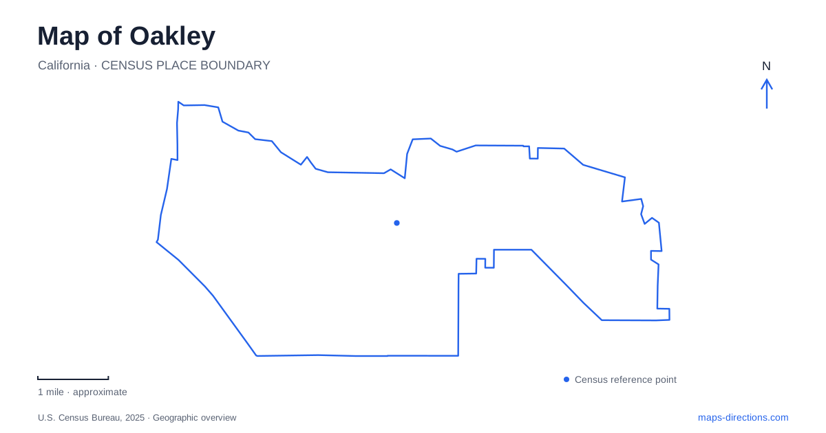
Street tiles load from OpenStreetMap when opened. The blue line shows the 2025 Census boundary.
- State
- California
- Population · July 2025
- 47,583
- Land area
- 15.9 sq mi
- Water area
- 0.3 sq mi
Oakley sits at a meeting point between everyday streets and the waterways of the Sacramento–San Joaquin Delta. Big Break makes that relationship visible: it is a small bay at the edge of the San Joaquin River and a regional shoreline destination reached from the local road network. On a map, distinguish the water body, the park and the trail bearing its name. They overlap geographically, but each label answers a different travel question.
Begin with Main Street and Big Break Road
The regional park district lists Big Break Regional Shoreline at 69 Big Break Road. Its approach directions use Main Street as the connection to that road. This supplies a more precise arrival reference than entering “Delta” into a search, which describes a vast region rather than one visitor entrance. Keep the complete park name and street address together when sharing the destination.
The district's directions also distinguish approaches using State Routes 4 and 160. Their junction is a reminder to inspect the actual route rather than assume that staying on the same highway number is always correct for the park. Let current navigation determine the appropriate exit from your starting location. The geographic purpose of the regional view is to show how Main Street and Big Break Road fit into that approach, not to promise unchanged lanes or driving times.
The shoreline is more than a blue area
Big Break occupies land that was formerly farmed and later submerged. The park district describes its estuarine setting, where river runoff and salt water influence the surrounding environment. This explains why a map here contains channels, shoreline edges and wetland features rather than a single simple lake outline. Those shapes help you understand the landscape, but they do not establish a route suitable for a boat.
For an Oakley waterfront visit, decide whether you intend to use the visitor center, walk on land or launch a small craft. The district identifies a beach launch reached by a walk from the parking area. That is materially different from assuming a car can be driven directly to every water-access point. Confirm the current conditions and relevant park rules before organizing a launch; water-quality notices can affect how a visit should be planned.
A regional trail has its own geography
The Big Break Regional Trail connects Big Break Road with the Marsh Creek Regional Trail. The park district identifies a completed paved portion of 2.75 miles. That description is useful for understanding the existing connection, rather than treating every line in a long-range trail plan as an available extension. Start with the completed route and the junction you actually intend to use.
On an Oakley map, the meeting of the two named trails deserves a closer view. If your journey continues along Marsh Creek, save that junction and the intended endpoint as separate references. A trail name alone can identify a corridor with several access possibilities. Someone arriving by bicycle and someone bringing a car may therefore need different directions even when both are meeting for the same outing.
Main Street also has a civic destination
Civic Center Plaza is at 3231 Main Street. The city uses it for community events, making it a distinct Main Street destination from the turn toward Big Break Road. A request to meet “on Main” is too broad when one person intends the civic plaza and another is thinking about the shoreline approach. Use the plaza name for an event and the regional park address for a nature visit.
Oakley's event information distinguishes the civic-center parking area from additional event parking across Main Street. That makes an event map more informative than a generic business or city-hall pin on busy occasions. Follow the arrangements published for the particular event rather than assuming a lot shown in an older notice will be available for every visit. The public street address establishes the location, while the event instructions establish how arrival is organized.
Keep city streets and Delta journeys separate
A map of Oakley should allow you to move between scales without losing the purpose of the trip. At regional scale, locate the Delta setting and the highway approach. At city scale, identify Main Street, the civic plaza or Big Break Road. At site scale, resolve the visitor center, trail junction or launch access. Those are three different decisions, and one dropped pin cannot reliably replace all of them. Save the destination that matches the activity, retain its full name and use the shoreline outline to understand the setting rather than as a substitute for an access map.
Map and statistics: U.S. Census Bureau, 2025 Gazetteer, January 2025 generalized place boundaries and Vintage 2025 population estimates. Local references: East Bay Regional Park District; City of Oakley. Article prepared by Maps & Directions.