Map of Oakland Park
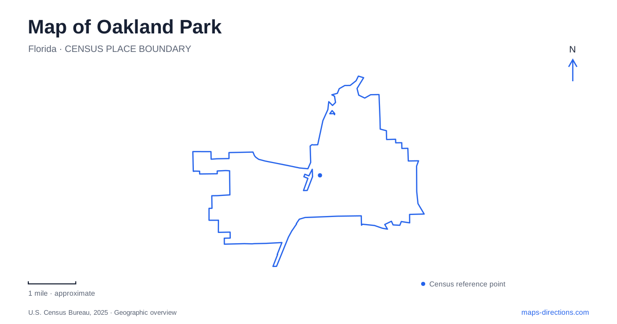
Street tiles load from OpenStreetMap when opened. The blue line shows the 2025 Census boundary.
- State
- Florida
- Population · July 2025
- 45,332
- Land area
- 7.5 sq mi
- Water area
- 0.7 sq mi
Oakland Park has a geography shaped by more than its position within metropolitan Broward County. Dixie Highway and the Florida East Coast Railway recall the early farming community, while the North Fork of Middle River helps explain where development first took hold. Farther west, parks protect pockets of wetland and sand pine scrub amid the street network. Following these particular features produces a more informative map than treating the city as an undifferentiated stretch of the Fort Lauderdale area.
Dixie Highway and a city that changed its boundaries
In 1922, a housing development was planned east of Dixie Highway and north of the North Fork of Middle River. The city's historical account connects its name to oaks along the riverfront. By then, agricultural settlement already existed near the railway north of present-day Northeast Thirty-eighth Street.
A much larger municipality called Floranada incorporated around the community in 1925. Its ambitious boundaries stretched from the ocean to U.S. 441 and from the river's North Fork to Cypress Creek. The development venture faltered, and Floranada was dissolved in 1929. The replacement municipality had a substantially smaller footprint.
This history explains why old maps of Oakland Park can be misleading without a date. Floranada's broad resort ambitions and the later city's boundaries describe different geographic entities. Dixie Highway, meanwhile, endured as the early business corridor. Its role helps tie the farming and subdivision periods to the recognizable downtown landscape, even as surrounding metropolitan development expanded.
A musician's name in the downtown landscape
Jaco Pastorius Park is at 4000 North Dixie Highway. The city named it in 2007 for the bassist and composer who grew up locally and attended Northeast High School. The tribute connects a public space to a specific cultural figure, rather than to the agricultural and real-estate names that dominate much of the earlier history.
The park includes walking space and an entrance promenade with an arched fountain. It also accommodates community events. In Oakland Park, that combination makes the site a gathering point within the downtown corridor: the park supports ordinary outdoor use while also providing room for larger civic occasions. Its highway address locates it on the long-established commercial axis, but the promenade and walking areas reveal a public-space function that a broad road map alone may not communicate.
Food businesses and the downtown district
The Culinary Arts District gives another identity to the downtown area. The city's redevelopment agency uses a district guide to introduce food and drink businesses and encourages people attending downtown events to explore nearby establishments. This is a district-wide economic effort, not a single culinary school or one enclosed food hall.
That distinction helps when arranging a visit around both an event and a meal. The park supplies one clear anchor, while individual businesses occupy their own properties within the surrounding district. A useful neighborhood map therefore keeps the street pattern visible beneath the district label. It can show the relationship between public gathering space and commercial activity without suggesting that every business has the same opening schedule or belongs to one managed attraction.
Royal Palm Park's wetland companion
Royal Palm Park is associated with property once proposed for the Whispering Lakes residential development. John Stunson helped turn that land toward park use in 1978. The nature trail named for him was dedicated in 2017 and includes a five-acre wetland habitat beside the larger park.
The Stunson Nature Trail is listed at 1701 Northwest Thirty-eighth Street, also identified as Park Lane West. Royal Palm's south pavilion shares that street address. The larger recreation area includes courts, an exercise path, playground facilities, and picnic space, while the trail emphasizes habitat and environmental interpretation.
For Oakland Park, this pairing preserves two different kinds of outdoor experience in one area. Organized recreation and wetland observation sit alongside each other, but they serve different purposes. The site's development history also shows that the green space resulted from a local land-use decision; it was not simply land left over between streets.
A separate remnant of sand pine scrub
Lakeside Sand Pine Preserve lies at 2820 Northwest Twenty-seventh Avenue. Its five acres protect a sand pine scrub ecosystem, with paved and unpaved paths, educational signs, and an observation deck. This is a different habitat from the wetlands associated with the Stunson trail.
The preserve makes Oakland Park's environmental variety visible at a small scale. Two similarly sized natural areas can represent different landscapes and support different observations. Plan this stop around its restricted opening schedule: the municipal listing provides Saturday access rather than daily hours. Its modest size is best understood as a chance to examine a surviving habitat remnant within the city, not as an extensive backcountry trail system.
Map and statistics: U.S. Census Bureau, 2025 Gazetteer, January 2025 generalized place boundaries and Vintage 2025 population estimates. Local references: City of Oakland Park. Article prepared by Maps & Directions.